
 Click to enlarged image (JPEG - 1.1MB)
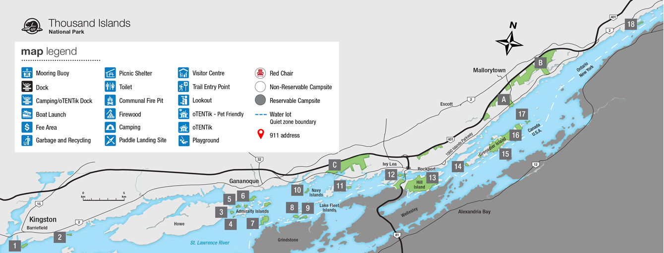
Mainland properties:
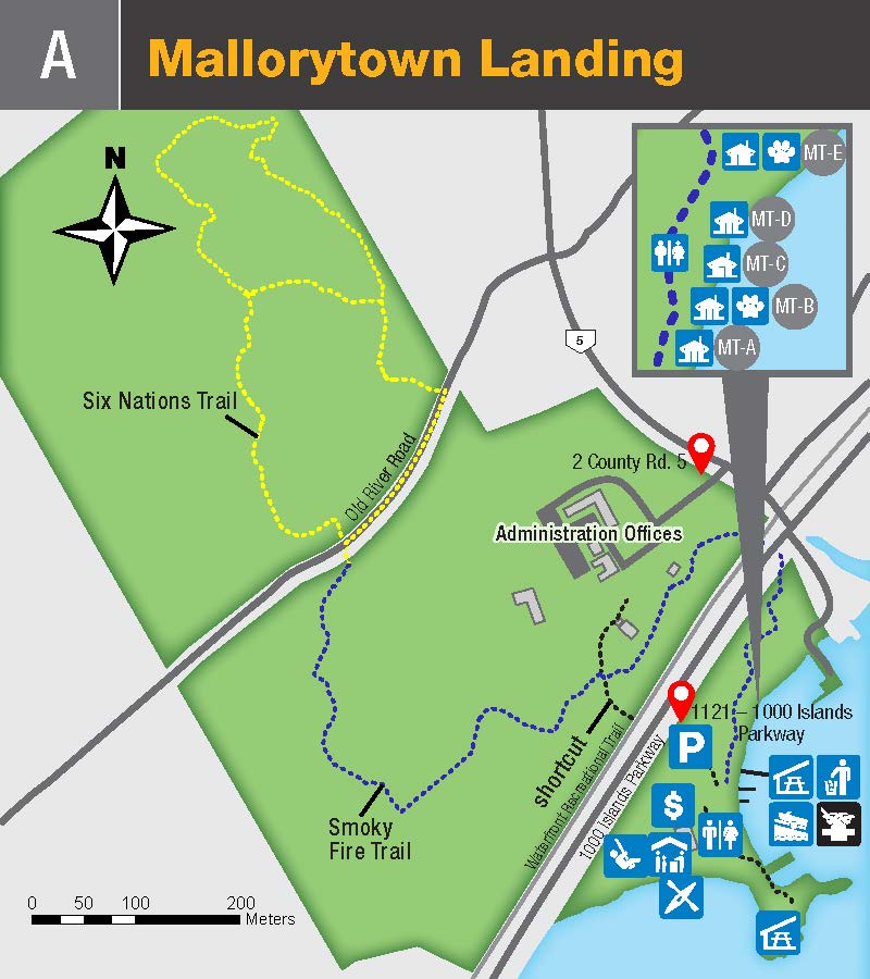
Mallorytown Landing
GPS Coordinates: 44.4523, -75.860317
Click to enlarged image (JPEG - 275KB)
Available Docking Space: 0-100 ft.
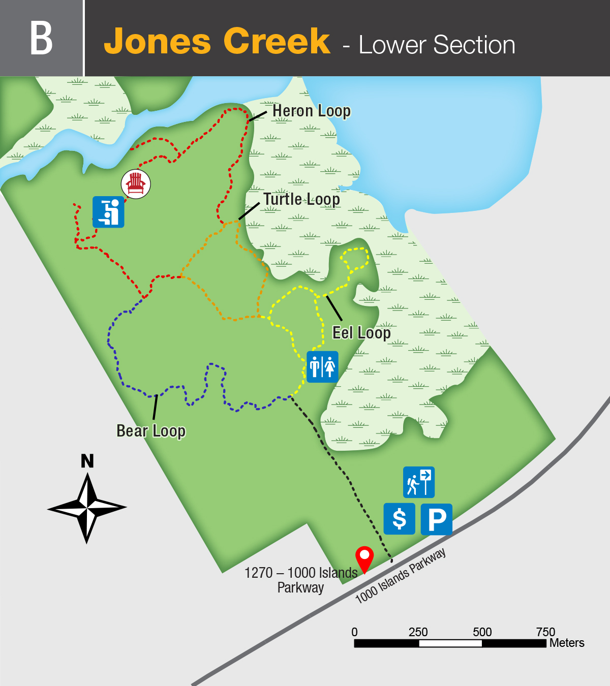
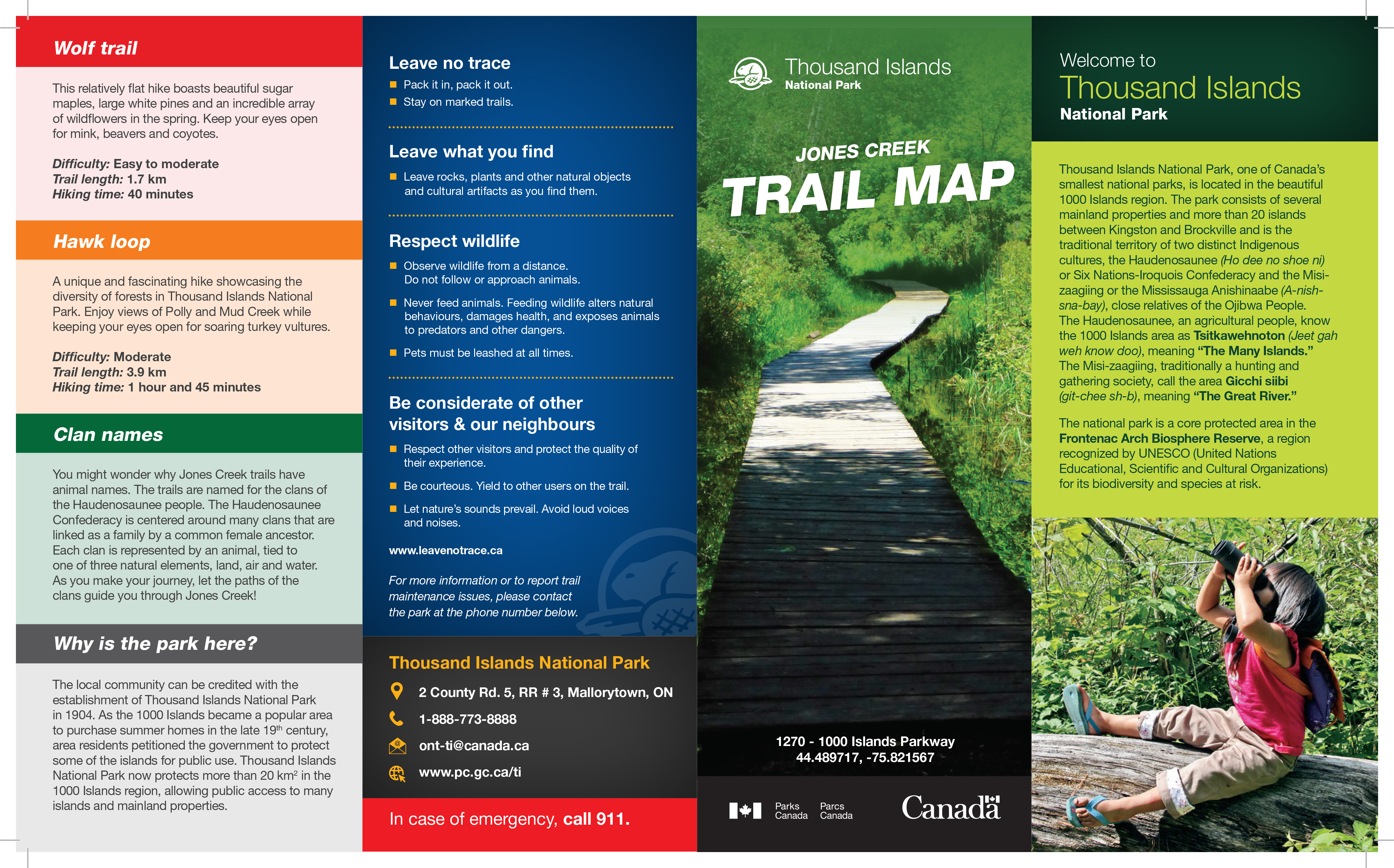
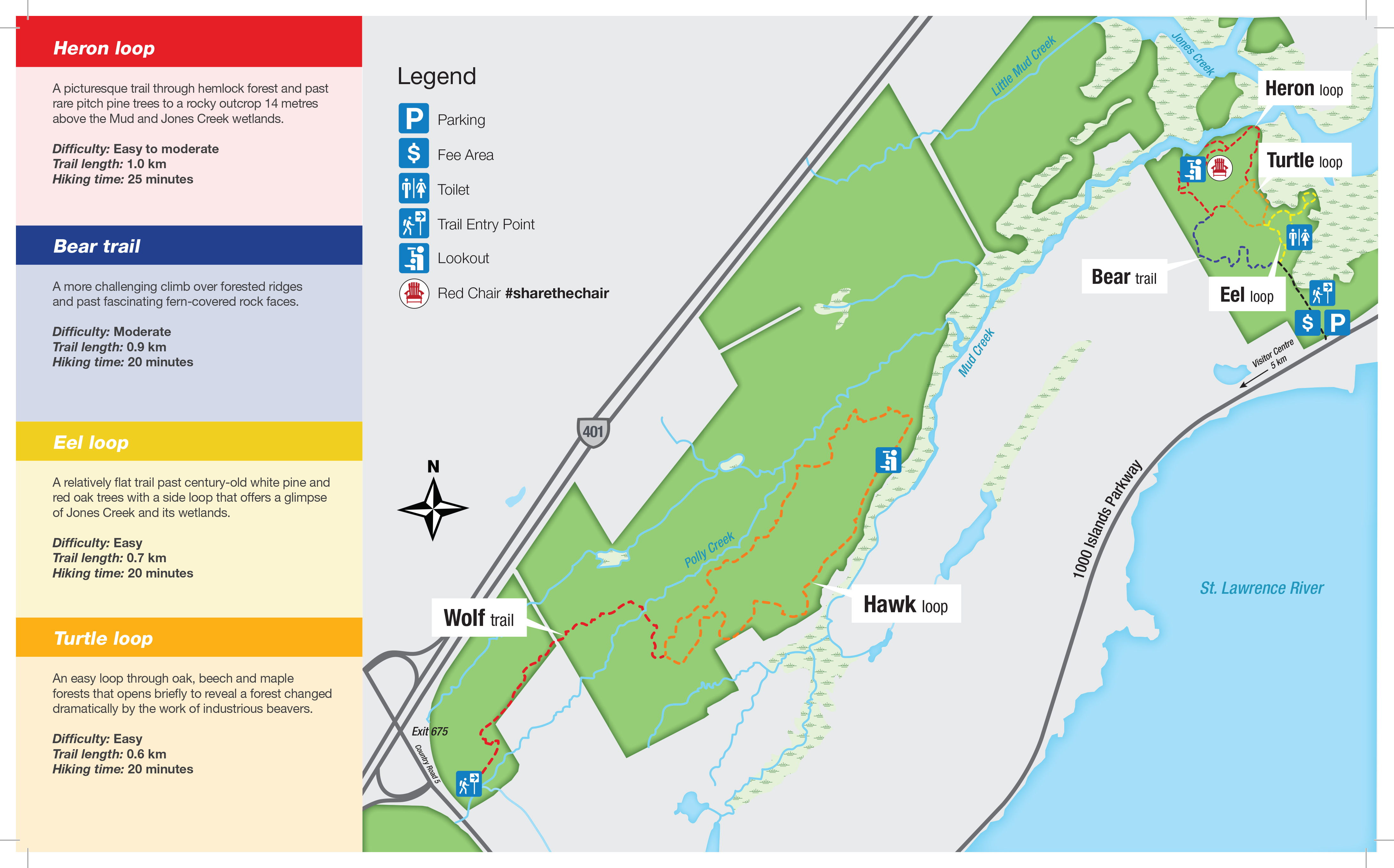
Jones Creek
GPS Coordinates : 44.489717, -75.821567
Close up map, Click to enlarged image (JPEG - 533KB)
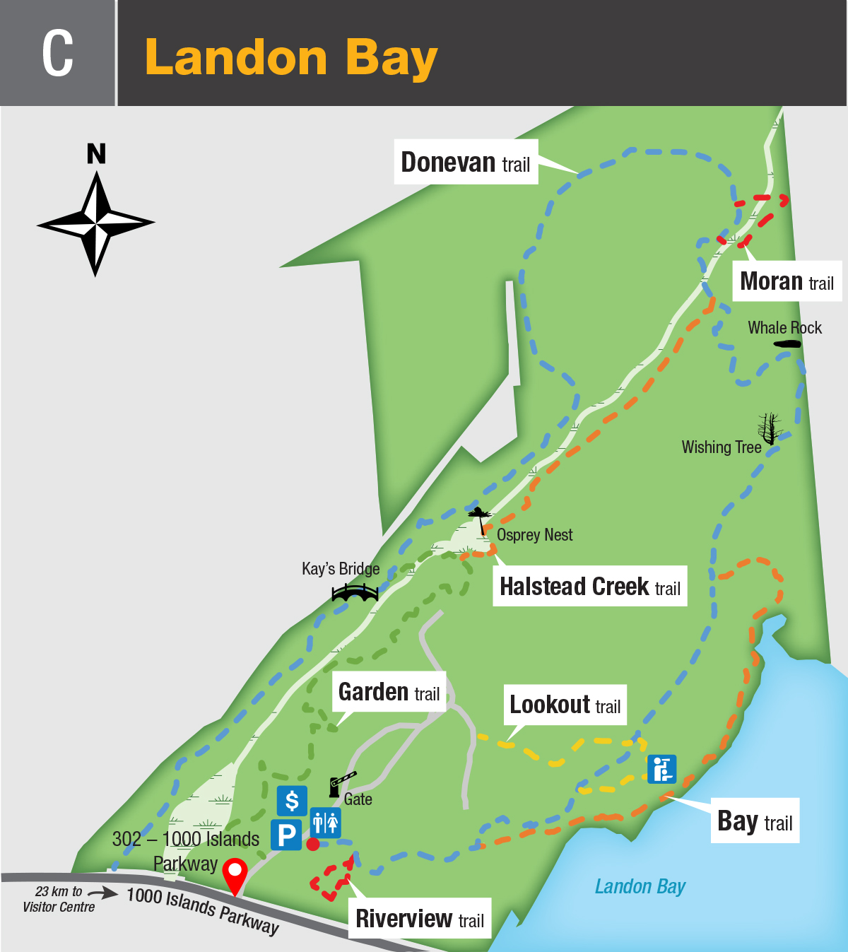
Landon Bay
Kingston Islands:
Cedar (1)
GPS Coordinates: 44.226825, -76.452608
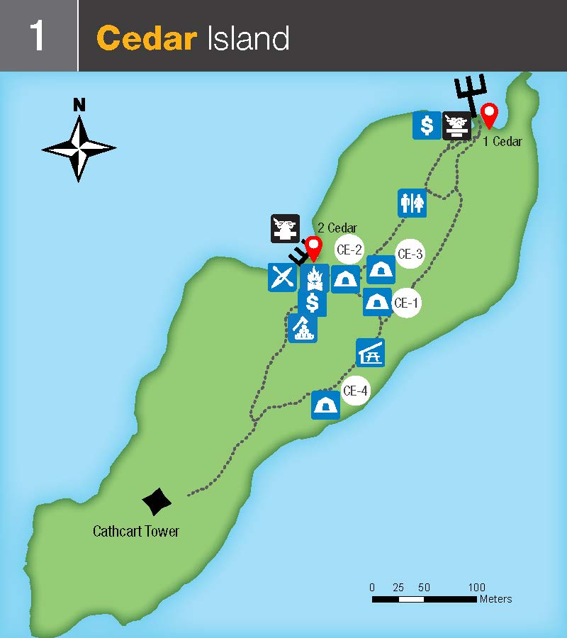
Available Docking Space >300 ft.
Milton (2)
GPS Coordinates: 44.244968, -76.398127
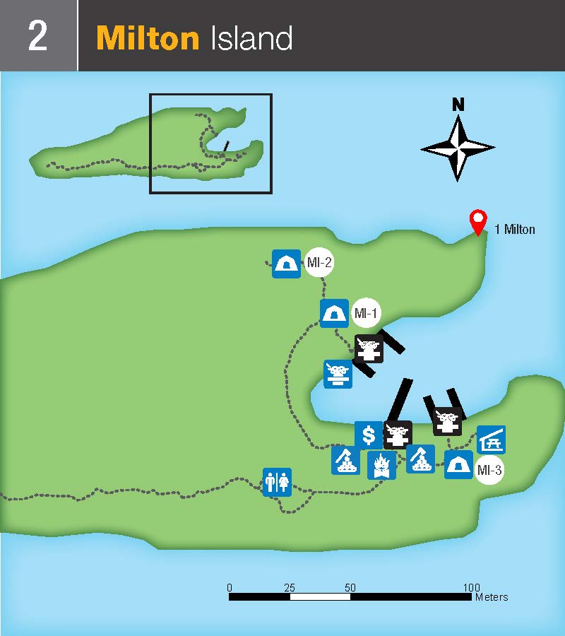
Available Docking Space 300 ft.
Admiralty Islands:
Aubrey (3)
GPS Coordinates: 44.296424, -76.193403
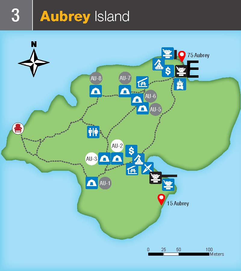
Available Docking Space at this location: >300 ft.
Mermaid (4)
GPS Coordinates: 44.295341, -76.188189
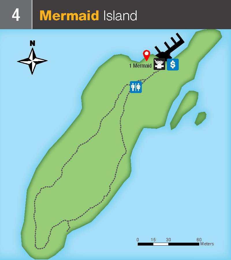
Available Docking Space at this location: 100-300 ft.
Beau Rivage (5)
GPS Coordinates: 44.303637, -76.187249
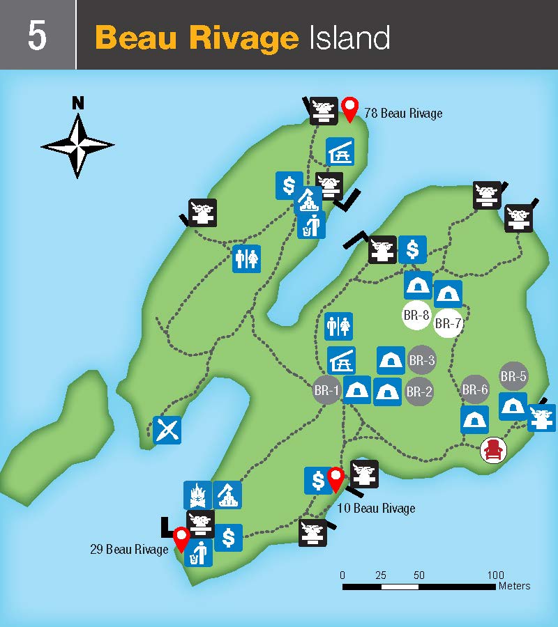
Available Docking Space at this location: >300 ft.
McDonald (6)
GPS Coordinates: 44.312212, -76.174218
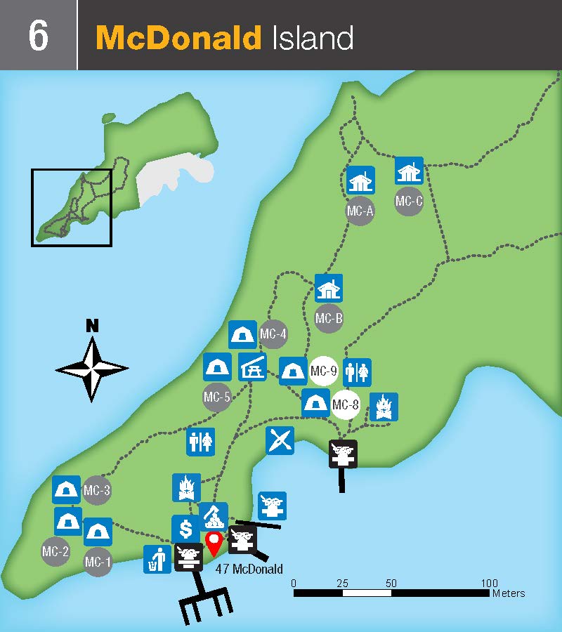
Available Docking Space at this location: >300 ft.
Thwartway (7)
GPS Coordinates: 44.291785, -76.152402
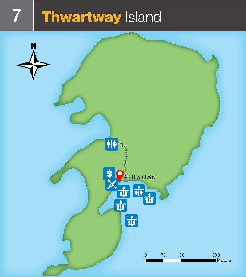
Available Docking Space at this location: 0-100 ft.
Lake Fleet Islands:
Camelot (8)
GPS Coordinates: 44.301500, -76.111012
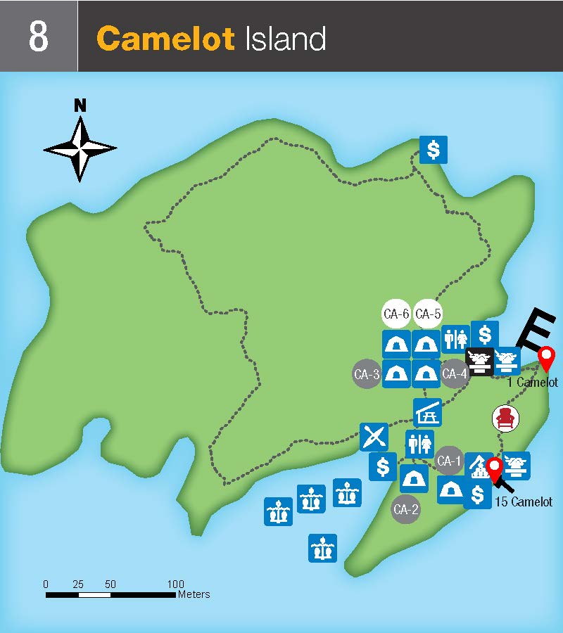
Available Docking Space at this location >300 ft.
Endymion (9)
GPS Coordinates: 44.302009, -76.097082
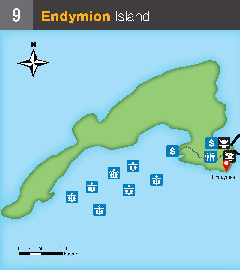
Available Docking Space at this location: 100-300 ft.
Navy Islands:
Gordon (10)
GPS Coordinates: 44.330466, -76.103106
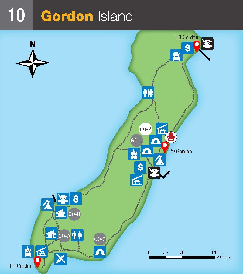
Available Docking Space at this location: >300 ft.
Mulcaster (11)
GPS Coordinates: 44.342781, -76.050551
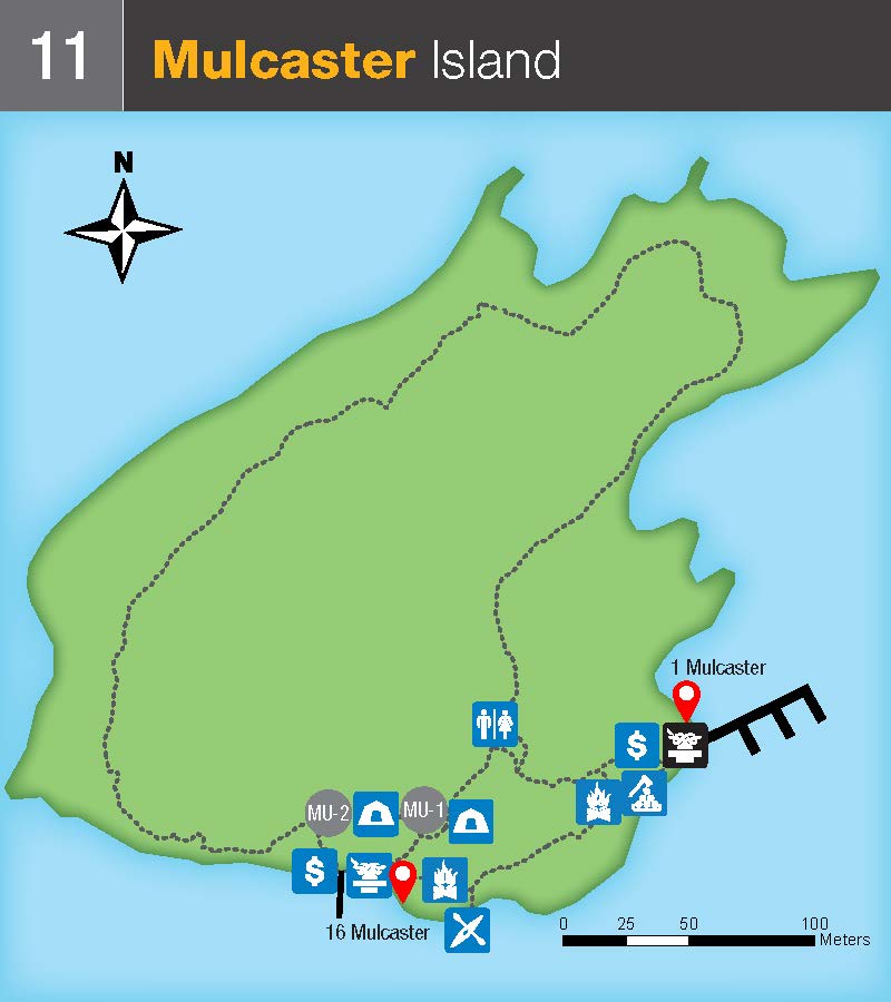
Available Docking Space at this location: >300 ft.
Middle Islands:
Georgina (12) and Constance (12)
GPS Coordinates: 44.361078, -75.984349 (Georgina), 44.359782, -75.979618 (Constance)
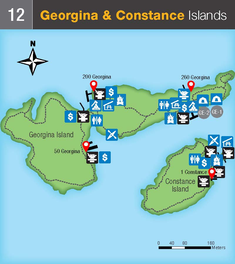
Available Docking Space at this location: >300 ft.
Hill (13)
GPS Coordinates: 44.366610, -75.953250
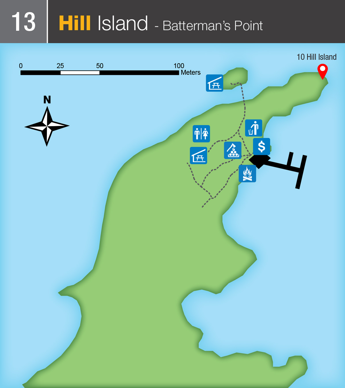
Available Docking Space at this location: 100-300 ft.
Grenadier Island:
Grenadier Island West (14)
GPS Coordinates: 44.384355, -75.906308
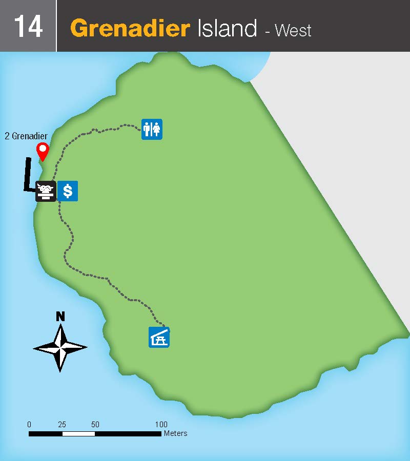
Available Docking Space at this location: 100-300 ft.
Grenadier Island Central (15)
GPS Coordinates: 44.402584, -75.875894
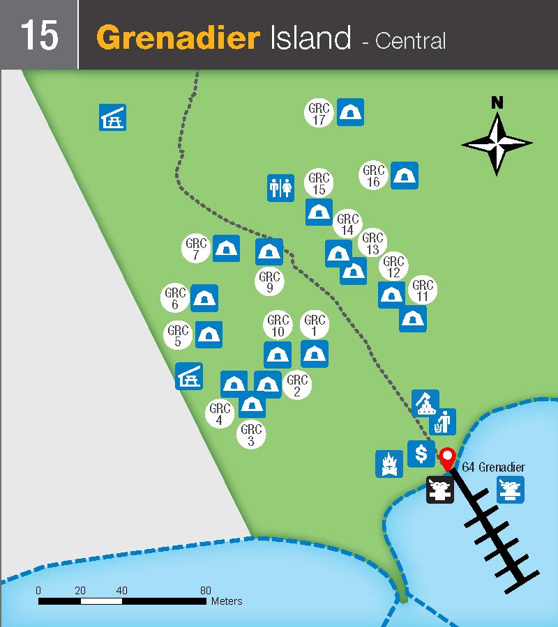
Available Docking Space at this location: 100-300 ft.
Grenadier Island East (16)
GPS Coordinates: 44.423970, -75.843665
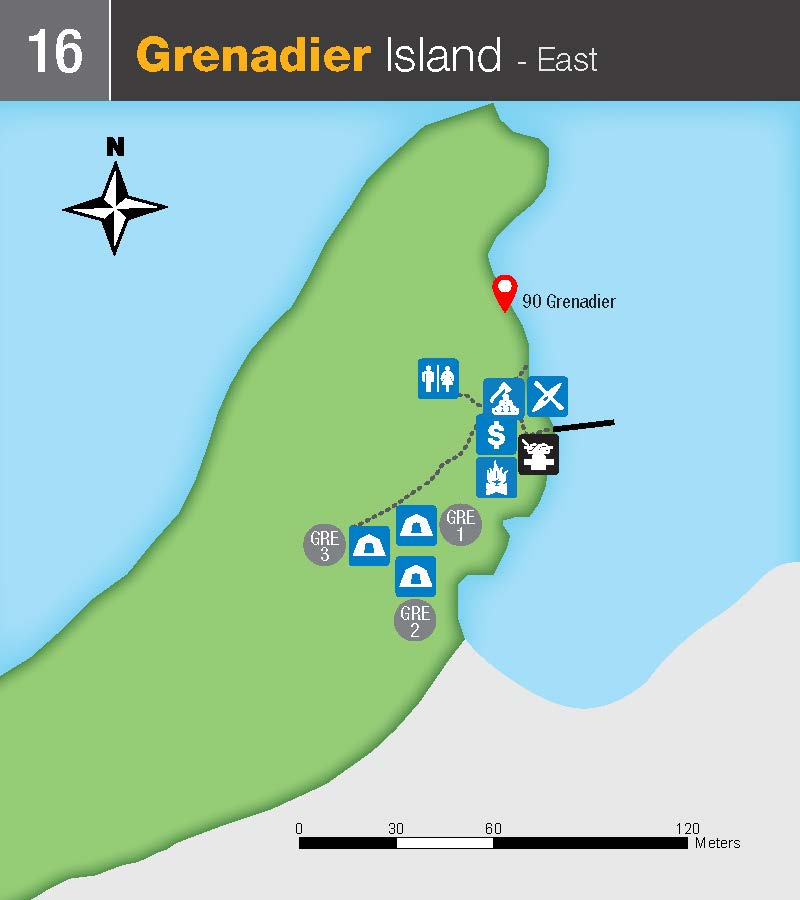
Available Docking Space at this location: 0-100 ft.
East Islands:
Adelaide (17)
GPS Coordinates: 44.434604, -75.839685
Click to enlarged image (JPEG - 52KB)
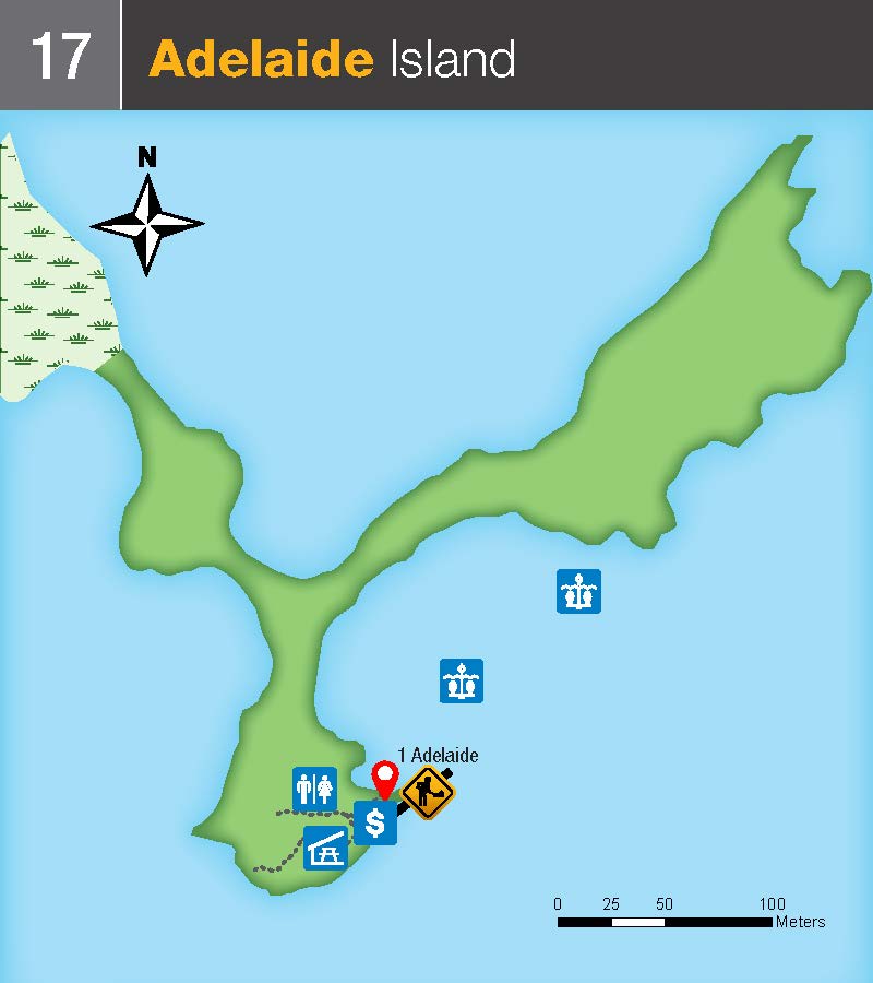
Available Docking Space at this location: 0-100 ft.
Stovin (18)
GPS Coordinates: 44.558640, -75.715078
Click to enlarged image (JPEG - 409KB)
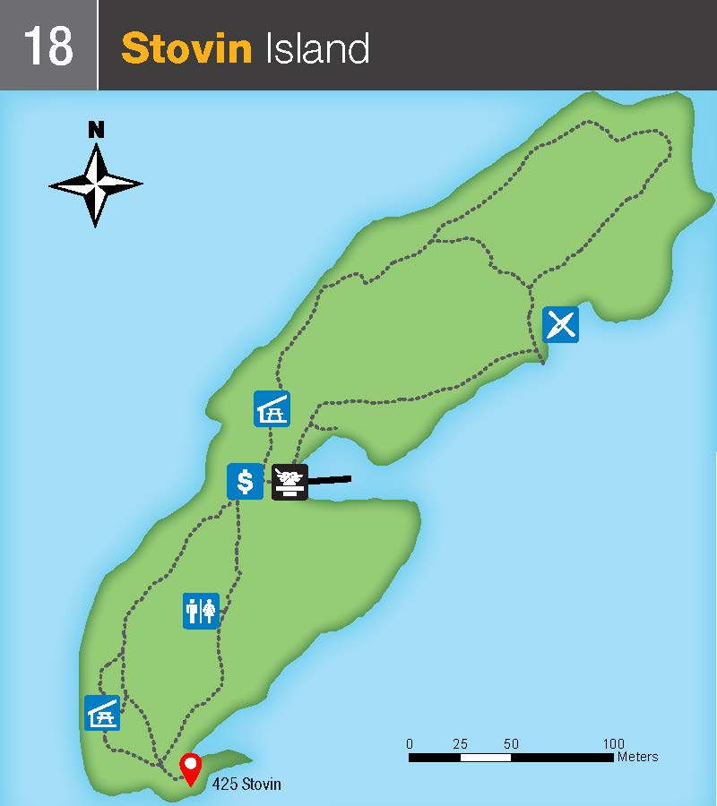
Future plans for this site in development. Available Docking Space at this location: 100-300 ft.
- Date modified :