
Facilities and services
Thousand Islands National Park
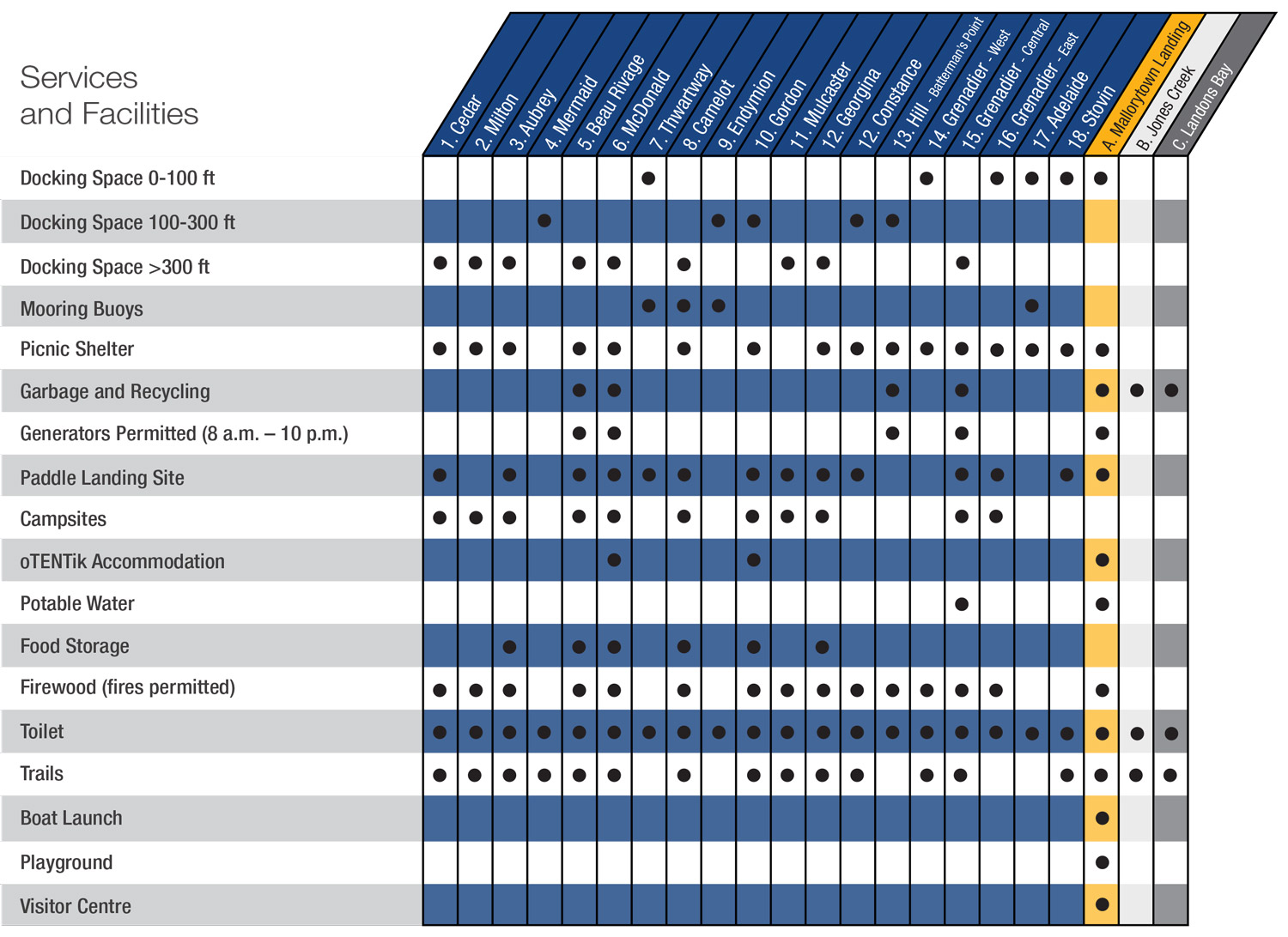
Facility and service chart
Map of Thousand Islands National Park
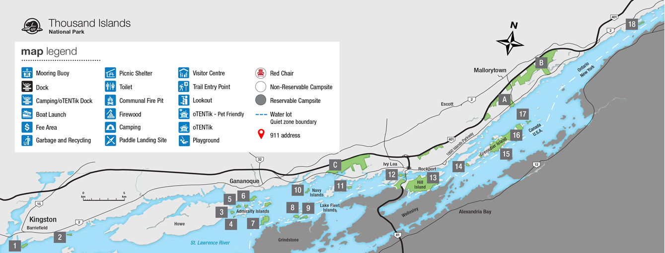
Mallorytown Landing
1121 - 1000 Islands Parkway (401 exit 675)
- Visitor centre with live animals, hands-on exhibits, Aboriginal stories, children's activities
- Outdoor exhibits and artwork
- Interpretive programs
- Playground
- 2-km trail with easy and moderate hiking loops
- Boat launch
- Paddling landing site
- Picnic areas
- Historical Pavilion (1904)
- Scenic river views
- Geocaches
- oTENTik accommodations
Jones Creek Trails
1000 Islands Parkway, 6 km east of Mallorytown Landing (401 exit 675 or 685)
- 12-km trail network of easy to difficult trail loops
- Wildlife viewing
- Lookout points
- Scenic wetland boardwalk
- Geocaches
Landon Bay Trails
302 - 1000 Islands Parkway (401 exit 647)
- 7-km trail network
- Scenic lookout
Islands
There are 19 island properties in the St. Lawrence River between Kingston and Brockville. Unless otherwise stated, national park islands have docks, composting toilets and walking trails; most have shelters and primitive campsites.
The St. Lawrence River is renowned for its dangerous shoals; accurate nautical charts are essential for boating safety. Nautical charts may be purchased at the Mallorytown Landing Visitor Centre or from private outlets listed on the website www.charts.gc.ca.
Related links
- Date modified :