
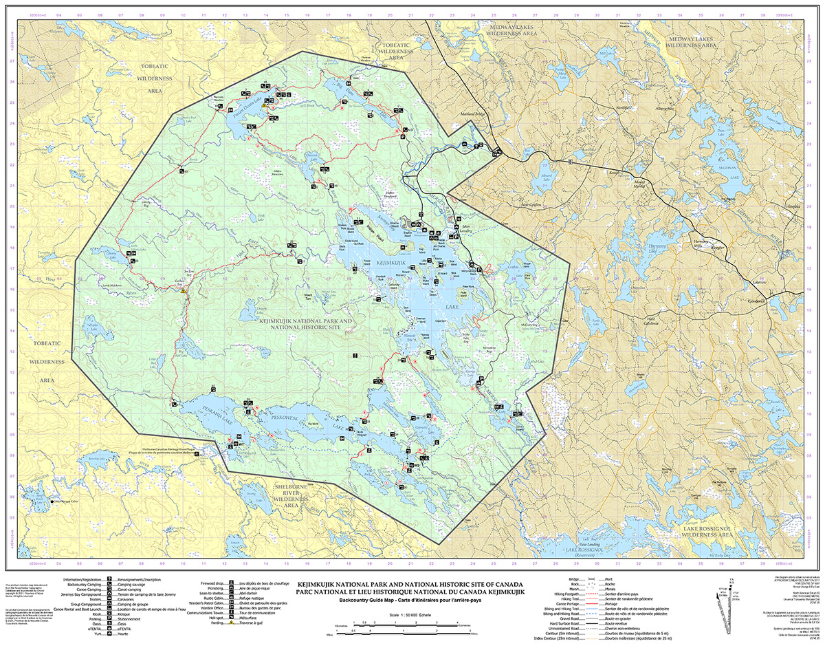
Backcountry Guide Map for Kejimkujik
Kejimkujik National Park and National Historic Site
Plan your backcountry camping trip and navigate using this interactive geoPDF Backcountry Guide Map for Kejimkujik.
This topographic map shows lakes, campsites, cabins, canoe rental and boat launch, firewood drop, and picnic spots.
NEW Navigation buoys will no longer be on Kejimkujik Lake. Visitors must come prepared to navigate to their campsite via map and compass and GPS.
How to access the map
There are three ways to get a copy of this map:
Download
Backcountry Guide Map for Kejimkujik (PDF, 25 KB)
Purchase a paper map
Paper maps (2017) are available to purchase at:
- the Visitor Centre
- Whynot Adventure, The Keji Outfitters
Use the Avenza Maps app for your smart phone
This map is available for free on the Avenza Maps app.
- Download the app
- Save the backcountry map to your smart phone.
- Use the downloaded map to navigate during your trip.
Navigate using a GPS device
If you use a GPS device for navigation in the field, download GPX data for Kejimkujik.
GPX data is available for many backcountry features including:
- trails
- portages
- campsites and cabins
- launch sites
- picnic areas
- Date modified :