
Salmon Pools
Cape Breton Highlands National Park
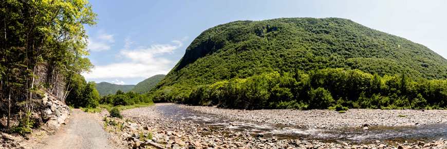
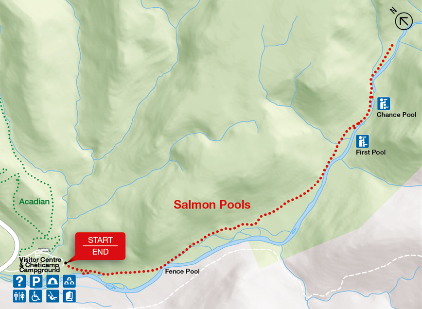
Ideal for a fitness walk or a stroll, this level trail follows the bottom of the Chéticamp River canyon with cliffs almost 400 metres (1,300 ft) high towering above. The First Pool is about 3.6 km up the Chéticamp River. The trail narrows and continues to Chance Pool where polished, exposed bedrock makes a great location for a picnic. Walk on through the forest and along the river past gravel bars interspersed with rapids and deeper pools for another 600 m where the trail currently ends. Watch for Atlantic salmon in the deeper pools. Listen for barred owls at dusk.
| Length | 9.5 km / 5.9 mi (return) |
        |
| Rating | Moderate  |
|
| Elevation | 15 - 100 m (50 - 330 ft) | |
| Time | 3 - 4 hours | |
| Significant features | Acadian forest, river canyon Suitable for most skill levels. Short climbs. Some rocky sections. |
|
| Trailhead | At Robert Brook campground (within Chéticamp campground) Lat: 46.643298 Long: -60.946835 |
Related links
- Acadian
- Le Chemin du Buttereau
- Le Buttereau
- Le vieux chemin du Cap-Rouge
- Corney Brook
- Skyline
- Bog
- Benjie's Lake
- Fishing Cove
- MacIntosh Brook
- Lone Shieling
- Aspy
- Mica Hill
- Jack Pine
- Coastal
- Jigging Cove Lake
- Green Cove
- Broad Cove Mountain
- Warren Lake
- Branch Pond Look-off
- Franey
- Clyburn Valley
- Middle Head
- Freshwater Lake Look-off
- Freshwater Lake
- Date modified :