
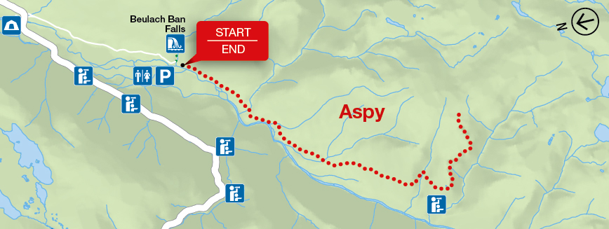
Aspy
Cape Breton Highlands National Park
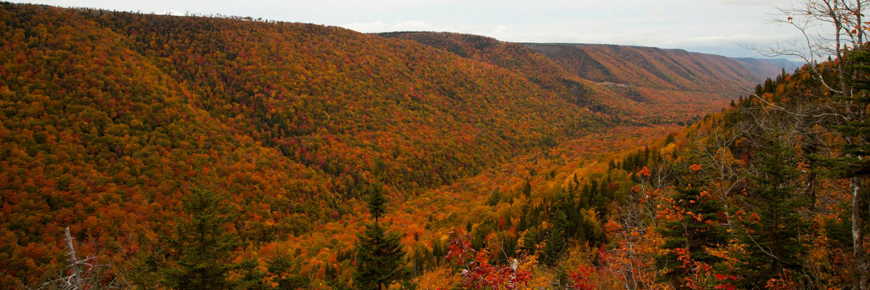
This trail meanders along the Aspy fault, through an Acadian and mixed forest. As nature reclaims land once used for farming and logging, a regenerated forest begins to blend in with the old growth. The magnificent red oak and the hoots of the barred owl or great horned owl will appeal to the true nature enthusiast. Recent work on this trail has made several stream crossings easier, but waterproof hiking boots are recommended.
| Length | 9.6 km / 6 mi (return) |
   |
| Rating | Moderate  / Difficult / Difficult  |
|
| Elevation | 60 - 450 m (200 - 1,500 ft) | |
| Time | 3 - 4 hours | |
| Significant features | Acadian and mixed forest Short climbs. Rugged sections. Stream crossings. |
|
| Trailhead | At the parking lot for Beulach Ban Falls Lat: 46.814041 Long: -60.626273 |
Related links
- Acadian
- Salmon Pools
- Le Chemin du Buttereau
- Le Buttereau
- Le vieux chemin du Cap-Rouge
- Corney Brook
- Skyline
- Bog
- Benjie's Lake
- Fishing Cove
- MacIntosh Brook
- Lone Shieling
- Mica Hill
- Jack Pine
- Coastal
- Jigging Cove Lake
- Green Cove
- Broad Cove Mountain
- Warren Lake
- Branch Pond Look-off
- Franey
- Clyburn Valley
- Middle Head
- Freshwater Lake Look-off
- Freshwater Lake
- Date modified :