
Photo : Shane Robins
Summer trail guide
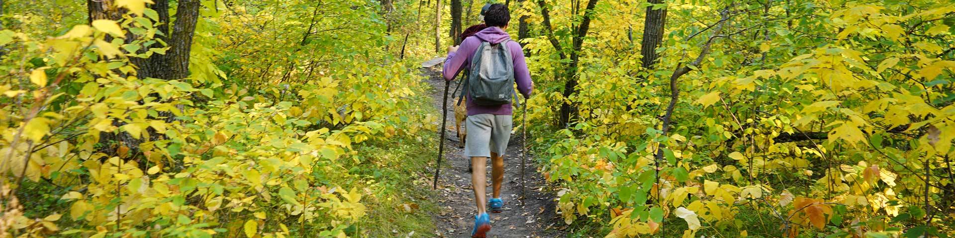
Riding Mountain National Park
Home to a staggering diversity of living things and unique histories, Riding Mountain’s trails are the best way to connect with it all! Summer and fall you can stroll, run, pedal or trot nearly 370 km’s of trails in all areas of the Park, each with their own flavour. Cross country skiing, snowshoeing or fat biking along one of the nearly 130 km of winter trails is the best way that you can embrace Riding Mountain National Park in the winter season too. This magical time of the year won’t let you down and will warm your heart.
Trail difficulty rating
 Easy
Easy-
- Suitable for all visitors including those with no trail experience
- Little or no elevation gain or loss
 Moderate
 -
- Suitable for most visitors who have some basic trail experience and basic experience in their chosen activity and are generally prepared
- May experience moderate elevation gain with some short steep sections
 Difficult
 -
- Suitable for visitors who have trail experience and experience in their chosen activity and are prepared
- May experience major elevation gain with long steep sections and a variety of terrain including wet areas and loose soil
Check out the Trail conditions | More maps
Wasagaming / Clear Lake
Wasagaming and Clear Lake trail conditions
Wasagaming / Clear Lake
Wasagaming and Clear Lake trail conditions
Arrowhead


Trail difficulty:  Moderate, 3.4 km, Loop
Whether you plan to visit the rolling terrain of Arrowhead trail during a bright summer’s day, or on snowshoes in the middle of winter, the trail is ideal in any season. See the diverse flora and fauna that adapted to this landscape carved out by glaciers on the family friendly trail. Keep an eye out for the beaver in the pond and try and spot its lodge!

Brûlé
Trail difficulty:  Easy, 2.2 km or 4.1 km, Loop
Within the boreal forest lies Brûlé Trail! A short drive from Wasagaming, the trail is shaped like a figure 8, forming a short loop and a long loop. Journeying on the long loop, see aging trees and a variety of flowers before arriving at Lake Kinosao. When the snow falls, strap on your snowshoes to experience a winter wonderland in the park!
Clear Lake (North Shore)


Trail difficulty: Moderate, 8 km
The Clear Lake North Shore Trail is accessible from Glen Beag, Spruces and Aspen picnic sites, making it a perfect route to enjoy lake views after lunch. See Wasagaming from across the lake take in the sunsets, natural springs, and boreal forest.
Clear Lake (North Shore) - Spruces to Aspen
Trail difficulty: Moderate, 0.5 km
The Clear Lake North Shore Trail is accessible from Glen Beag, Spruces and Aspen picnic sites, making it a perfect route to enjoy lake views after lunch. See Wasagaming from across the lake take in the sunsets, natural springs, and boreal forest.
Clear Lake (South Shore) - Boat Cove to Frith Beach
Trail difficulty: Moderate, 3.8 km
Trek through the forest and along the shoreline to experience the Clear Lake South Shore Trail. Arrive at the isthmus, the portion of land that divides South Lake from Clear Lake. Capture the moment and relax on the red chairs before continuing your adventure. Level up and portage your bike across a narrow channel that morphs with the changing water levels. Take a break at Frith Beach for a picnic and a swim before continuing your journey!
Clear Lake (South Shore) - Frith beach to Camp Wannacumbac
Trail difficulty: Moderate, 3.2 km
Trek through the forest and along the shoreline to experience the Clear Lake South Shore Trail. Arrive at the isthmus, the portion of land that divides South Lake from Clear Lake. Capture the moment and relax on the red chairs before continuing your adventure. Level up and portage your bike across a narrow channel that morphs with the changing water levels. Take a break at Frith Beach for a picnic and a swim before continuing your journey!
Cowan Lake
Trail difficulty: Easy, 7.8 km
The Cowan Lake Trail is an excellent route if you are looking for a short overnight hike. Follow the gently rolling trail to a back country campsite, nestled beside Cowan Lake. At night, hear the boreal forest transform and listen to frogs croaking, crickets chirping, and owls hooting.
Grey Owl

Trail difficulty:  Moderate, 14.8 km, Return
Take a day out of your visit to Riding Mountain National Park to explore the wilderness that Archie Belaney (commonly known as Grey Owl) called home during his six-month stay at Beaver Lodge Lake. The cabin at the end of the trail is named after the first naturalist hired to inspire Canadians to support the creation and protection of National Parks. The trail makes for a great day hike and an even better mountain bicycle trip. When winter settles in, ski your way through the Boreal forest to the warming hut for a warm drink. Just like Grey Owl, settle in and explore the outdoors.
Kinosao
Trail difficulty: Moderate, 1.9 km, One-way
This rolling trail runs parallel to Brulé trail on its way to Kinosao Lake, where it then heads Northwest and connects with Grey Owl Trail. Day hikers can close the loop to return to the trailhead making a complete a 7.5km hike or continue to Grey Owls cabin approximately 6kms further. Lots of options.
Lakeshore - Main Beach to Deep bay
Trail difficulty: Easy, 3.6 km
Stroll the shore from the Main Beach to Deep Bay. This gravel surfaced trail is a perfect fit for a morning run, walks with Grandparents or a bathing suit and towel to chill on any number of the public docks found along it on a hot day.
Lakeshore (Deep Bay to Wishing Well)
Trail difficulty:  Easy, 2.5 km
This paved trail follows the old Lakeshore Road and brings you to the Wishing Well. An easy bike ride for families young and old and perfect for pushing a stroller. Pack a snack to enjoy in the gardens and to give you energy for your return trip.
Lake Katherine
Trail difficulty: Moderate, 3.5 km, Loop
Lake Katherine Multi-use
Ominnik Marsh
Trail difficulty: Easy, 0.5 km, Loop
From bulrushes to beavers, Ominnik Marsh has it all! Listen to the marsh come alive as you follow along the floating boardwalk. Explore deeper and visit Friends of Riding Mountain to rent a Marsh Kit.
South Lake

Trail difficulty: Easy, 3.0 km, Loop
Experience the harmony between the water of Clear Lake and the forest beside it on the South Lake Trail! Only a short distance from Wasagaming, the loop trail can be accessed from the Boat Cove or the Ominnik Marsh Trail head.
East Escarpment
East Escarpment trail conditions
Bald Hill - Reeves to JET
Trail difficulty:  Difficult, 1.9 km
This difficult trail has a reputation of providing one of the best views in RMNP. It’s an investment in time and energy to get there safely and the rewards and views are worth it. Trail surfers and mountain bikers have options to start from the top and work down the escarpment from the North Escarpment trailhead or plan for an easier downhill route back by starting with the climb up first when starting from either of the two East trailheads. One of the main trails of the East escarpment network you can include this trail in a much bigger adventure involving other trails in the network. *It’s a difficult 11km return trip to the Bald Hill viewpoint and back. The winter sees this lower portion of trail tracked for cross country skiing from the East Trailhead to the JET trail junction.

Bald Hill - JET to North Escarpment
Trail difficulty: Difficult, 4.3 km
This difficult trail has a reputation of providing one of the best views in RMNP. It’s an investment in time and energy to get there safely and the rewards and views are worth it. Trail surfers and mountain bikers have options to start from the top and work down the escarpment from the North Escarpment trailhead or plan for an easier downhill route back by starting with the climb up first when starting from either of the two East trailheads. One of the main trails of the East escarpment network you can include this trail in a much bigger adventure involving other trails in the network. *It’s a difficult 11km return trip to the Bald Hill viewpoint and back.
Breezy Hill

Trail difficulty: Moderate, 1.8 km
This short trail provides access to the Breezy Hill horse camp from the North Escarpment. Feel free to check it out on foot too.
East Gate Link
Gorge Creek
Trail difficulty: Difficult, 6.4 km
Beautiful views, fern filled creeks and ‘goat paths’ are features you will experience along this trail. Not a loop and without connections to other trails most people leave a vehicle at the Birches trailhead at the base of the escarpment and walk uphill to start the hike and down hill on their return to the car. Biking is not permitted.
J.E.T.
Trail difficulty: Difficult, 7.8 km
This exhilarating trail offers a noteworthy ride for mountain bike enthusiasts. Rewarded along this trail with a great view from the ridge, you can scan the horizon for miles. Plan to include this trail along with the other trails in the East escarpment trail network for your day long ride full of ups and downs.
Escarpment Trail

Trail difficulty: Moderate, 8.7 km
The Escarpment Trail is great on its own or use it to connect with trails that create several unique trail loops that access some of the best vistas the Park has to offer; Bald Hill, J.E.T. and Reeve’s Ravine. Bring your overnight gear and book a night under the stars at either the Breezy Hill or East Deep Lake backcountry campsites.
Oak Ridge

Trail difficulty: Moderate, 3.1 km or 6.5 km, Loop
Take a morning hike along either the short or long loops of the Oak Ridge trail. Let the sounds of the forest guide you to views overlooking Scott Creek and through groves of Oak trees and hazel. Pack a lunch and stop in at the Agassiz Day Use area further up the road to snack and relax creekside after the hike.

Reeve's Ravine - Trailhead to Junction
Trail difficulty: Moderate, 2.5 km
Developed in partnership with the Manitoba Escarpment Trail Society, Reeve’s Ravine is ideal for mountain bikers. Connected with the rest of the East escarpment network, this flowy single-track trail allows for a remarkable escarpment experience along the ravine’s edge. Pedal away and take in some of the most spectacular views in the park!
Reeve's Ravine - Junction to J.E.T.
Trail difficulty: Moderate, 2 km
Developed in partnership with the Manitoba Escarpment Trail Society, Reeve’s Ravine is ideal for mountain bikers. Connected with the rest of the East escarpment network, this flowy single-track trail allows for a remarkable escarpment experience along the ravine’s edge. Pedal away and take in some of the most spectacular views in the park!
Reeve's Ravine - Junction to Bald Hill
Trail difficulty: Moderate, 2.6 km
Developed in partnership with the Manitoba Escarpment Trail Society, Reeve’s Ravine is ideal for mountain bikers. Connected with the rest of the East escarpment network, this flowy single-track trail allows for a remarkable escarpment experience along the ravine’s edge. Pedal away and take in some of the most spectacular views in the park!
Scott Creek
Trail difficulty: Easy, 1.6 km
Perfect for a quick overnight in the backcountry this trail ends at a beautiful campsite beside Scott Creek. Leaving from the trailhead it shares with Oak Ridge, this short and sweet trail takes you in and out through the forest and fern.
Whirlpool Lake
Trail difficulty: Moderate, 3.4 km
Whirlpool Road serves as a great untracked ski or snowshoe route to the warmup shack at Whirlpool Lake.
Driving distance to trailhead from Wasagaming: 16 km (25min)
![]() Summer Visitor Guide and Map | Trail conditions | More maps
Summer Visitor Guide and Map | Trail conditions | More maps
Lake Audy/ West
Baldy Lake
Trail difficulty: Moderate, 10 km
Catering to those wanting a long trip, this trail provides access to the meadows and forests of the west end and ultimately connections to the extended spine of the West end network; Central Trail. Make plans to camp at several backcountry campsites you can incorporate into a long weekend in the backcountry.

Deep Lake
Trail difficulty: Moderate, 8.6 km, Return
Groomed and maintained for winter use by volunteers, this winter trail follows the access road into Deep Lake Campground to a warmup shelter. If volunteers can find the time it is also groomed for freestyle and classic skiing most winters.
Central - East Trailhead to Gunn Lake
Trail difficulty: Moderate, 26.4 km
The spine of the West end network, this retired patrol road provides access to the western half of the park. Stretching from a trailhead shared with Strathclair trail at North end of the Bison enclosure to Deep Lake campsite in the parks far West. Horseback, horse wagon and bike packing allows you to cover ground and experience where the wild things are.

Central - Gunn Lake to Sugarloaf
Trail difficulty: Moderate, 22 km
The spine of the West end network, this retired patrol road provides access to the western half of the park. Stretching from a trailhead shared with Strathclair trail at North end of the Bison enclosure to Deep Lake campsite in the parks far West. Horseback, horse wagon and bike packing allows you to cover ground and experience where the wild things are.
Central - Sugarloaf junction to West Trailhead
Trail difficulty: Moderate, 17.6 km
The spine of the West end network, this retired patrol road provides access to the western half of the park. Stretching from a trailhead shared with Strathclair trail at North end of the Bison enclosure to Deep Lake campsite in the parks far West. Horseback, horse wagon and bike packing allows you to cover ground and experience where the wild things are.
Grasshopper Valley
Trail difficulty: Moderate, 15.6 km
Users of this parkland trail sees plenty of wildlife and wildflowers. Leaving from the trailhead at the Lake Audy Dam, creative trail users can make a two night backcountry trip using Long Lake and Minnedosa River campsites.
Gunn Lake
Trail difficulty: Difficult, 1.9 km
This short and sweet trail provides access to the Gunn Lake campsite. Its steep and only built for hikers, horseback and bikers. No Wagon access.
Long Lake
Trail difficulty: Moderate, 14 km
Another retired patrol road that provides access to Long Lake campsite and the pike that live there. The trail travels through mixed forest before it crosses Bone Creek and joins Central trail just East of Whitewater Lake for further adventure.
Strathclair
Trail difficulty: Moderate, 22.9 km
Step back through time and onto the historic Strathclair Trail! Along this north-south passage and through this highland region, see a mixture of forest and meadows. The changing landscape offers a great opportunity for wildlife viewing, especially elk and white-tailed deer. Pitch a tent at the Vermillion River or Kinnis Creek back country site and share your favourite stories around a warm campfire.
Sugarloaf
Trail difficulty: Moderate, 8 km
A full day of hiking or shorter day by bike or horse takes you to the rolling hills and views found along the Birdtail Valley. The views and wildlife are worth every effort it takes to get there especially in the fall!
Tilson Lake - West Section
Trail difficulty: Difficult, 14.5 km
The perfect trail for the adventurous, either ride or hike through this prairie mixed with forest, but be prepared for some bumps along the way! Journey to the Tilson Lake backcountry campsite, above the surrounding aspen parkland and check out the view of the lake below. Or, camp out at Birdtail campsite, right beside the water. Don't forget to bring your binoculars and camera!
Tilson Lake - East Section
Trail difficulty: Difficult, 21.5 km
The perfect trail for the adventurous, either ride or hike through this prairie mixed with forest, but be prepared for some bumps along the way! Journey to the Tilson Lake backcountry campsite, above the surrounding aspen parkland and check out the view of the lake below. Or, camp out at Birdtail campsite, right beside the water. Don't forget to bring your binoculars and camera!
Riding Mountain Parkway
Ochre River
Trail difficulty: Difficult, 14.5 km
This is a perfect trail to get away into the heart of Riding Mountain’s wilderness. This 14.5km in and out trail brings you to Cairn’s Cabin where you can reserve a night or two with friends; away from it all while immersed in Riding Mountain’s starlit skies. In winter this wilderness trail is a challenging wilderness ski tour trail.

Bead Lakes
Trail difficulty: Moderate, 3.9 km, Loop
Nestled between two treed ridges, lies the string of Bead Lakes. Rolling through mature spruce and birch, this loop trail leads hikers and snowshoers to the water’s edge and back.
Edwards Creek
Trail difficulty: Moderate, 6.1 km, Loop
This trail rolls along the ridge overlooking Edwards creek. It is a 6.1 km loop trail groomed for cross country skiing and fat biking in the winter. The East side of the loop crosses adjoining wetlands in several places, which is why it is designated a winter trail once the wetlands freeze up. The West side of the loop remains dry most of the year and is a great 3.0 km connector between the Crawford Creek Trailhead and the Northgate Trail system adjacent to the park.
Boréal
Trail difficulty: Easy, 1 km
A great trail for families young and old to break up any wildlife drive along the Parkway. Mature spruce, Jackfish Creek and boardwalk all come together here to tell the story of the Boréal forest.
Moon Lake
Trail difficulty: Difficult, 9.5 km, Loop
Add your tracks to those of the many animals that use this trail. Stands of large spruce and fir line the trail as it hugs the Moon Lake shore. Expect a number of wet crossings where small creeks flow to refresh the waters of the lake.
Kippan's Mill
Trail difficulty: Easy, 1.3 km, Loop
This short trail lets you step back in time and explore the last sawmill site in the park. Being located in the park highcountry makes it a perfect deep snow winter place to test your snowshoes.
Crawford Creek
Trail difficulty: Difficult, 10.1 km, Return
Mountain bikers and hikers will feel the burn! Built upon an old logging road this trail climbs steadily up the escarpment and will challenge your endurance.
Beach Ridges
Trail difficulty: Easy, 3.5 km, Loop
The beaches disappeared thousands of years ago, but the ridges remain covered by oak and hazel. Spend an afternoon exploring the ancient shore of Glacial Lake Agassiz.
Maps and guides
Related links
- Date modified :