
Photo: Karen Best
Meadows in the Sky Parkway
Mount Revelstoke National Park
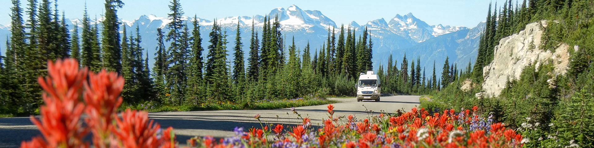
Mount Revelstoke National Park offers the extraordinary experience of driving a paved road from an elevation of 470 metres on the Trans Canada Highway to 1835 metres at Balsam Lake. Winding 26 kilometres uphill, the Meadows in the Sky Parkway takes you through forests of cedar and hemlock, spruce and fir to the renowned subalpine wildflower meadows of Mount Revelstoke National Park.
On this page
Hours of operation and accessibility
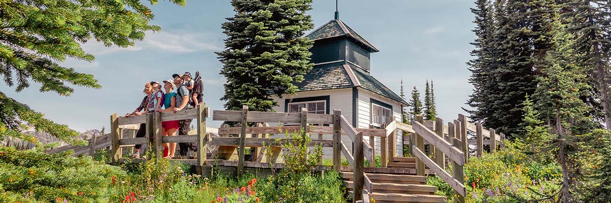
Easy strolls as well as longer hikes begin at the Balsam Lake parking area and the summit. To prevent damage to this mountain-top environment, you are asked to stay on the system of marked trails only. The subalpine vegetation of the meadows area is extremely fragile and the growing season is very short. The summit offers rare mountain-top hiking, strolling, picnicking and photography opportunities. A historic firetower crowns the summit.
The summit of Mount Revelstoke is a 1-km walk by trail or paved road from the Balsam Lake parking area. Accessible parking is available at the summit for those with permits. Please ask at the Parkway Welcome Kiosk for a permit.
Hours and seasons of operation for Parkway
Restrictions
Visiting with dogs
Dogs are not allowed above Columbia Viewpoint (12 km) on the Meadows in the Sky Parkway, which includes the summit area and backcountry of Mount Revelstoke National Park. Dogs are also not permitted in vehicles or on trails beyond this point. Elsewhere in the park, dogs must be on leash at all times.
Vehicle restrictions
Parking at the summit area is limited. Arrive early to avoid disappointment. The Meadows in the Sky Parkway is narrow and has tight switchbacks. Some vehicles are not permitted:
- Buses and Class A motorhomes over 7.9 metres (26 feet)
- Towed trailers or towed vehicles. These may be dropped off at the Nels Nelsen Historic Area, 0.5 km up the parkway from the Trans-Canada Highway.
Viewpoints and picnic areas
| Name | Distance | Description of view | |
|---|---|---|---|
| A | Revelstoke | 5km | The City of Revelstoke and Mount Begbie |
| B | Rainforest | 6.5km | A quiet mountainside creek |
| C | Monashee | 8km | The Columbia River, Monashee Mountains and Eagle Pass |
| D | Columbia | 12km | The Selkirk Mountains and Columbia Valley |
| E | Eagle Pass | 13km | Eagle Pass and the Monashee Mountains |
| F | Panorama Point | 24km | Illecillewaet and Columbia River valleys |
- Date modified :