
Day Hikes
Kootenay National Park
In the mountains, trail conditions can change quickly. Find the latest trail condition reports and closures for Kootenay National Park. Be sure to check back often for up-to-date information.
Hiking in Kootenay National Park
Day hikes in Kootenay National Park
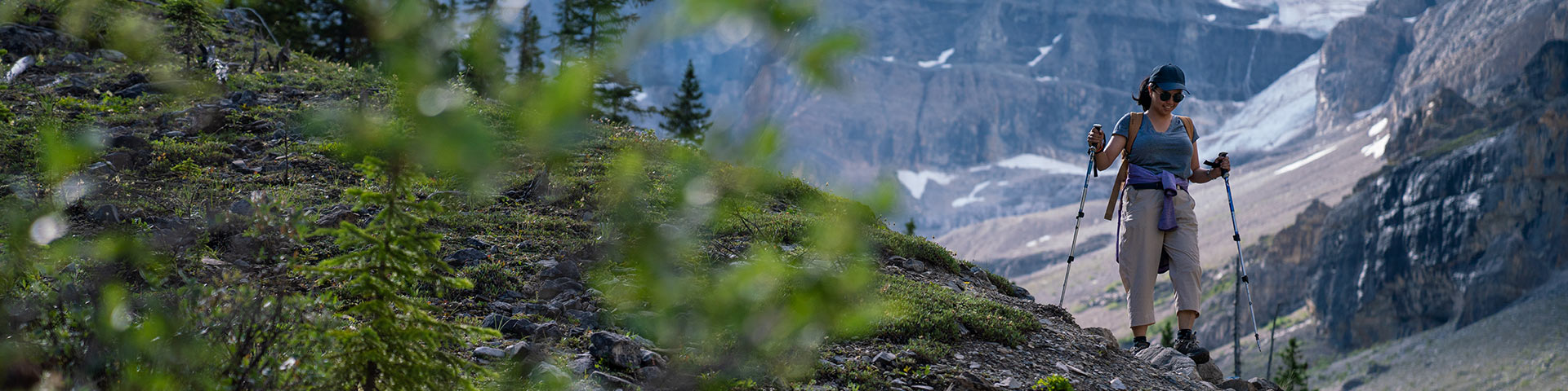
Challenge yourself on the Kindersley-Sinclair Loop through alpine meadows and over mountain ridges, or set out on an ambitious day hike through naturally fire-swept forest to the active Stanley Glacier.
| Trail | Distance (one way) | Estimated Time (return) | Elevation gain* | Elevation loss* |
|---|---|---|---|---|
 Helmet - Ochre Junction
 |
5.8 km | 4 hours | 235 m | 150 m |
| Simpson River |
8.8 km | Up to 5.5 hours | 135 m | 190 m |
 Stanley Glacier Stanley Glacier |
4.4 km | 3 hours | 385 m | 40 m |
| Kimpton Creek |
4.6 km | 3 hours | 455 m | 100 m |
 Numa Creek Numa Creek
|
6.3 km | 4 hours | 385 m | 250 m |
| Kindersley / Sinclair Loop |
17.3 km loop | 6 hours | 1,325 m | 1,325 m |
| Hawk Creek & Ball Pass |
8.9 km | 7 hours | 1,065 m | 150 m |
| Floe Lake |
10.5 km | 7 hours | 1,110 m | 415 m |
*Note: On most hiking trails you will gain and lose elevation before you reach your destination. Elevation gain represents all the up and elevation loss all the down you will experience on a one-way hike.
Trail Descriptions
Helmet - Ochre Junction
Helmet - Ochre Junction
Length (one way): 5.8 km
Estimated time (return): 4 hours
Elevation gain: 235 m | Elevation loss: 150 m
Trailhead: Paint Pots parking lot, 84 km east of Radium Hot Springs.
Habitat: Forested trail with lush ground cover leading to a river.
Description: A good backpacking destination for beginners through lush forest. Alternatively, a 4-hour day hike.
Backpacking: This trail leads to the Helmet / Ochre Junction backcountry campground. It is the northernmost access point for the popular Rockwall multiday backpacking route.
Simpson River
Simpson River
Length (one way): Up to 8.8 km
Estimated time (return): 5.5 hours
Elevation gain: 135 m | Elevation loss: 190 m
Trailhead: Simpson River parking lot, 57 km east of Radium Hot Springs.
Habitat: Forested trail near a three valley confluence. Watch for evidence of wildlife.
Description: A walk through a valley marked by fire. Check out the interpretive signs along the first 1.5 km of the trail. Learn about the incredible forces of nature: Lightning, wildfire, regeneration and succession.
Backpacking: This trail leads into Mount Assiniboine Provincial Park in British Columbia.
Stanley Glacier
Stanley Glacier
Length (one way): 4.4 km
Estimated time (return): 3 hours
Elevation gain: 385 m | Elevation loss: 40 m
Trailhead: Stanley Glacier parking lot, 91 km east of Radium Hot Springs.
Habitat: Regenerating forest, glacier, glacial moraine, cliffs, many small mammals. Watch for fossils.
Description: An extremely popular trail. Hike up to a stunning alpine basin and watch glacier meltwater tumble down massive rock walls. You can also experience this trail on a guided Burgess Shale fossil hike.
Kimpton Creek
Kimpton Creek
Length (one way): 4.6 km
Estimated time (return): 3 hours
Elevation gain: 544 m | Elevation loss: 100 m
Trailhead: Kimpton Creek parking lot, 9 km east of Radium Hot Springs. From the parking pullout, walk 100 m south-west along the highway and cross a small footbridge to start the trail.
Habitat: Forested trail with prominent avalanche slopes. Watch for bears.
Description: A cool forested trail on a hot day.
Numa Creek
Numa Creek
Length (one way): 6.3 km
Estimated time (return): 4 hours
Elevation gain: 385 m | Elevation loss: 250 m
Trailhead: Numa Falls parking lot, 80 km east of Radium Hot Springs.
Habitat: Forested, creekside trail opening into prominent avalanche paths.
Description: A shaded creekside trail.
Backpacking: This trail leads to the Numa Creek backcountry campround and is a middle access point for the popular Rockwall multiday backpacking route.
Note: This trail gets heavily impacted by avalanche debris year-round and may be closed. Check the trail report for updates.
Kindersley – Sinclair Loop
Kindersley – Sinclair Loop
Length (one way): 17.3 km
Estimated time (return): 6 hours
Elevation gain: 1,325 m | Elevation loss: 1,325 m
Trailhead: Kindersley Pass parking lot, 12 km east of Radium Hot Springs OR Sinclair Creek parking lot, 11 km east of Radium Hot Springs.
Habitat: Forested trail with avalanche slopes and rocky ridges. Watch for bears.
Description: A classic. Travel through a mixed landscape of forest, avalanche paths, alpine meadows and rocky ridges. A 1.2 km section on the highway completes the loop.
Be advised: Mandatory minimum group size of four because of grizzly bears in the area. Check the Trail Report.
Hawk Creek and Ball Pass
Hawk Creek and Ball Pass
Length (one way): 8.9 km
Estimated time (return): 7 hours
Elevation gain: 1,065 m | Elevation loss: 150 m
Trailhead: Floe Lake parking lot, 72 km east of Radium Hot Springs.
Habitat: Regenerating, post-burn forest.
Description: A challenging day hike to a rocky, rugged pass providing access to the Shadow Lake and Egypt Lake regions of Banff National Park.
Backpacking: This trail leads to backcountry camping in the Shadow Lake area of Banff National Park.
Floe Lake
Floe Lake
Length (one way): 10.5 km
Estimated time (return): 7 hours
Elevation gain: 1,110 m | Elevation loss 415 m
Trailhead: Floe Lake parking lot, 72 km east of Radium Hot Springs.
Habitat: Open and meadowy trail, burnt forest, glaciers, peaks and a large lake.
Description: One of the most popular day hikes in the park. Steep trail with sunny exposures and views along the way. Spectacular lakeside destination.
Backpacking: This trail leads to the Floe Lake backcountry campground and is the southernmost access point for the popular Rockwall Trail, multi-day route.
Related links
- Date modified :