

A drive through Rogers Pass in Glacier National Park is unlike any other section of the Trans-Canada Highway. Mountains rise steeply on either side as you traverse the second highest point along the Trans-Canada Highway at 1,330 metres.
Plan ahead with DriveBC
Check the weather forecast and driving conditions before you hit the road. The most up to date information on road conditions, closures, and delays is available on DriveBC (www.drivebc.ca).
On this page
Most requested
Winter driving safety
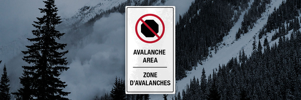
Glacier National Park receives an average of 14 metres of annual snowfall at treeline. Over a 40 km stretch of highway, there are 135 avalanche paths. To keep the transportation corridor safe, Parks Canada and the Canadian Armed Forces work in partnership to run the world’s largest mobile avalanche control program. Occasional highway closures are necessary for avalanche control during winter. To ensure your safety, sections of the highway below avalanche paths are no stopping areas. These areas are clearly marked with signs.
Be prepared for highway closures
When conditions warrant, Parks Canada and the Canadian Armed Forces will close the highway to perform avalanche control. Closures can last from 2 to 8 hours or longer depending on avalanche hazard, road conditions, weather, and traffic volumes. For safety and to ensure travellers have access to services, traffic will be held in Revelstoke and Golden when longer closures are required.
Let someone know your travel plans, keep your gas tank full, and always keep a safety kit in your vehicle in case of extended closures or mechanical failure. This should include water, food, candles, extra clothing and blankets.
Allow extra time and use caution when the highway reopens as traffic will be backed up. Be aware that even though the highway just reopened, there may be traffic coming the other direction including snowplows, traffic management crews and Parks Canada or provincial highway and avalanche control personnel. Once underway, resist the urge to make up for driving time lost during the closure; a motor vehicle incident can require the highway to close again!
Snow tires required in winter
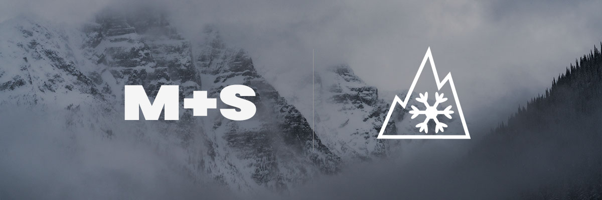
Rapid changes in elevation and weather can make highway conditions unpredictable during the winter. You may start a trip in sunshine but face stretches of slush, ice, heavy snowfall or compact snow along the way. Tires with a mountain and snowflake or M+S rating are required from October 1 to March 31. Parks Canada and British Columbia's Ministry of Transportation and Infrastructure recommend winter tires with a mountain and snowflake symbol as they provide superior traction in ice and snow. Learn more about winter tires.
Parking restrictions
There is no winter frontcountry camping in Glacier National Park and sleeping in vehicles overnight in parking areas is prohibited.
Parking areas at the Rogers Pass Discovery Centre and Illecillewaet Valley trailhead are open and do not require a permit between 4:00 AM and 9:00 PM. All other parking lots in Glacier National Park are restricted between November and April each year, and require a Winter Parking Permit. Restricted parking lots open or close daily depending on avalanche control work.
All parking lots provide access to Winter Restricted Areas and trails that enter avalanche terrain. If you want to leave your vehicle and stretch your legs, please speak to staff at the Rogers Pass Discovery Centre for advice and suggestions on how to stay safe.
Map of parking areas
Open parking
To park here:
- National park pass required
Restricted parking
To park here:
- The area must be open
- Winter Permit required
- National park pass required
No stopping
These zones are exposed to avalanche danger at all times. No stopping is allowed.
Related links
- Date modified :