
Campground maps
Waterton Lakes National Park
The map shows the location of campsites, services and facilities in the Townsite Campground, located in the Waterton community. The map illustrates roads, Cameron Creek, Upper Waterton Lake and any other closed or restricted areas in the vicinity. A map illustrating the locations of the campsites at Belly River Campground, and access to the area. This map lists information about group camping, services and facilities available, lists contact information in case of emergencies and any other closed or restricted areas in the vicinity.Townsite Campground Map
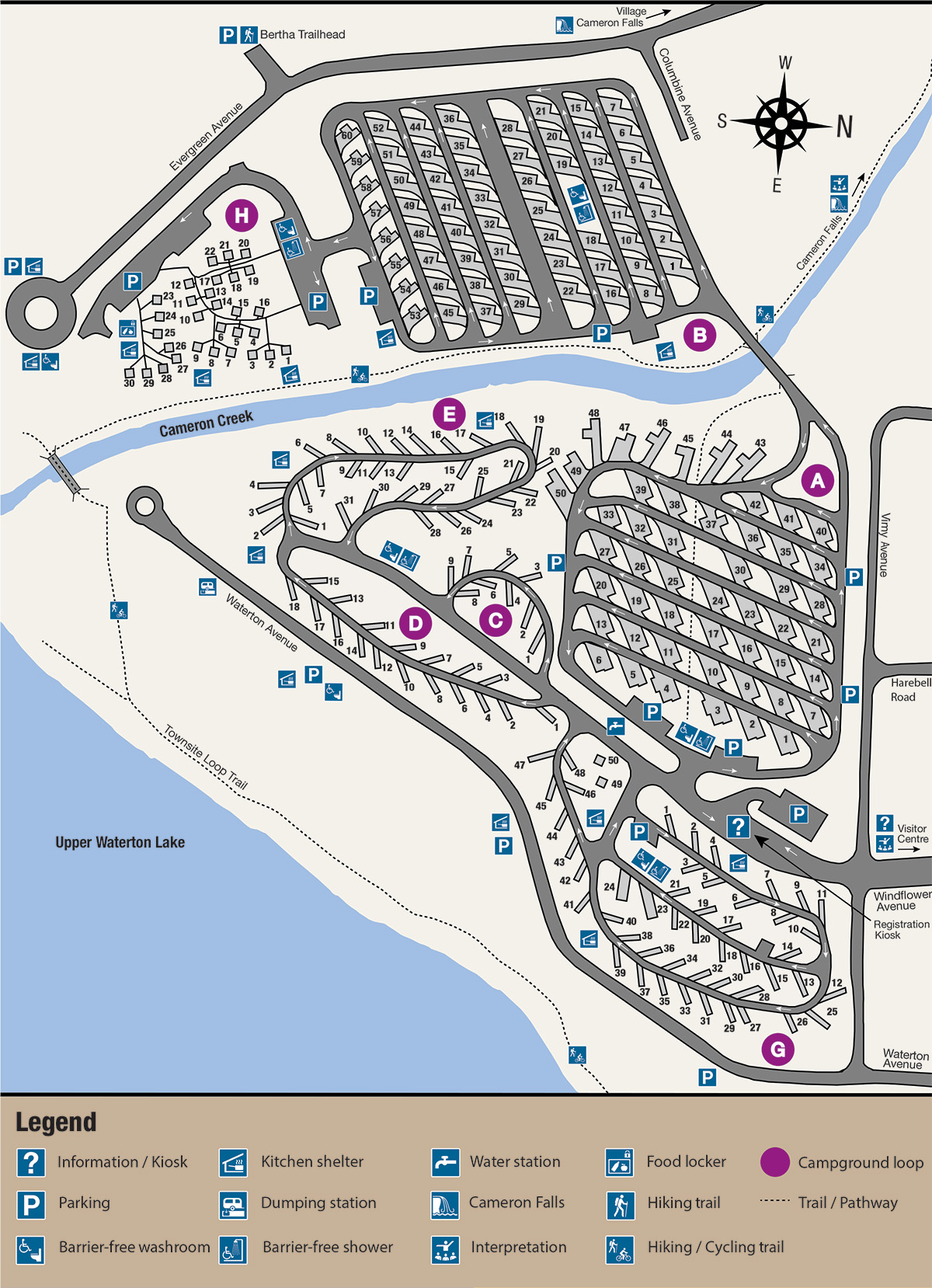
Townsite campground map - Text description
Belly River Campground Map
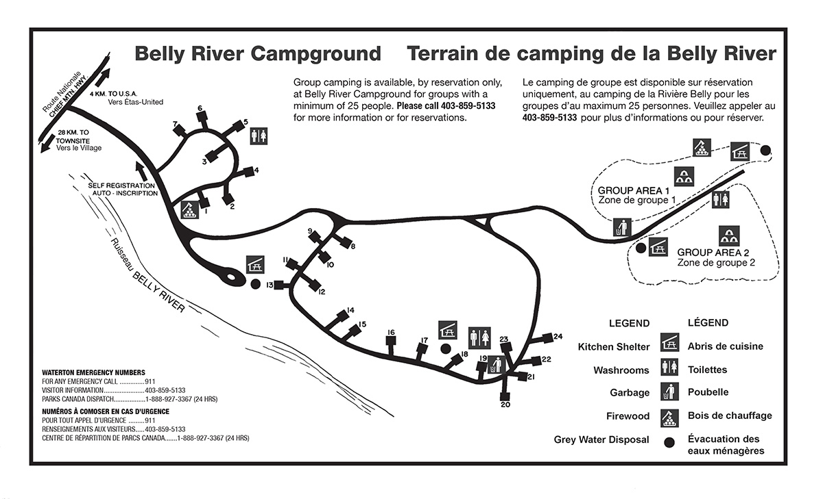
Belly River campground map - Text description
Related links
- Date modified :