
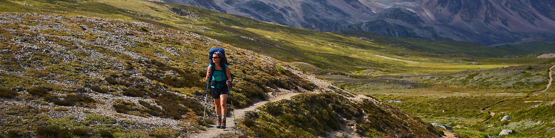
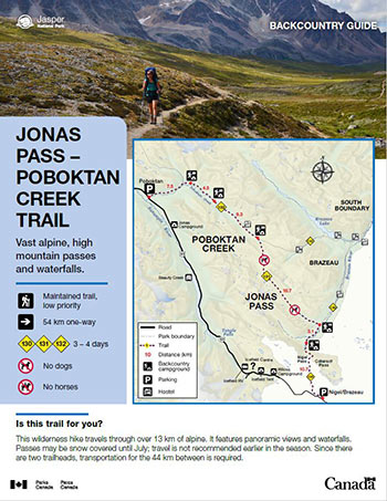
Vast alpine, high mountain passes and waterfalls.
Jonas Pass-Poboktan Creek
Jasper National Park
 Jonas Pass-Poboktan Creek Backcountry Guide (PDF, 3.61 MB)
This wilderness hike travels through over 13 km of alpine. It features panoramic views and waterfalls. Passes may be snow covered until July; travel is not recommended earlier in the season. Since there are two trailheads, transportation for the 44 km between is required.
Planning considerations
- Maintained trail: low priority
- 54 km one-way
- Trail #130, #131 and #132: 3 - 4 days
- No dogs
- No horses
The details
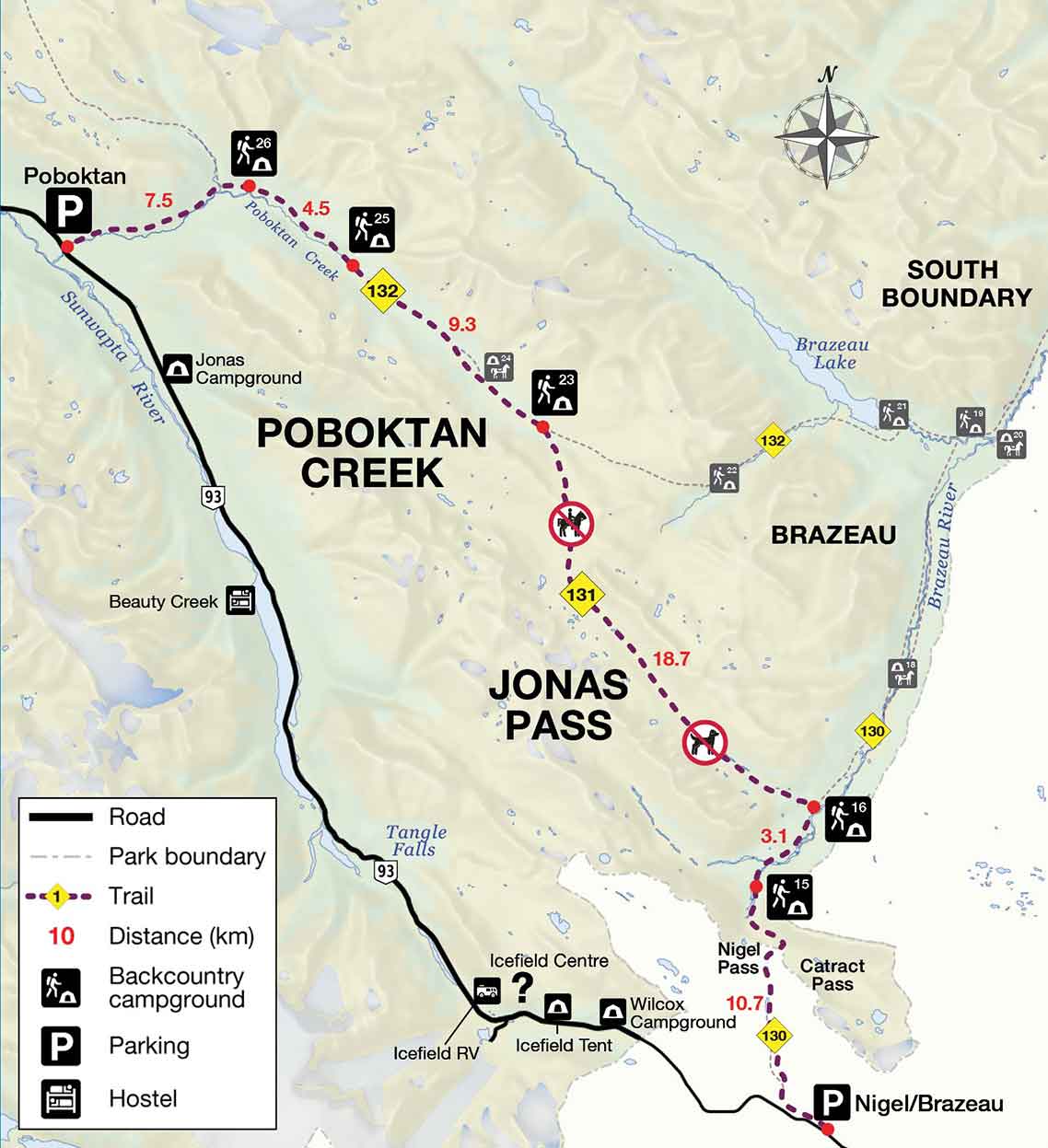
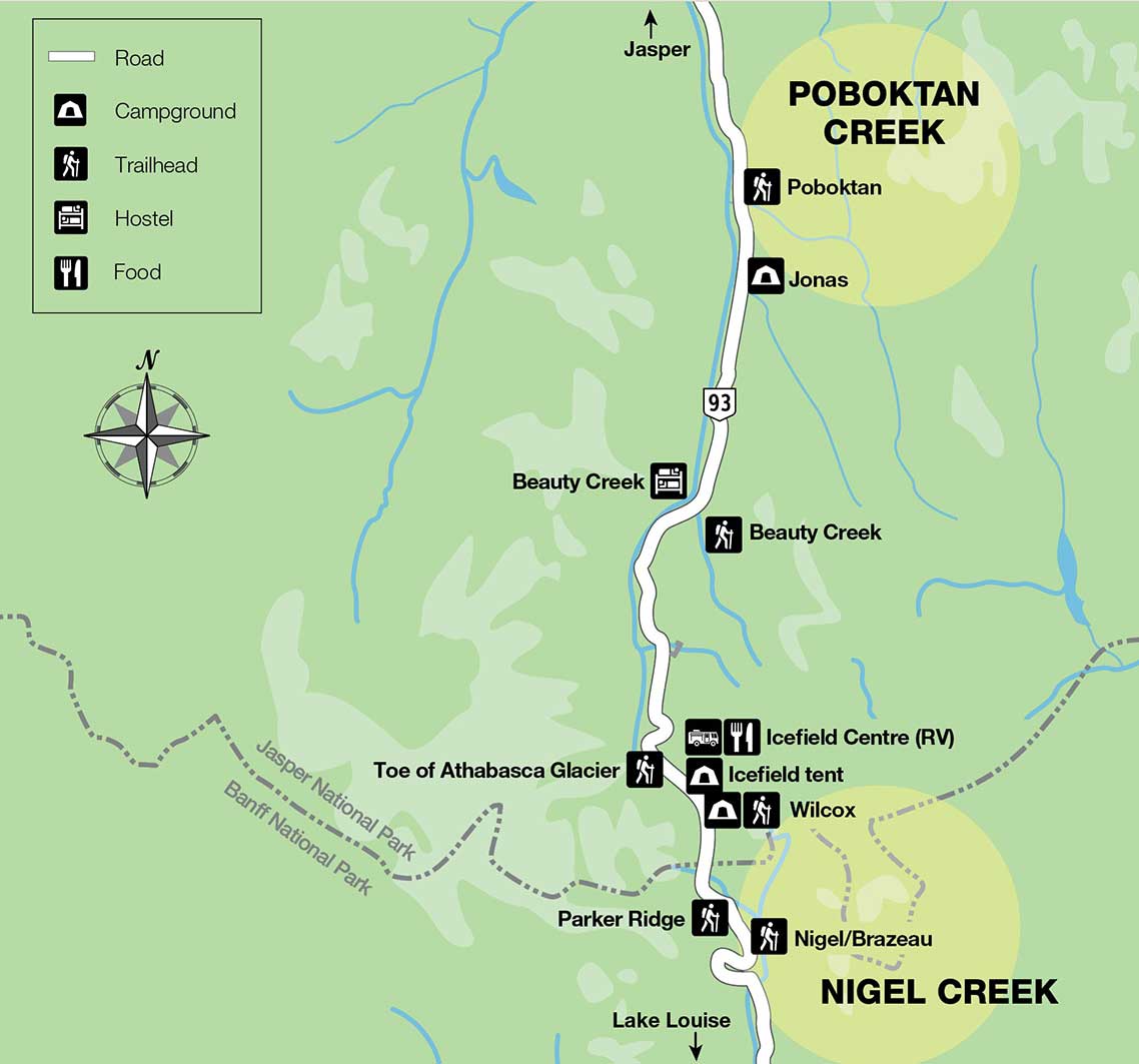
You can begin this trip from either the Poboktan Creek trailhead, or the Nigel Creek trailhead. Nigel Creek to Poboktan Creek loses more elevation than it gains.
From Nigel Creek trailhead, hike over Nigel Pass to Four Point campground (#16,13.9 km). The next day is strenuous, travelling over Jonas Pass and up Jonas Shoulder to Jonas Cutoff campground (#23,18.9 km). Continuing north along Poboktan Creek brings hikers to Waterfalls campground (#25, 9.3 km), then to Poboktan Creek campground (#26, 4.5 km) and finally Highway 93 at Poboktan Creek trailhead (7.5 km).
- Fires are only permitted in designated fire pits. Fires are not allowed at Jonas Cutoff Campground (#23). Check for fire bans.
- Horses are not permitted on Jonas Pass trail (131).
- Dogs are not permitted on the Jonas Pass trail (131) or the Poboktan Creek trail (132).
- The Poboktan Creek and Jonas Pass trails are seasonally closed for caribou from November 1 to May 15.
Elevation profile
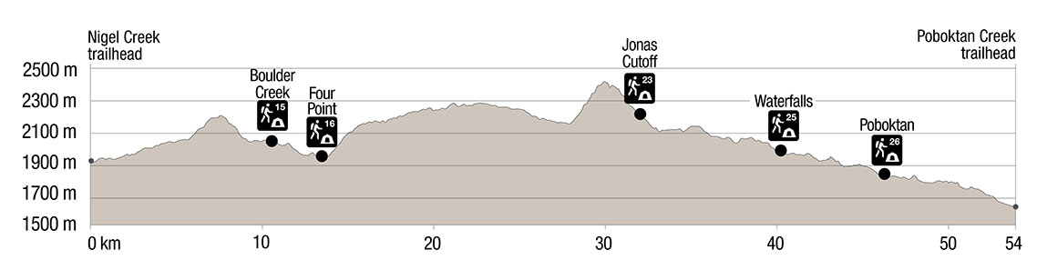
Text version
- The elevation profile shows the trail beginning at the Poboktan trailhead at 1540 m.
- Over the next 10.7 km, the trail ascends over Nigel Pass, (2195 m) then descends to Boulder Creek Campground (2036 m).
- The trail mainly descends 3.1 km to Four Point Campground (1935 m).
- Over the next 18.7 km, the trail travels over Jonas Pass (2320 m), up a steep ascent to the top of Jonas Shoulder (2470 m) and then steeply down over 3.3. km to Jonas Cutoff Campground (2094 m).
- The 9.3 km of trail to Waterfalls Campground (1916 m) travels mainly downhill.
- The next 4.5 km of trail to Poboktan Creek Campground (1771 m) travels mainly downhill.
- The trail descends for the final 7.5 km to Poboktan Creek trailhead at 1540 m.
Campground information
| Campground | Elevation | Description | # of sites | Toilet type | Food storage | UTM |
|---|---|---|---|---|---|---|
| Boulder Creek #15   |
2036 m | This campground has pretty views and is located close to the Brazeau River. | 4 | Throne | Lockers | 11U 492962 5790100 |
| Four Point #16 |
1935 m | A forested campground close to the Brazeau River with nice views. The junction for Jonas Shoulder is just after this campground. | 8 | Throne | Lockers | 11U 494770 5792240 |
| Jonas Cutoff #23   |
2094 m | This campground sits next to a creek and offers beautiful views. Note this high-elevation campground is somewhat exposed; it does not provide much shelter in inclement weather. | 8 | Barrel | Lockers | 11U 485891 5805050 |
| Waterfalls #25 |
1916 m | This campground is situated on a bench above a beautiful waterfall with wonderful mountain views. | 8 | Throne | Lockers | 11U 479517 5810723 |
| Poboktan #26 |
1773 m | A forested campground next to Poboktan Creek. | 4 | Throne | Lockers | 11U 476187 5813156 |
How to get there
Nigel Creek trailhead
From Jasper
- 116 km south on Highway 93 (the Icefields Parkway).
- Turn left at the Nigel Creek parking lot. The parking lot is 13 km south of the Icefields Centre.
From Banff and Lake Louise
- From Highway 1, take Highway 93 (the Icefields Parkway) towards Jasper for 114 km.
- Turn right into the Nigel Creek parking lot.
Poboktan Creek trailhead
From Jasper
- The parking lot is 72 km south on Highway 93 (the Icefields Parkway) on the left side.
From Banff and Lake Louise
- From Highway 1, take Highway 93 (the Icefields Parkway) towards Jasper for 161 km.
Are you prepared?
Safety is your responsibility
Refer to the Jasper National Park Backcountry Planning Guide:
- descriptions of trail types and campground facilities;
- equipment checklists;
- responsible camping practices;
- safety information.
Before heading out, check trail, weather and road conditions at: parks.canada.ca/jaspertrails.
Maps
| NTS | National Geographic |
|---|---|
| Columbia Icefield 83C/3 Sunwapta Peak 83C/6 |
Jasper South |
Permits
A backcountry camping permit is mandatory for all overnight trips and can be obtained online at reservation.pc.gc.ca or by calling 1-877-737-3783.
Related links
- Athabasca Island
- Athabasca Pass
- The Brazeau Loop
- Celestine Lake to Rock Lake Trail
- Fiddle River Trail
- Fryatt Trail
- Saturday Night Lake Loop
- Jacques Lake
- Maligne Lake
- Skyline
- Tonquin Valley Trail
- Random camping
- Little Heaven – Upper Blue Creek
- Maligne Pass
- The North Boundary Trail
- South Boundary trail
- Bivouacking guidelines
- Horse use in Jasper National Park
- Date modified :