
A remote, rugged trek through stunning wilderness in Jasper’s northern region.
Little Heaven – Upper Blue Creek
Jasper National Park
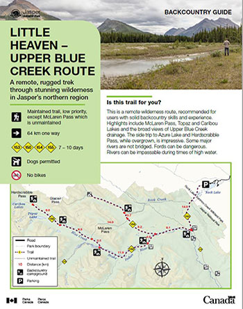 Little Heaven – Upper Blue Creek Backcountry Guide (PDF, 862 KB)
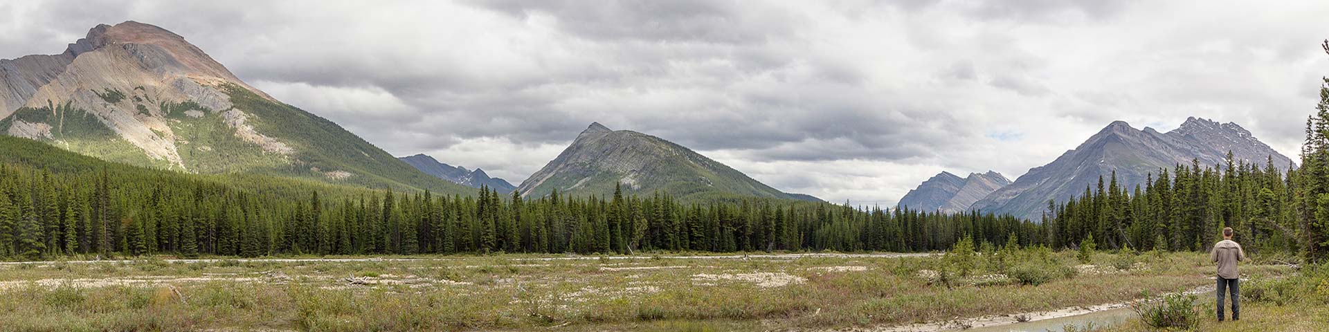
This is a remote wilderness route, recommended for users with solid backcountry skills and experience. Highlights include McLaren Pass, Topaz and Caribou Lakes and the broad views of Upper Blue Creek drainage. The side trip to Azure Lake and Hardscrabble Pass, while overgrown, is impressive. Some major rivers are not bridged. Fords can be dangerous. Rivers can be impassable during times of high water.
Planning considerations
- Maintained trail: Low priority, except McLaren Pass which is unmaintained
- 64 km one way
- Trails #153, 150, 154, 155: 7 - 10 days
- Dogs permitted
- No bikes
The details
This trip begins and ends at Rock Lake, in the Province of Alberta. The first 1.5 km of trail are on an old road. At the first junction, follow the trail to Willow Creek and cross into Jasper National Park at km 5. The first campsite is Willow Creek (#66) on the North Boundary trail. Travel west along the North Boundary trail to the Glacier Pass / Little Heaven junction at km 23. The Glacier Pass trail runs above Deer Creek and climbs to the meadows at Little Heaven. The Little Heaven camping area (#84) and the junction for McLaren Pass are just before a Parks Canada cabin. The 14 km McLaren Pass route (unmaintained) then travels along Deer Creek for the majority of the distance before the climb to the alpine meadows of its scenic pass. After a steep descent, the route intersects with the trail on the north side of Blue Creek. Here you have the option of turning right to explore the Upper Blue Creek drainage or turning left to head back to the North Boundary trail.
The rewarding Upper Blue Creek valley leads hikers through extensive meadows toward the peaks of the Ancient Wall. From the McLaren pass junction, the trail heads northwest along Upper Blue Creek. The Ancient Wall hiker/horse camping area (#86) is a little over 6 km from the junction. Continuing up-valley, the 1.7 km side trip to Topaz Lake is a worthy destination, though requires a ford of Blue Creek and route finding. At km 15.5 from the McLaren pass junction is the Natural Arch hiker/horse campground (#87). The Natural Arch viewpoint is 1.5 km beyond and offers a unique view of a rock arch carved out of the limestone mountain. Caribou Lakes can be explored in the area also.
To complete this trip, head back down the Blue Creek drainage to Blue Creek Campground (#70) on the North Boundary trail. Along the 39 km back to the Rock Lake trailhead, you have the option of taking a short 400 m side trip off the trail to see Welbourne Falls.
- There is little or no maintenance on this route. Some sections of trail are overgrown, decreasing sightlines and making route finding necessary.
- Many creeks and rivers are not bridged. Fords can be dangerous or impassable. Travel is not recommended during times of high water.
- Bridges and corduroys are not maintained. Some corduroys have been removed across bog areas due to safety concerns.
- Camping areas are basic.
- McLaren Pass is not passable for horses due to the removal of corduroy west of Little Heaven.
- There are several old routes in the Upper Blue Creek valley that make for fascinating exploration. Route finding skills are essential.
- The Rock Creek trail and the North Boundary trail are seasonally closed for caribou conservation from November 1 to May 15.

Campground information
| Campground | Elevation | Description | # of sites | Toilet type | Food storage | UTM |
|---|---|---|---|---|---|---|
| Willow Creek – Hiker |
1360 m | A simple camping area near Willow Creek, across the creek from Willow Creek Horse Camp. | 4 | Throne | Cable | 11U 410612 5914645 |
| Little Heaven |
1720 m | An unmaintained camping area near a meadow at the Glacier Pass / McLaren Pass junction. | 4 | Bar | Cable | 11U 396428 5917532 |
| Ancient Wall |
1707 m | A simple camping area along Blue Creek. | 4 | Throne | None | 11U 382686 5915583 |
| Natural Arch |
1795 m | A simple camping area at the edge of a meadow. | 4 | Throne | Pole | 11U 376081 5920440 |
| Blue Creek |
1520 m | A simple camping area, that is shared with horse groups, in the forest near Blue Creek. | 4 | Throne | Pole | 11U 391067 5910390 |
| Welbourne – Hiker |
1440 m | A simple camping area near Willow Creek, across the creek from Willow Creek Horse Camp. | 4 | Bar | Pole | 11U 400416 5911090 |
How to get there
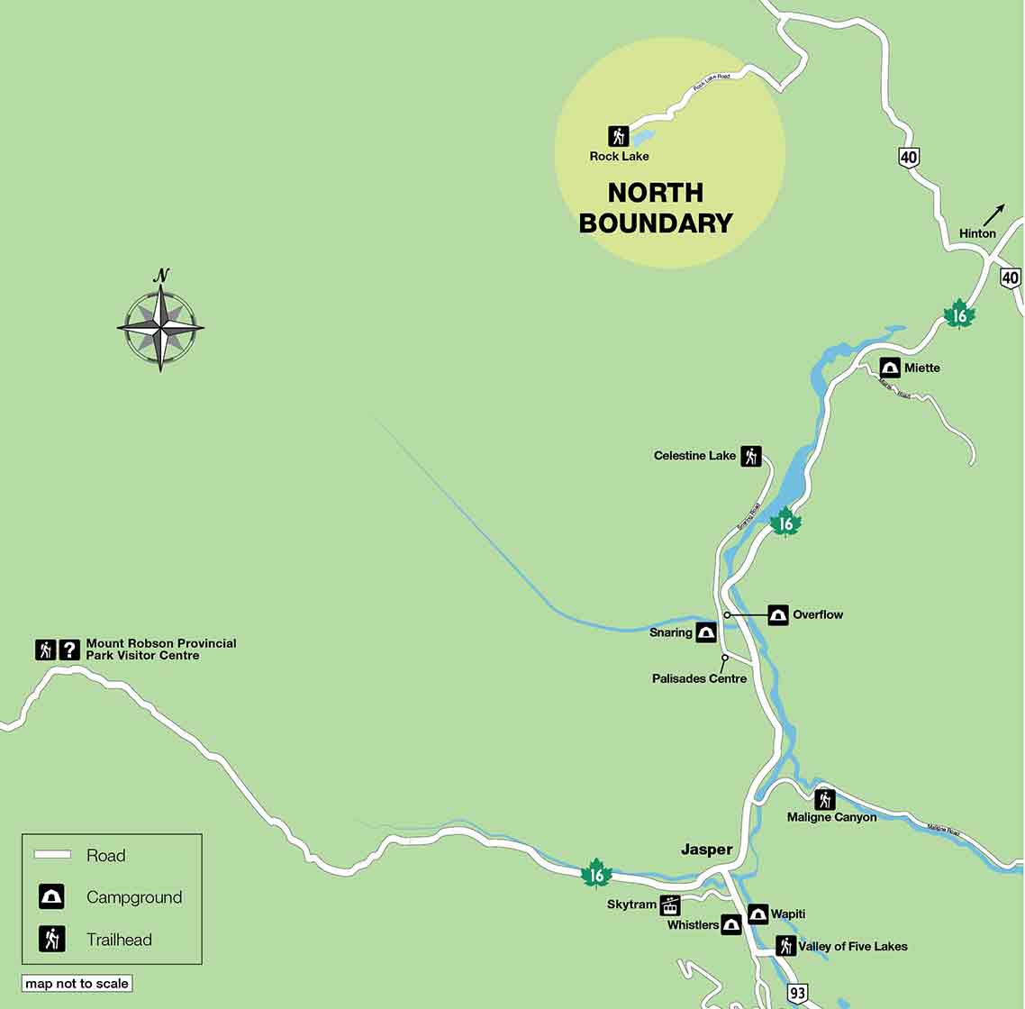
Rock Lake trailhead
This trailhead is located in the Willmore Wilderness outside of the park.
- Travel Highway 16 east, about 70 km, toward Hinton,
- Turn north on Hwy 40 and travel about 40 km,
- Turn west at the Rock Lake turnoff and travel 32 km on a gravel road to Rock Lake.
- Look for the signs directing you to Willmore Wilderness Park and the trailhead parking lot. You do not want to park at the Rock Lake Campground.
Are you prepared?
Safety is your responsibility
Refer to the Jasper National Park Backcountry Planning Guide:
- descriptions of trail types and campground facilities;
- equipment checklists;
- responsible camping practices;
- safety information.
Before heading out, check trail, weather and road conditions at: parks.canada.ca/jaspertrails.
Maps
| NTS | National Geographic |
|---|---|
| Rock Lake 83E/8 Blue Creek 83E/7 |
Jasper North |
Permits
A backcountry camping permit is mandatory for all overnight trips and can be obtained online at reservation.pc.gc.ca or by calling 1-877-737-3783.
- Date modified :