
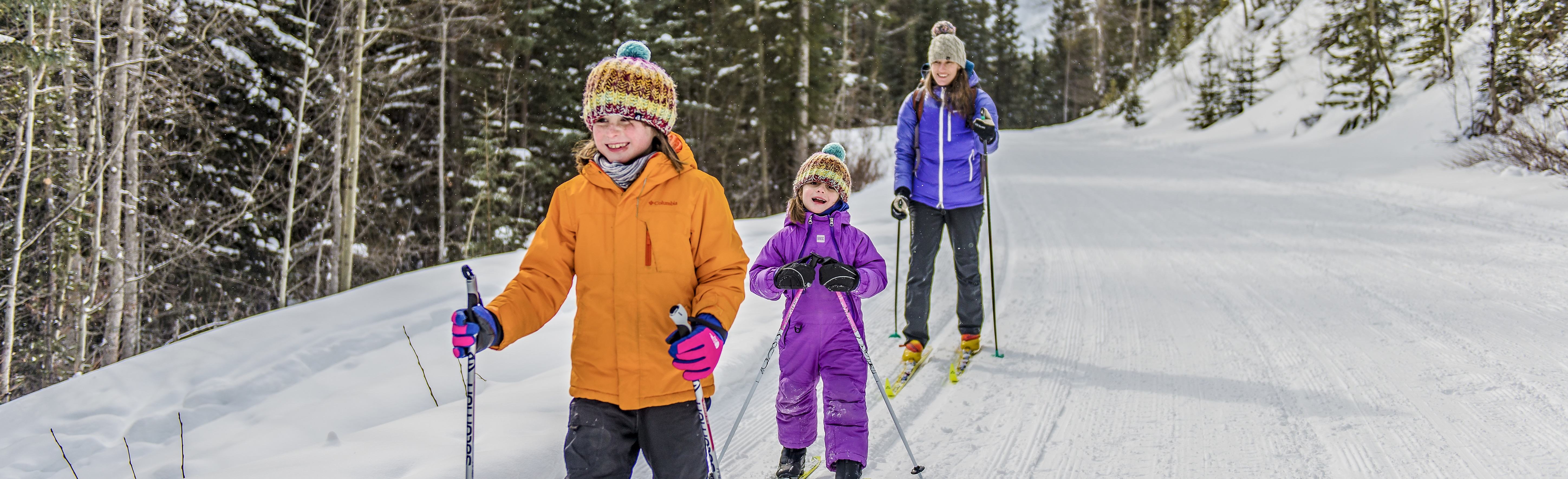
Recommended cross-country ski trails in the Banff area
Banff National Park
Winter Safety
Safety is your responsibility. There are always hazards associated with outdoor recreation. Even short trips from the town of Banff can have serious consequences.
- Ask for advice at a Parks Canada Visitor Centre for help with trip planning.
- Check current trail conditions, warnings and closures.
- Study descriptions and maps before heading out. Always choose a trail suitable for the least experienced member in your group.
- Tell somebody where you are going, when you will be back and who to call if you do not return.
- Expect that trail conditions and winter hazards may change throughout the day. Consult weather forecasts and be prepared for changing weather and emergencies.
- Winter hazards include avalanches, disorientation, thin ice, hypothermia and frostbite.
- From November to March, make sure your vehicle is winterized. Snow tires are mandatory on some roads. Consult the winter driving safety information and visit 511.alberta.ca for road reports.
- In case of EMERGENCY, call 911 or satellite phone: 403-762-4506. Cell phone coverage is not reliable throughout the national park.
Recommended Packing List
- Trail guide and map: guidebooks and topographic maps are available at the Banff and Lake Louise visitor centres, and retail outlets in Banff and Lake Louise.
- Full water bottle or thermos
- High energy food
- Bear spray
- First aid kit and repair kit
- Lightweight emergency blanket, candle and lighter or waterproof matches
- Headlamp or flashlight with spare batteries
- Toque or winter hat and gloves
- Sunscreen and sunglasses
- Hand and toe warmers
- Extra warm clothing in case of an emergency
- Cell phone or satellite emergency communication device
Visit parksmountainsafety.ca for additional information on winter packing.
Wildlife
Although bears are denning during the winter, they can awaken at any time for short periods. Cougars, wolves and other wildlife remain active throughout the year. If you see wildlife, do not approach; give them lots of space and observe from a distance with binoculars or a telephoto lens. If tracks are observed, do not follow them towards the animal.
Be alert, make noise, carry bear spray and know how to use it. Learn more about keeping yourself safe.
Report wildlife encounters and sightings of bears, cougars, wolves and coyotes: 403-762-1470
Avalanche Risk

Avalanche season in the mountains extends from November to June, and even a short walk can take you into avalanche terrain. Trails on this page with a known hazard are identified with an avalanche symbol. When travelling beyond marked trails, or past an avalanche danger sign, assume you are in avalanche country – your group should be prepared with the appropriate knowledge, skills and equipment.
Check the current avalanche forecast at a Parks Canada visitor centre or avalanche.ca. Visit parksmountainsafety.ca for more information on backcountry travel and how to stay safe in the mountains.
Trail Etiquette
Trails are shared in the national park, which means you could see people fat biking while you are winter hiking, or people skiing while you are snowshoeing.
- The track-set portion of the trail is for classic skiing only. The flat, groomed lane is for other users.
- When climbing, please yield the right of way to descending skiers and fat bikers.
- If you fall, move off the track as quickly as possible.
- When taking a break, step to the side, leaving room for others to pass.
- Leave no trace. Pack out everything you pack in.
- Read the trail descriptions as dogs are not allowed on some trails. Keep dogs on leash and under physical control at all times.
Roam Public Transit

Trails identified with a bus symbol indicate that the trailhead is accessible by public transit. Limited bike rack space available on buses. Skis and snowshoes are welcome inside buses. Visit the Roam Public Transit desk at the Banff Visitor Centre or visit roamtransit.com for fares, maps and schedules.
Trail Ratings
|
Easy |
|
|
Moderate |
|
| For all trails, be prepared as conditions can change quickly; easy and moderate trails can become difficult due to weather change, icy conditions or poor visibility. | |
| Trail | Distance | Activity recommended |
|---|---|---|
 Tunnel Mountain Winter Trails Tunnel Mountain Winter Trails |
8 km all loops | |
| Spray River West Trail |
5.6 km one way | |
| Healy Creek |
5.5 km one way |   |
| Cascade Valley (to Cascade River bridge) |
6.3 km one way | |
| Cascade Valley (to Stoney Creek) |
15.1 km one way | |
| Castle Junction |
3.9 km of trails | |
 Goat Creek and Spray River Goat Creek and Spray River |
19 km one way | |
| Brewster Creek |
11.1 km one way |  |
| Redearth Creek |
10.5 km one way | |
| Castle Junction |
5 km one way |
Easy trails
Tunnel Mountain Winter Trails
8 km all loops
No elevation gain
Trailhead: Tunnel Mountain Trailer Court Campground entrance
Roam route 2
Two seasonally closed campgrounds offer first-time skiers the perfect place to try out a new sport. Get your evening fitness fix with 2.6 km of lit trails in Trailer Court or explore the 5.4 km quiet, forested loops of Village 1. Dogs are prohibited on ski trails.
Spray River West Trail
5.6 km one way from Spray River West trailhead to Spray River bridge
Elevation gain 105 m, elevation loss 70 m
Trailhead: Spray River West trailhead, past the Fairmont Banff Springs Hotel
Roam route 2
This locals' favourite is double track-set with skate-skiing lane, offering rolling terrain in a picturesque river valley. Bring a snack; there is a picnic spot beside the river near the bridge.
Avalanche hazard: Avalanche paths from Sulphur Mountain cross the Spray River 4.5 - 5 km from the Spray River trailhead. Do not stop in this area.
Healy Creek
5.5 km one way from Healy Creek/Brewster Creek trailhead to Sundance Canyon junction
Elevation gain 95 m, elevation loss 100 m
West Trailhead: Healy Creek/Brewster Creek trailhead on the Sunshine Village Access Road
East Trailhead: Cave and Basin National Historic Site, start at Sundance Trail west of the building
This forested trail is a taste of the backcountry, close to town. Track setting occurs when adequate snow is available. For a shorter one-way trip, arrange for a drop-off at the Healy Creek/Brewster Creek trailhead, and ski or fat bike into the town; a short trail will bring you along Cave Avenue to the Banff Avenue bridge.
Cascade Valley
6.3 km one way to Cascade River bridge
Elevation gain 135 m, elevation loss 50 m
15.1 km one way to Stoney Creek
Elevation gain 250 m, elevation loss 85 m
Trailhead: Lake Minnewanka Day-use Area parking lot
This wide trail is double track set with a skate skiing lane to Cascade River bridge and single track set for the remaining route to Stoney Creek on pleasant rolling terrain. Enjoy a fun downhill return trip. For an additional 2 km round trip, ski the trail to Upper Bankhead.
Castle Junction
3.9 km of trails
Minimal elevation gain
Starting point: Parking area on the HI Hostel road south of Castle Junction
A series of interconnected single track-set trails that wind through spruce forest.
Moderate trails
Goat Creek and Spray River
19 km one way
Elevation gain 435 m, elevation loss 160 m
Goat Creek trailhead: 8 km south of Canmore on Spray Lakes Road
Spray River West trailhead: Parking area behind the Fairmont Banff Springs Hotel
The track-set trail can be skied and the flat, groomed lane can be biked in either direction. Most people choose to start at the Goat Creek trailhead above Canmore and ski or bike downhill most of the way to Banff. Bikes are prohibited on Spray River West in the winter. Vehicle shuttle recommended.
Avalanche hazard: Avalanche paths from Sulphur Mountain cross the Spray River 4.5 - 5 km from the Spray River trailhead. Do not stop in this area.
Brewster Creek
11.1 km one way (2.6 km from trailhead to Brewster Creek junction, plus 8.5 km to Sundance Lodge)
Elevation gain 315 m, elevation loss 150 m
Trailhead: Healy Creek/Brewster Creek trailhead on the Sunshine Village Access Road
This trail offers valley views through open and forested areas. Track setting occurs when adequate snow is available. For the more experienced, take the trail to Sundance Lodge. Note that hills can get icy.
Redearth Creek
10.5 km one way
Elevation gain 335 m
Trailhead: Redearth Creek trailhead
The trail climbs gradually through lodgepole pine forests to the Shadow Lake Trail. The last few kilometres back to the highway can be exhilarating; be extra cautious if conditions are icy.
Avalanche hazard: From the trailhead, two avalanche paths cross the trail at kilometres 3.3 and 4.4. Between kilometres 6.3 and 8, avalanche paths from Copper Mountain exist above the trail. Do not stop in these areas.
Castle Junction
5 km one way
Minimal elevation gain
Starting point: Parking area on the HI Hostel road south of Castle Junction
This trail runs from Castle Junction to Castle Mountain Lookout along the Bow Valley Parkway (Hwy 1A).
- Date modified :