
© Ray Schmidt
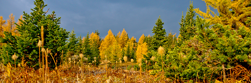
Golden larch day-hikes
Banff National Park
The peak season for autumn colours is from mid to late September.
Many locals and visitors make a special pilgrimage during the fall larch season. As a result, the most popular trail – Larch Valley – sees a huge influx of hikers. If you’re looking for a similar experience but with a few less hikers, these 8 hikes offer wonderful larch viewing opportunities in memorable settings.
When to go | Where to go | What to bring | Safety and etiquette | Trail report
Taylor Lake
6.3 km one way, 585 m elevation gain
4 to 5 hour round trip
Level of Difficulty: Difficult
Trailhead: Taylor Creek day-use area, 8 km west of Castle Junction on the south side of the Trans-Canada Highway.
Description: Thick forest gives way to subalpine meadows as you climb steadily to this classic glacial lake.
Side trip to O’Brien Lake:
2.1 km one way, 55 m elevation gain from Taylor Lake. Extend your Taylor Lake hike by
visiting the charming tarn.
Saddleback
3.7 km one way, 595 m elevation gain
3 to 4 hour round trip
Level of Difficulty: Difficult
Trailhead: Follow the Saddleback trail starting on the boathouse side of Lake Louise.
Description: Rising steadily above Lake Louise up to the Saddleback, you will be captivated by views of Mount Temple and Paradise Valley.
Lake Agnes
3.4 km one way, 385 m elevation gain
2.5 to 3 hour round trip
Level of Difficulty: Moderate
Trailhead: Start at the Upper Lake Louise parking area, 4 km from the village of Lake Louise.
Description: Framed by a quaint European style tea house, the Lake Agnes hike is the most “civilized” way to see the Rockies. To get there, hike up the well-maintained trail to enjoy a beautiful tarn tucked underneath towering peaks. Larch trees dot the shore of the lake.
Side trip to Big Beehive: 1.6 km one way; 135 elevation gain from Lake Agnes. Beyond Lake Agnes, use switchbacks to climb the Big Beehive for a stunning panorama of Lake Louise and the Chateau.
Side trip to Little Beehive: 1 km one way; 105 elevation gain from Lake Agnes. The Little Beehive was once the site of a fire lookout, and offers commanding views of the Bow Valley.
Arnica Lake
5.1 km one way, 580 m elevation gain
5 hour round trip
Level of Difficulty: Difficult
Trailhead: Vista Lake viewpoint on Highway 93 South, 8 km south of Castle Junction.
Description: The quietest of our fall larch hikes, the trail to Arnica Lake passes through both young post-fire forest and mature old growth timber before reaching a peaceful lake surrounded by larch groves.
Side Trip to Twin Lakes: 2.9 km one way, 135 m elevation gain from Arnica Lake. Hike under a canopy of larch trees over the scenic saddle between Arnica and Twin Lakes.
Boulder Pass
8.6 km to the pass, 640 m elevation gain
6 to 7 hour round trip
Level of Difficulty: Difficult
Trailhead: Fish Creek parking area, off Whitehorn Road, 3 km north of Lake Louise.
Description: After 4 km on a wide access road, you will reach a world dotted with lakes and inviting alpine meadows. From the pass, you get a spectacular view into a remote corner of Banff
National Park.
Healy Pass
9.0 km one way; 655 m elevation gain
6 to 7 hour round trip
Level of Difficulty: Moderate
Trailhead: Sunshine Village parking lot, 9 km from the Trans-Canada highway.
Description: From the far end of the Sunshine Village parking lot you will follow Healy Creek as it leads towards the continental divide. This classic hike provides expansive views, vast alpine meadows and larch trees.
Rockbound Lake
7.7 km to Tower Lake, 8.4 km to Rockbound Lake; 760 m elevation gain;
6 - 7 hour round trip
Level of Difficulty: Moderate
Trailhead: Rockbound Lake parking lot, 0.2 km east of Castle Junction on the Bow Valley Parkway (Highway 1A).
Description: A long, steady climb through the woods takes you to Castle Mountain’s “other side” where you will be treated to a pair of beautiful lakes you will not soon forget.
Bourgeau Lake
7.2 km one way; 725 m elevation gain;
6 hour round trip
Level of Difficulty: Moderate
Trailhead: South side of the Trans-Canada Highway, 13 km west of the Mt. Norquay Interchange.
Description: Rise through the dark mossy forests of the Bow Valley to a rock-rimmed alpine lake. The cliff face of Mt. Bourgeau provides a dramatic backdrop, making it a picture-perfect spot for lunch.
- Date modified :