
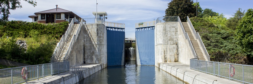
Drawdown
Trent-Severn Waterway National Historic Site
Drawdown is guided by research, engineering and decades of experience.
Drawdown is when water levels are lowered in the Trent-Severn Watershed.
It's a complex process that takes into consideration storage capacity of the lakes on the system, timing of fishery spawning, requirements for flood mitigation, typical fall and winter precipitation levels, downstream topography including constrictions like narrow river beds or dams, and overall volumes and flow rates.
For lakes Simcoe and Couchiching a unique guideline, called a "rule curve," is used to guide the lowering of water levels to allow room for future winter snow melt and precipitation. Since these lakes are so large and the outflows so small relative to the volume of water, the drawdown must be carefully managed to mitigate flooding and protect public safety.
In the Haliburton reservoir lakes area, drawdown occurs throughout the summer season to address downstream needs along the Trent-Severn Waterway. Water levels are based on equal percentage drawdown as developed through collaboration with local community participants.
Drawdown forecast
Most recent:
- October 2, 2023 (PDF 27 KB)
- September 24, 2023 (PDF 27 KB)
- September 17, 2023 (PDF 27 KB)
- September 10, 2023 (PDF 27 KB)
- September 3, 2023 (PDF 27 KB)
- August 27, 2023 (PDF 27 KB)
- August 20, 2023 (PDF 27 KB)
- August 12, 2023 (PDF 30 KB)
- August 8, 2023 (PDF 30 KB)
- July 29, 2023 (PDF 27 KB)
- July 23, 2023 (PDF 27 KB)
- July 16, 2023 (PDF 26 KB)
- July 9, 2023 (PDF 30 KB)
- July 3, 2023 (PDF 16 KB)
Previous:
- October 3, 2022 (PDF 25 KB)
- September 25, 2022 (PDF 22 KB)
- September 20, 2022 (PDF 22 KB)
- September 12, 2022 (PDF 22 KB)
- September 6, 2022 (PDF 22 KB)
- August 28, 2022 (PDF 22 KB)
- August 22, 2022 (PDF 22 KB)
- August 15, 2022 (PDF 22 KB)
- August 08, 2022 (PDF 22 KB)
- August 02, 2022 (PDF 22 KB)
- July 25, 2022 (PDF 17 KB)
- July 18, 2022 (PDF 22 KB)
- July 10, 2022 (PDF 22 KB)
- July 4, 2022 (PDF 22 KB)
- October 12, 2021 (PDF 17 KB)
- September 28, 2021 (PDF 22 KB)
- September 20, 2021 (PDF 16 KB)
- September 13, 2021 UPDATED (PDF 17 KB)
- September 7, 2021 (PDF 22 KB)
- August 29, 2021 (PDF 21 KB)
- August 23, 2021 (PDF 21 KB)
- August 16, 2021 (PDF 22 KB)
- August 9, 2021 (PDF 22 KB)
- August 3, 2021 (PDF 16 KB)
- July 26, 2021 (PDF 11 KB)
- July 20, 2021 (PDF 17 KB)
- July 14, 2021 (PDF 17 KB)
- July 6, 2021 (PDF 16 KB)
- June 29, 2021 (PDF 17 KB)
- June 22, 2021 (PDF 22 KB)
- June 14, 2021 (PDF 22 KB)
- October 4, 2020 (PDF 167 KB)
- September 28, 2020 (PDF 167 KB)
- September 20, 2020 (PDF 167 KB)
- September 12, 2020 (PDF 167 KB)
- September 9, 2020 (PDF 167 KB)
- August 25, 2020 (PDF 167 KB)
- August 18, 2020 (PDF 166 KB)
- August 10, 2020 (PDF 167 KB)
- August 4, 2020 (PDF 167 KB)
- July 27, 2020 (PDF 167 KB)
- July 14, 2020 (PDF 167 KB)
- July 7, 2020 (PDF 166 KB)
- June 29, 2020 (PDF 166 KB)
- September 30, 2019 (PDF 15.7 KB)
- September 22, 2019 (PDF 21 KB)
- September 16, 2019 (PDF 21 KB)
- September 10, 2019 (PDF 21 KB)
- September 3, 2019 (PDF 21 KB)
- August 26, 2019 (PDF 25 KB)
- August 19, 2019 (PDF 21.3 KB)
- August 13, 2019 (PDF, 24 KB)
- August 6, 2019 (PDF, 24 KB)
- July 29, 2019 (PDF, 11.6 KB)
- July 22, 2019 (PDF, 21.5 KB)
- July 16, 2019 (PDF, 21.5 KB)
- July 10, 2019 (PDF, 21.5 KB)
- July 4, 2019 (PDF, 21.5 KB)
- October 1, 2018 (PDF, 21.5 KB)
- September 24, 2018 (PDF, 7.05 KB)
- September 17, 2018 (PDF, 7.05 KB)
- September 10, 2018 (PDF, 8 KB)
- September 5, 2018 (PDF, 8 KB)
- August 27, 2018 (PDF, 8 KB)
- August 23, 2018 (PDF, 8 KB)
- August 13, 2018 (PDF, 8 KB)
- August 8, 2018 (PDF, 8 KB)
- July 31, 2018 (PDF, 8 KB)
- July 17, 2018 (PDF, 8 KB)
- July 9, 2018 (PDF, 7.08 KB)
- July 4, 2018 (PDF, 8 KB)
- October 2, 2017 (PDF, 14 KB)
- September 26, 2017 (PDF, 14 KB)
- September 6, 2017 (PDF, 7 KB)
- September 12, 2017 (PDF, 14 KB)
- September 19, 2017 (PDF, 21 KB)
- September 22, 2017 (PDF, 21 KB)
- August 21, 2017 (PDF, 14 KB)
- August 28, 2017 (PDF, 7 KB)
- Date modified :