
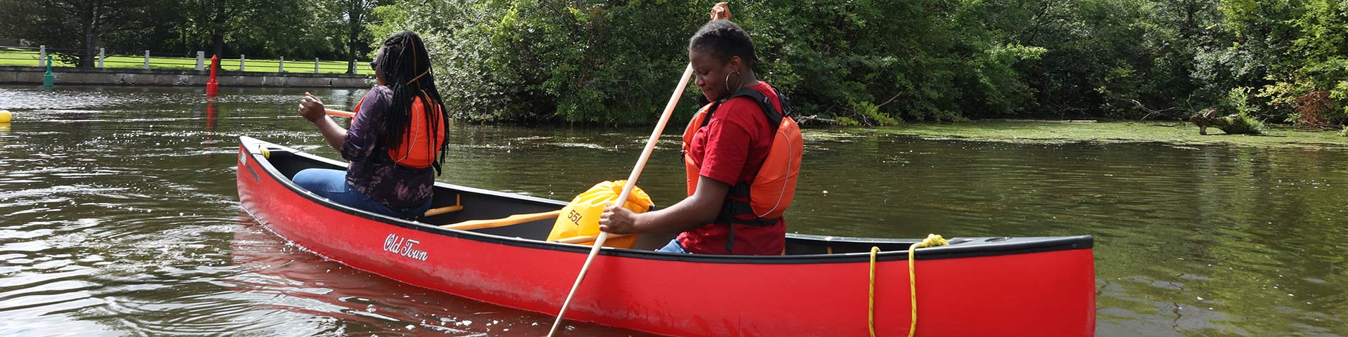
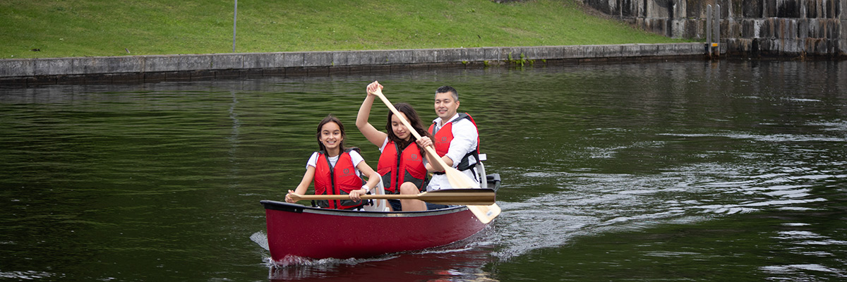
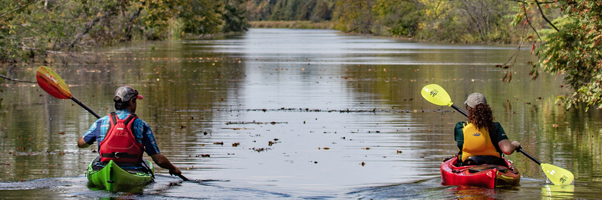
Paddling
Rideau Canal National Historic Site
Rideau Canal overview
The Rideau Canal National Historic Site stretches 202 km from Kingston to Ottawa, connecting visitors with an earlier time when canal building was a means of improving trade and defending a growing nation. Today the canal offers the perfect setting for relaxation and recreation, particularly for the paddler travelling by canoe or kayak.
The Rideau system encompasses 47 locks, 24 lockstations, several historic buildings, and two large watersheds: the Rideau and the Cataraqui. A number of natural paddling environments – lakes, rivers and wetlands – showcase the beauty and diversity of the system.
The canal was built in the early 19th century under the direction of Lt. Colonel John By of the British Royal Engineers, but Indigenous people of the area had been travelling the lakes and rivers of the Rideau route for centuries. In fact, only 19 kilometers of the system is cut channel.
Environments and conditions
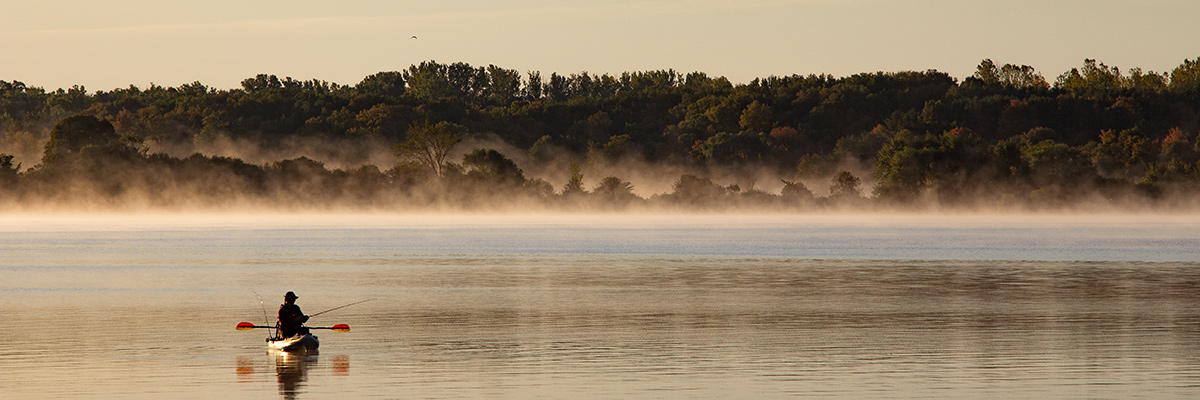
Imagine yourself gliding across the calm waters of the Rideau on a crisp morning. The first rays of sun bring nature to life, penetrating the ghostly fog and rising from the same tranquil waters that your boat silently travels. In the distance you hear a few common loons calling, while an osprey with piercing eye flies in circles looking to enter the morning fog and capture fresh fish for breakfast.
Classifications
- Open lake*
- Class I river (if you avoid dams)
- Class IV to Class VI at dams
*Capsize potential on the large lakes, particularly in extreme conditions such as thunderstorms and strong winds.
Paddling environments
When following the navigation route, the Rideau Canal offers five different paddling environments: lakes (various sizes and depths), marshes, open rivers, narrow channels, and populated rivers. Below is a description of what to expect on different sections along the way.
Kingston to Upper Brewers Locks
Overview
- Starts with the Cataraqui Marsh (Class I Wetland)
- Followed by Kingston Mills Lockstation and Colonel By Lake (a shallow, stump-littered lake with a shoreline of low rocks and few trees)
- Colonel By Lake then leads into a narrow channel and canal with cattails, grasses and overhanging trees
Other notes
- Great place to escape the wind (with the exception of Colonel By Lake which can become quite rough)
- Not the best place to swim
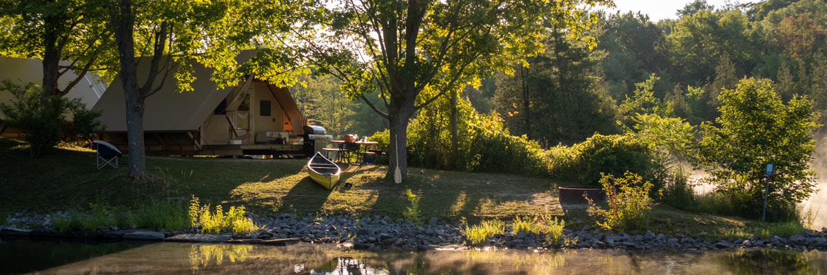
- Camping is excellent at all lockstations on this route
Upper Brewers Locks to Narrows Lock (including the Big Rideau)
Overview
- Beautiful, clear, scenic lakes with natural shorelines featuring local flora and fauna
- Short sections of canal as you enter and exit lockstations along the way
Other notes
- This stretch of the canal is the most popular with boaters and visitors
- Great for swimming and fishing
- Many bays and islands; an ideal atmosphere for paddling
Beveridges Locks to Long Island Locks
Overview
- Marsh, winding canal and river intermixed with smaller, shallow, flooded lakes and marshy shorelines
- Before the Detached Lockstation in Smiths Falls, you will encounter the Swale (Class I Wetland), the Tay River and the Tay Marsh (Class I Wetland) and Beveridges Lockstation
Other notes
- After the Detached Lockstation in Smith Falls, there are numerous other locks with easy take-out and put-in spots, making this area an ideal choice for short day trips
- En route, upstream from Merrickville you will find a Federal Bird Sanctuary and Class 1 and 2 Wetlands
Long Island Locks to Ottawa
Overview
- Winding canal lined with overhanging trees
- Largely sheltered from strong winds and waves
Other notes
- An urban type of paddling and a chance to get out on the water without having to go far from the city
- The density of residential development along the shoreline increases as you approach Ottawa
Navigating the Canal
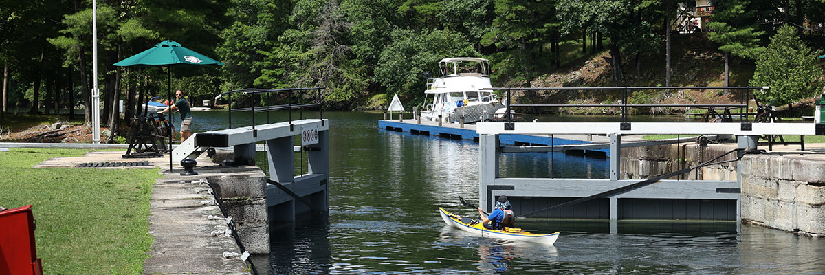
Travelling through lockstations
Depending on the length of your paddling trip, you may be required to pass through one of the 24 lockstations that connect various lakes and rivers along the Rideau Canal. When you reach a lockstation, you have two options:
Locking through
- Locks are designed to raise and lower boats from one water level to another
- You must purchase a lockage permit in order to travel through the locks
Portaging
Most lockstations have a paddle dock or suitable shoreline for exiting your paddlecraft and carrying your vessel to the other side of the lockstation free of charge.
Maps
There are two types of maps we suggest you consult on your paddling trip:
- Navigation charts can be purchased at most lockstations or the main canal office in Smiths Falls
- Topographic maps cover a wider area than the navigation charts (including: feeder lakes, rivers and streams along with highways and road access points) and can be downloaded from various sources online
Length of your trip
You can plan a paddling trip on the Rideau Canal that lasts an afternoon, a weekend, or an entire summer. With the ability to camp at almost any lockstation, plus an array of other reserveable accommodations to choose from, it's easy to design an adventure that fits your schedule.
End to end
The time it takes to paddle all 202 km of the Rideau Canal in one trip depends on the weather and skill level of the paddler. In general, you should set aside 6-10 days to paddle the entire system. If you'd also like to paddle the many lakes and rivers throughout the Rideau and Cataraqui watersheds, plan for an entire summer of canoe tripping.
Safety information
A number of visitor guidelines are in place on the Rideau Canal to help ensure that visitors enjoy a safe and memorable paddling experience while Parks Canada continues to preserve and protect this special place. Before visiting, review all visitor guidelines.
Mandatory equipment
- Lifejacket(s) for each paddler; wearing or within easy reach
- One extra paddle
- Bailing can
- Whistle or a horn for emergencies
- Throw rope; preferably floating rope
Dams and waste weirs
For your safety, stay away from any dams and waste weirs. For the most part, these hazards are located near lockstations and marked with either signs or orange and white booms.
Boatwash or wake
Watch out for boatwash or wake, and be prepared to handle the oncoming waves either by turning into the wave or using a low brace to stabilize the boat.
Weather conditions
Always check weather forecasts before heading out and choose your route accordingly. During a multi-day excursion, think ahead and check with lock staff as to the conditions for the next leg of your journey. Know the wind direction (not always a prevailing wind) and how this will affect your craft (head, side, or tail wind).
During periods of high water (April to mid-June), river flows/currents increase in strength and paddlers should be cautious. However, paddling current on the main channel does not exceed Class I. Other sections of the canal (dams and their run-off) can be classified as Class VI.
Important Bulletins
Be sure to check our Important Bulletins page before heading out on your paddling trip. Here we post information on closures, water levels and other information that may affect your travels. We post similar bulletins on social media. Follow @RideauCanalNHS on Twitter.
Paddling Tips
Best time to paddle
The best times to paddle on the Rideau Canal are during the shoulder seasons (May, June, September and October).
- Fewer powerboats
- Moderate temperatures
- Best choice of campsites
Paddling during peak season
If you wish to paddle during the height of powerboat season (July and August), the trip can still be fantastic. Unlike powerboats, canoes and kayaks do not have to follow the channel. In fact, most paddlers prefer to follow the shoreline and take a less direct route from one lock to another, away from the noise and wake of powerboats, and closer to interesting sights on shore. You may even decide to portage into the canal's numerous feeder lakes and rivers.
Best direction to paddle
If you wish to paddle the Rideau Canal in its entirety, or to travel a large section, the best direction to paddle is from Kingston to Ottawa for two reasons:
- Prevailing southwest winds blow in that general direction and there is nothing worse than tackling a large lake such as the Big Rideau and paddling for miles into a stiff south wind
- As you approach Ottawa, the current becomes less of a factor
Camping and accommodations
Camping at lockstations
Paddlers are welcome to camp at most lockstations on the Rideau Canal for a small nightly fee. Reservations are not required, but space is allocated at the discretion of the Lockmaster on a first-come, first-served basis.
oTENTik
Upgrade your camping experience by reserving a one-of-a-kind Parks Canada oTENTik (where available) and enjoy the rustic feeling of camping with the comfort of a covered shelter and bed.
Historic accommodations
Treat your paddling group to an overnight stay in a beautifully restored lockmaster's house or canalman's cottage at select lockstations. Get off the water for the weekend, or make it a memorable one-night stopover on your journey to the next destination.
Other options:
Colonel By Island
Camping is available on Colonel By Island on Big Rideau Lake. This government island has a beautiful 2km walking trail and an interior lake that opens onto the main lake. Lost Lake is not suitable for powerboats, but great for a nice evening or morning paddle. Deer, osprey and loons are but a few inhabitants of this island.
Provincial Parks and other lodgings
- Murphy's Point Provincial Park on Big Rideau Lake has several paddle-in camping areas
- Rideau River Provincial Park is located near Becketts Landing northwest of Kemptville
- There are also a number of hotels, lodges and bed & breakfasts up and down the Rideau Canal
- Date modified :