
How to get here
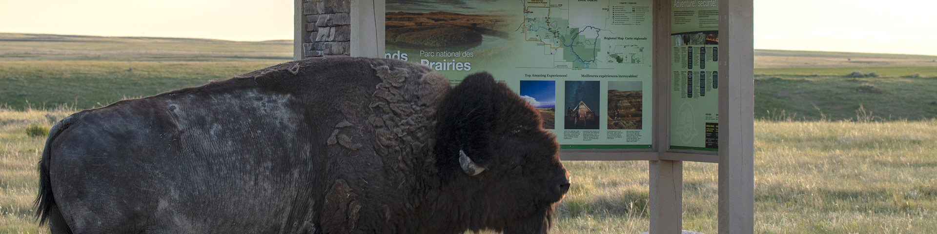
Grasslands National Park
All accesses to both blocks of Grasslands National Park are by gravel road only.
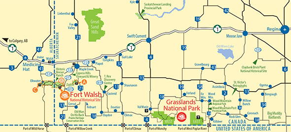
Grasslands National Park is located in southwestern Saskatchewan near the Saskatchewan-Montana border. The Park has two separate blocks. The West Block centres on the Frenchman River Valley and the East Block features the Badlands of Rock Creek and the Wood Mountain Uplands. The park's West Block can be accessed near the village of Val Marie on Hwy #4 and Hwy #18. Val Marie is a one and a half hour drive south of Swift Current. The Park's East Block can be accessed near the town of Wood Mountain on Hwy #18.
Finding your way
- The Visitor Centre and Campground receptions have up-to-date weather forecasts, road conditions and park maps.
- Cell phone coverage is not reliable in the park.
- Get oriented at the Visitor Centre and use navigation tools (maps, compass, GPS)
- Technology can be wonderful, but sometimes doing things the old fashioned way pays off. If you are travelling to Grasslands National Park, please be aware that GPS directions are not always correct. Be sure to research your route ahead of time, including road directions to the Block of the park that you are travelling to.
- Roads may become impassable when wet within the Park. This includes roads to the campgrounds.
- Make sure to plan ahead and fuel up your vehicle when possible.
Maps
We’re closer than you think!Distance between the two Grasslands National Park blocks: 166 km
By Vehicle
West Block:
a) Ecotour Road:
From the Visitor Centre, travel east on Hwy #18 for approximately 14.5 km, turn south and follow this gravel road for about 4 km. Watch for the park signs and the beaver symbol. Once inside the West Block, watch for pull-offs and interpretive panels for the Ecotour Scenic Drive. This is the main road through the West Block and is gravel.
b) 70 Mile Butte Access:
From the Visitor Centre, travel south on Hwy#4 for approximately 5km, turn east and follow this gravel road for about 5km.
c) Two Trees Access:
From the Visitor Centre, travel south on Hwy #4 for approximately 8km. Watch for the park signs and the beaver symbol. Continue straight onto the gravel road for approximately 2km. Turn East and continue to the Two Trees.
East Block:
Travel south of Wood Mountain Regional Park on Highway #18 for 22.4 km, watch for Grasslands National Park signs, turn west onto gravel road for 6.4 km, turn south for 6.4 km, then turn west for 2.4 km. Watch for Rock Creek Campground signs at each turn.
By air
Regina, Saskatoon and Calgary all have international airports that are serviced by major national and international carriers. Learn more about airline service to:
By rental car
There are several rental car agencies located Swift Current, Regina or Saskatoon.
Related sites:
- Canada Border Services Agency: for border crossing information
- Prairie Wind and Silver Sage: for topographic maps.
- Date modified :