
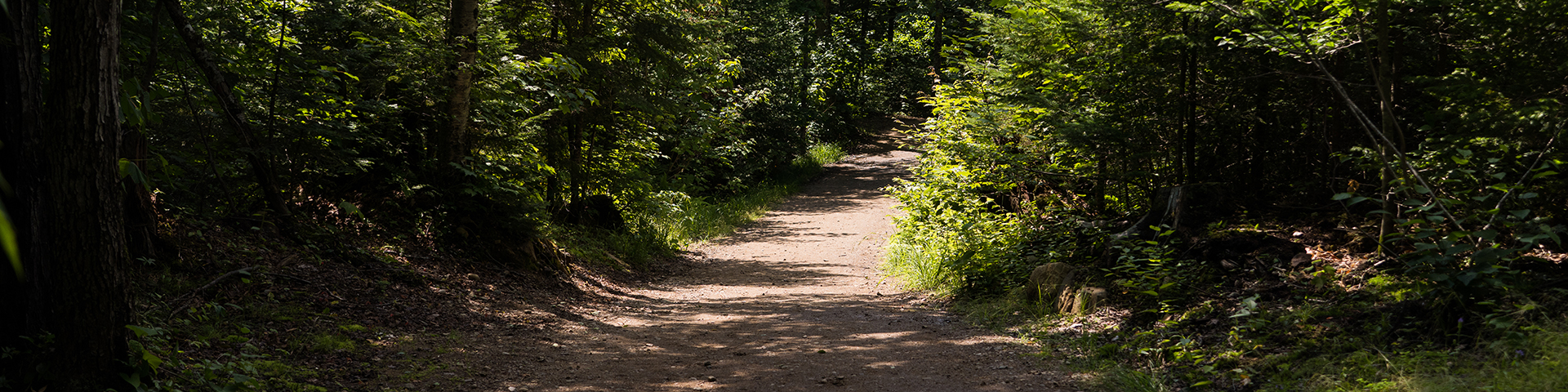
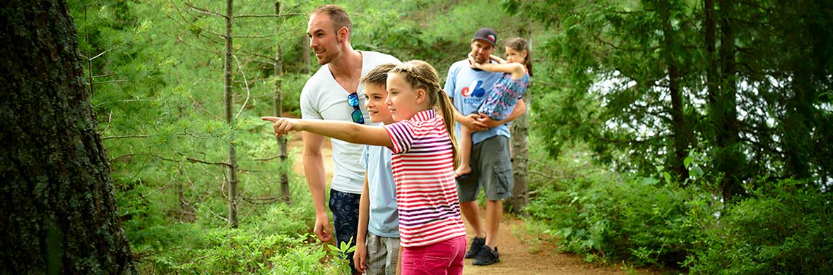
Easy, intermediate or difficult, the trails of La Mauricie National Park are accessible to all hiking enthusiasts.
Trail description
La Mauricie National Park
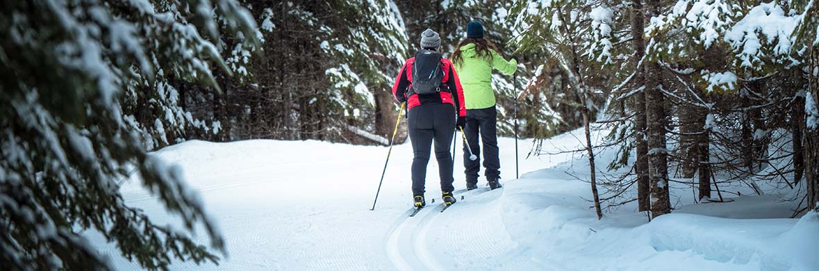
La Mauricie National Park gives you access to a vast network of marked trails. Whether you hike or ride a gravel bike in the summer, or cross-country ski or snowshoe in the winter, you are sure to find a trail that matches your ability and leads you to breathtaking lookout points.
Please note: The approximate times are for hiking and snowshoeing only. There are no approximate times given for the gravel bike and cross-country ski trails.
The multipurpose trails are shared by bikes and pedestrians in summer, cross-country skiers in winter and park service vehicles.
Easy: 
Intermediate: 
Difficult: 
Summer season
 Hiking trail
 Biking trail
 Trail requiring canoeing
Accessible via Saint-Jean-des-Piles Entrance
Off season, the Rivière à la Pêche sector parking lots, trails and pit toilets remain available. Note that emergency services could be unavailable or considerably delayed.
| Trail | Level of difficulty | Distance | Estimated time | Trailhead | Offer | |
|---|---|---|---|---|---|---|
| Multipurpose trail (#3) | 
|
15 km | ----- | Saint-Gérard Entrance |
|
|
This trail links St-Gérard and Rivière-à-la-Pêche. Rivière-à-la-Pêche to Isaïe shelter: 5 km Rivière-à-la-Pêche to La Pêche shelter: 9.5 km Rivière-à-la-Pêche Domaine Wabenaki-Andrew: 12 km |
||||||
| Sentier #5 |
|
3.5 km | ----- | ----- |
|
|
This oneway trail links the trails #6 (Pimbina shelter) and #3 (Isaïe shelter). |
||||||
| Trail #6 |
|
12 km | ----- | Rivière à la Pêche Service Centre |
|
|
From the Rivière à la Pêche Service Centre to the Pimbina Shelter (5.5 km), the trail is easy and overlooks Pimbina Lake. The section between the Pimbina and Marie shelters (6.5 km) is intermediate. |
||||||
| Trail #6A |
|
2.5 km | ----- | Rivière à la Pêche Service Centre |
|
|
This trail runs along the Parkway to Lake Bouchard. |
||||||
| Trail #7 |
|
3.5 km | ----- | ----- |
|
|
This trail for gravel bike enthusiasts takes you from the Marie Shelter, to the junction of #6 and #9, to the La Pêche Shelter on #3, on the shore of Lac-à-la-Pêche. |
||||||
| Trail #9 |
|
8 km | ----- | ----- |
|
|
Suitable for gravel biking, this trail runs along Lake Edward and Lake Marie. |
||||||
| Familiale (#11) |
|
4 km (loop) | 1.5 h | Rivière à la Pêche Service Centre |
|
|
An ideal trail for young families and to learn about hiking and gravel bike. |
||||||
| Lac-Solitaire (#13) |
|
5.5 km (loop) | 3 h | Rivière à la Pêche Service Centre |
|
|
Walk through a forest which is regenerating after a prescribed fire. Signs on the trail explain how prescribed fires improve forest health. Reading the signs will also give you a chance to catch your breath on the hill! The trail continues with a series of additional ascents and descents around the lake. |
||||||
| Ruisseau-Bouchard (#14) |
|
8.3 km (loop) | 4 h | Rivière à la Pêche Service Centre |
|
|
Begin by hiking along a portion of the Lac Solitaire Trail and discover some splendid panoramas. You then continue on your way to the Lac aux Chevaux lookout, and end your outing along a stretch running next to Bouchard Creek. |
||||||
| Lac-du-Pimbina (#15) |
|
13.1 km (loop) | 5 h | Rivière à la Pêche Service Centre |
|
|
You’ll be hiking through mountainous terrain, with stops at the lookouts at Lac Solitaire, Lac aux Chevaux and Lac du Pimbina. On the way back, you’ll travel alongside Bouchard Creek. |
||||||
| Deux-Criques |
|
17 km (loop) | 7 h | Rivière à la Pêche Service Centre |
|
|
Hike one of the park’s most beautiful and demanding trails. Get to see the Ruisseau du Fou falls. And, once you reach one of the lookouts, you’ll enjoy some breathtaking views. |
||||||
| Lac-Étienne |
|
1.4 km (loop) | 30 minutes | Lac-Édouard Picnic Area |
|
|
This trail is suitable for jogging strollers. A trail bringing you in contact with different aquatic habitats. Observation stations, interpretation panels and an adjustable telescope will enhance your walk. |
||||||
| La Cache |
|
3 km (loop) | 1 h | Lac-du-Fou parking lot |
|
|
This trail is suitable for jogging strollers. Watch wildlife through the telescope in the blind set up on the edge of Lac du Fou. Identify animals with the help of interpretation panels. |
||||||
| Mekinac |
|
11 km (loop) | 4 h | Rivière à la Pêche Service Centre Mekinac parking |
|
|
Take a challenging climb to the Lake Rosoy lookout and head to the red chairs for a breathtaking view of the Saint-Maurice River. |
||||||
Accessible via Saint-Mathieu-du-Parc Entrance
This sector is accessible during the Summer season only.
| Trail | Level of difficulty | Distance | Estimated time | Trailhead | Offer |
|---|---|---|---|---|---|
| Ruisseau-Brodeur |
|
1.4 km (round trip) | 30 minutes | Ruisseau-Brodeur |
|
Follow this narrow-sided brook as it cascades gently in the direction of Wapizagonke Lake. |
|||||
| La Tourbière |
|
300 m (loop) | 15 minutes | Esker Picnic Area |
|
Venture forth on a boardwalk into the middle of a floating green “carpet,” home to some fascinating orchids and carnivorous plants. |
|||||
| Vallerand |
|
3 km (round trip) | 1.5 h | Esker Picnic Area |
|
This trail is suitable for jogging strollers. As you walk along this trail, which passes under the Parkway and connects the Esker and Shewenegan picnic areas, you will come across the Vallerand, a cottage used in the past by hunting and fishing clubs. |
|||||
| La Terrasse |
|
3.8 km (loop) | 1.5 h | Wapizagonke Picnic Area |
|
This trail is suitable for jogging strollers. |
|||||
| Les Cascades |
|
2 km (loop) | 1 h | Shewenegan Picnic Area |
|
Follow a cascading stream and cross a marsh on a boardwalk. Take advantage of the waterway to take a break and refresh yourself. The first part of the trail is paved. |
|||||
| Lac-Gabet |
|
3 km (round trip) | 1.5 h | Lac-Gabet Parking lot |
|
Discover the secrets of a typical Laurentian forest. Take a break at the blind located on the edge of the lake. |
|||||
| Les Falaises |
|
3.8 km( loop) | 2 h | Ruisseau-Brodeur |
|
Hike to the lookouts located atop rock walls and admire the landscape surrounding Wapizagonke Lake. |
|||||
| Les Chutes Waber |
|
9.2 km by canoe / 7.9 km of hiking |
6 to 8 h | Wapizagonke Picnic Area |
|
Energize yourself with this one-day expedition to the amazing Waber Falls that combines canoeing and hiking. Plan to leave early in the morning and bring a lunch. |
|||||
| Lac-Reid |
|
7.9 km (loop) | 3 h | Le Passage |
|
This trail will take you to the shores of Reid Lake. |
|||||
Accessible via Saint-Gérard Entrance
Off season, the Saint-Gérard sector parking lots, trails and pit toilets remain available. Note that emergency services could be unavailable or considerably delayed.
| Trail | Level of difficulty | Distance | Estimated time | Trailhead | Offer |
|---|---|---|---|---|---|
| Multipurpose trail (#3) |
|
15 km | ----- | Saint-Gérard Entrance |
|
This trail links St-Gérard and Rivière-à-la-Pêche. Saint-Gérard to Domaine Wabenaki-Andrew: 3.5 km Saint-Gérard to La Pêche shelter: 6 km Saint-Gérard to Isaïe shelter: 10.5 km |
|||||
| Trail #8 |
|
4 km (loop) | ----- | Saint-Gérard Entrance |
|
This bike trail connects trails #3 and #7 and leads to the edge of Lake Parker. |
|||||
| Chute Parker |
|
8.2 km (round trip) | 3 h | Saint-Gérard Entrance |
|
Discover the Chute Parker, one of the hidden treasures of the park. |
|||||
Here are some additional landmarks:
- Rivière-à-la-Pêche to Isaïe shelter: 5 km
- Rivière-à-la-Pêche to La Pêche shelter: 9.5 km
- Rivière-à-la-Pêche to Place-de-la-Grande-Maison: 12 km
Winter season
 Hiking or snowshoeing trail
 Classic cross-country skiing trail
 Freestyle cross-country skiing trail
Accessible via Saint-Jean-des-Piles Entrance
Off season, the Rivière à la Pêche sector parking lots, trails and pit toilets remain available. Note that emergency services could be unavailable or considerably delayed.
| Trail | Level of difficulty | Distance | Estimated time | Trailhead | Offer | |
|---|---|---|---|---|---|---|
| Du Camping (#1) |
|
3.1 and 4.5 km (loop) | 2 h 30 | Rivière à la Pêche Service Centre |
|
|
Designed for beginners and families, this trail begins at the Rivière à la Pêche Service Centre. It circles round the campground and you can choose between two different return routes. The first route goes directly back to the point of departure, while the second extends the outing by 1.4 kilometres, offering pleasant views out over the Saint-Maurice River. |
||||||
| Trail #2 |
|
12 km | ----- | Rivière à la Pêche Service Centre |
|
|
Experienced cross-country skiers will be delighted to discover the majestic winter scenery offered by the Bérubé and Français lakes. |
||||||
| Multipurpose trail (#3 - North) |
|
11.5 km | ----- | Rivière à la Pêche Service Centre |
|
|
This trail links Rivière-à-la-Pêche Service Centre and the Domaine Wabenaki-Andrew. Rivière-à-la-Pêche to Isaïe shelter: 5 km Rivière-à-la-Pêche to La Pêche shelter: 9.5 km Rivière-à-la-Pêche to Domaine Wabenaki-Andrew: 11.5 km |
||||||
| Trail #5 |
|
3.5 km | ----- | ----- |
|
|
This oneway trail links the trails #6 (Pimbina shelter) and #3 (Isaïe shelter). |
||||||
| Trail #6 |
|
12 km | ----- | Rivière à la Pêche Service Centre |
|
|
From the Rivière à la Pêche Service Centre to the Pimbina Shelter (5.5 km), the trail is easy and overlooks Pimbina Lake. The section between the Pimbina and Marie shelters (6.5 km) is intermediate. |
||||||
| Trail #6A |
|
2.5 km | ----- | Rivière à la Pêche Service Centre |
|
|
Free style is forbidden on #6A trail. One-way trail. |
||||||
| Trail #7 |
|
3.5 km | ----- | ----- |
|
|
This trail for gravel bike enthusiasts takes you from the Marie Shelter, to the junction of #6 and #9, to the La Pêche Shelter on #3, on the shore of Lac-à-la-Pêche. |
||||||
| Trail #9 |
|
8 km | ----- | Rivière à la Pêche Service Centre |
|
|
This cross-country ski trail, located between trail #10 and the junction of trails #6 and #7, is open to both classic and free styles. This trail runs along Lake Edward and Lake Marie. |
||||||
| Trail #10 |
|
11.5 km | ----- | Rivière à la Pêche Service Centre |
|
|
This portion of the Parkway is reserved for fans of classic or free-style cross-country skiing. |
||||||
| Trail #11 (La Familiale) |
|
4 km (loop) | ----- | Rivière à la Pêche Service Centre |
|
|
An ideal trail for young families and to learn about cross country skiing. |
||||||
| Lac-Solitaire (#13) |
|
5.5 km (loop) | 3 h | Rivière à la Pêche Service Centre |
|
|
Upon completing a first ascent, you’ll reach the Lac Solitaire lookout. The trail continues with a series of additional ascents and descents around the lake. Take a break in the red chairs at the Lac aux Chevaux lookout. |
||||||
| Ruisseau-Bouchard (#14) |
|
8.3 km (loop) | 4 h | Rivière à la Pêche Service Centre |
|
|
Begin by hiking along a portion of the Lac Solitaire Trail and discover some splendid panoramas. You then continue on your way to the Lac aux Chevaux lookout, and end your outing along a stretch running next to Bouchard Creek. |
||||||
| Lac-du-Pimbina (#15) |
|
13.1 km (loop) | 5 h | Rivière à la Pêche Service Centre |
|
|
You’ll be hiking through mountainous terrain, with stops at the lookouts at Solitaire Lake, Lac aux Chevaux, Benoît Lake and Lac du Pimbina. On the way back, you’ll travel alongside Bouchard Creek. |
||||||
| Deux-Criques |
|
17 km (loop) | 7 h | Rivière à la Pêche parking |
|
|
Hike one of the park's most beautiful and quiet trails, but also one of its most challenging. Reach lookouts offering breathtaking views. |
||||||
| Mekinac |
|
11 km (loop) | 4 h | Rivière à la Pêche parking Mekinac parking |
|
|
Take a challenging climb to the Lake Rosoy lookout and head to the red chairs for a breathtaking view of the Saint-Maurice River. On your way back, take a break at the Familiale Shelter located near the Rivière-à-la-Pêche parking lot. |
||||||
Accessible via the Saint-Gérard Entrance
Off season, the Saint-Gérard sector parking lots, trails and pit toilets remain available. Note that emergency services could be unavailable or considerably delayed.
| Trail | Level of difficulty | Distance | Estimated time | Trailhead | Offer |
|---|---|---|---|---|---|
| Multipurpose trail (#3 - North) |
|
3.5 km | ----- | Saint-Gérard Entrance |
|
This groomed trail links the Saint-Gérard entrance and the Domaine Wabenaki-Andrew. The section is tracked on weekends only. To get to Trails 4 and 4A, and the Domaine Wabenaki-Andrew, you must take the Trail 3 – South. Saint-Gérard to Domaine Wabenaki-Andrew: 3.5 km |
|||||
| Lac-Parker (#4) |
|
2.1 km (round trip) | 1 h | Saint-Gérard Entrance |
|
From Domaine Wabenaki-Andrew to Parker Lake, snowshoers will discover spectacular viewpoints overlooking the surrounding mountains and they will be able to access the National Trail and the Parker Falls. To get to Trail #4, you must take Multipurpose trail #3 - South. |
|||||
| Lac à la Pêche Trail (#4A) |
|
6.3 km | 3 h | Saint-Gérard Entrance |
|
This trail travels along the rivière à la Pêche and the falls along this river, leading to a spectacular panorama. Next is a series of climbs and descents offering a variety of perspectives out over lac à la Pêche. Only the segment leading to the lac à la Pêche backcountry camping site no. 1 qualifies as difficult. |
|||||
| Trail #8 |
|
4 km (loop) | ----- | Saint-Gérard Entrance |
|
This classic cross-country ski trail links trails #3 - South and #7 and leads to the edge of Lake Parker. |
|||||
- Date modified :