
Day-use map of Kejimkujik National Park Seaside
Kejimkujik National Park and National Historic Site
Use this map to plan your trip to Kejimkujik National Park Seaside. It shows points of interest and facilities and services including: Harbour Rocks hiking trail, Port Joli Head hiking trail, parking, washrooms, and a picnic shelter.
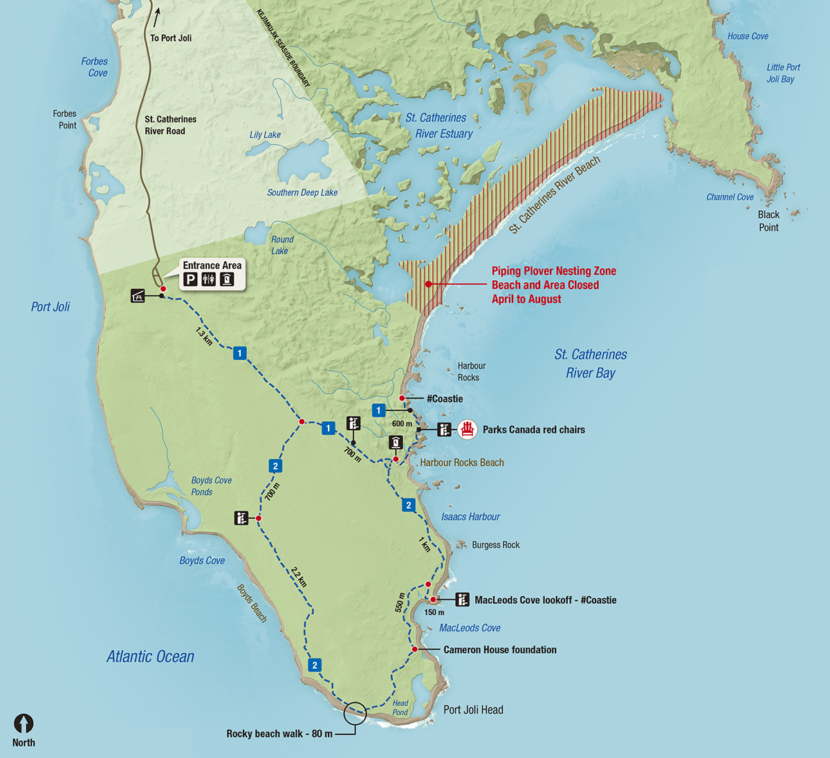
Legend
![]() Parking
Parking
![]() Picnic shelter
Picnic shelter
![]() Lookout
Lookout
![]() Gender-specific washrooms
Gender-specific washrooms
![]() Outhouse
Outhouse
![]() Hiking trail: Moderate
Hiking trail: Moderate
![]() Harbour Rocks Trail
Harbour Rocks Trail
![]() Port Joli Head Trail
Port Joli Head Trail
Piping plover nesting zone
St. Catherines River Beach and Little Port Joli Beach are closed for piping plover nesting from April to August.
Entrance Area
Facilities and services:
- Parking
- Gender-specific washrooms
- Outhouse
- Picnic shelter
Hiking trails
Harbour Rocks Trail
Trailhead: Begins at the entrance area and ends at the beginning of St. Catherines River Beach.
Length: 2.6 km (one way)
Difficulty: Moderate (Trail ratings guide)
Points of interest:
- Harbour Rocks lookoff
- Harbour Rocks Beach
- Parks Canada red chairs lookoff near Harbour Rocks Beach
- #Coastie site overlooking St. Catherines River Beach
Facilities and services:
- Outhouses near Harbour Rocks Beach
Port Joli Head Trail
Trail heads: Two entrances off Harbour Rocks Trail at 1.3 km and 2 km marks.
Length: 4.75 km (one way)
Difficulty: Moderate (Trail ratings guide)
Accessibility: Part of the trail is a rocky beach walk. This 80 metre section is located near the half way point of the trail, near Head Pond.
Points of interest:
- Boyds Cove lookoff
- Head Pond
- Port Joli Head
- Cameron House foundation
- MacLeods Cove
- #Coastie site at MacLeods Cove lookoff
- Burgess Rock
- Isaacs Harbour
Area shown on the map
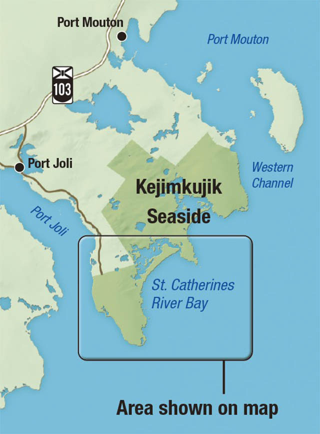
The southern area of Kejimkujik National Park Seaside is shown on the map.
Related links
- Date modified :