
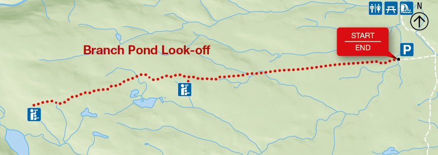
Branch Pond Look-off
Cape Breton Highlands National Park
The Branch Pond Look-off Trail is no longer maintained due to the removal of an unsafe bridge near the beginning of the trail. This page will be archived on April 1, 2024, and the trail will be removed from park maps and this website.Trail closed
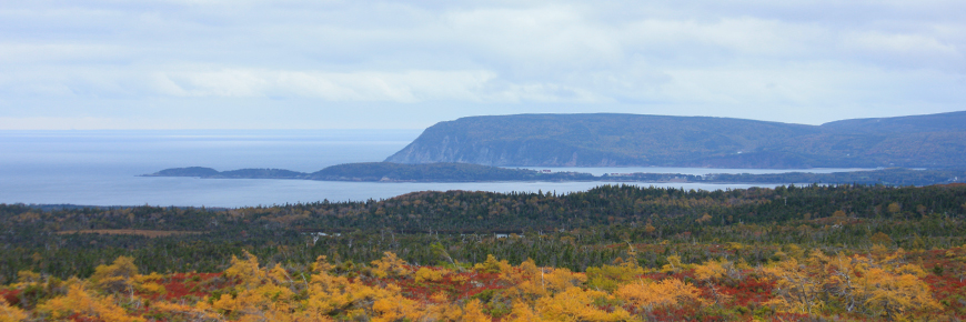
The trail explores Acadian, Boreal and Taiga land regions and leads to a look-off offering an impressive view of the Atlantic coast and the park interior plateau, with Cape Smokey and Cape North appearing as miniature mountains in the distance.
| Length | 8.4 km / 5.2 mi (return) |
    |
| Rating | Moderate |
|
| Elevation | 100 - 305 m (330 - 1,000 ft) | |
| Time | 4 - 5 hours | |
| Significant features | Highland plateau, barrens Gentle climb. Rugged sections. |
|
| Trailhead | Follow the Mary Ann Falls Road for about 5.9 km to a small parking area Lat: 46.753010 Long: -60.364957 |
Related links
- Acadian
- Salmon Pools
- Le Chemin du Buttereau
- Le Buttereau
- Le vieux chemin du Cap-Rouge
- Corney Brook
- Skyline
- Bog
- Benjie's Lake
- Fishing Cove
- MacIntosh Brook
- Lone Shieling
- Aspy
- Mica Hill
- Jack Pine
- Coastal
- Jigging Cove Lake
- Green Cove
- Broad Cove Mountain
- Warren Lake
- Franey
- Clyburn Valley
- Middle Head
- Freshwater Lake Look-off
- Freshwater Lake
- Date modified :