 Map of Manitoba
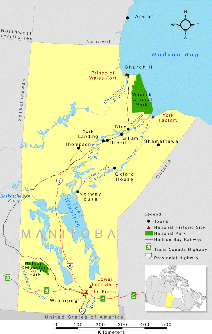
Image description
A map of Manitoba featuring Wapusk National Park bordering Hudson Bay in the northeast and Riding Mountain National Park in the southwest. The province is coloured pale yellow, parks are green, and bodies of water are blue. Neighbouring provinces are grey. In the north, Prince of Wales Fort is located just west of Churchill and York Factory is southeast of Wapusk National Park, separated by the Nelson and Hayes rivers. Lower Fort Garry is situated northeast of Winnipeg and The Forks is in downtown Winnipeg. A legend has black dots denoting the towns of Churchill, Bird, Gillam, Ilford, York Landing, Thompson, Shamattawa, Oxford House and Norway House. Red triangles denote national historic sites while green rectangles denote national parks. A thick horizontal line crossed with thin vertical lines denote the Hudson Bay Railway between Winnipeg and Churchill. A red horizontal line interrupted by a vertical-oriented green rectangle with a white maple leaf inside denotes the Trans-Canada Highway, while a red horizontal line interrupted by a downward-facing pentagon denotes provincial highways.
Data used to compile this map was supplied by Natural Resources Canada, Manitoba Land Inventory, and Parks Canada Agency.
This map is intended for general orientation purposes only and should not be used for navigation.
Map is projected in the Lambert Conformal Conic coordinate system.
