

The Peel Basin
Lachine Canal National Historic Site
This so-called "Peel Basin" is located between Lock No. 2 and the Wellington Bridge and is the first section of Reach No. 2, which is the body of water between Lock No. 2 and the Saint-Gabriel Lock. Although the name “Peel Basin” is embedded in popular culture, it was not an official place name during the years of the canal's operation as a commercial shipping channel.
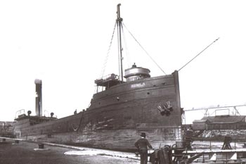
Historically, the Peel Basin area has played a major role in the industrial development of Montreal and Canada. Because of its depth and size, Peel Basin was a "reversal” basin and was the only section of the Lachine Canal that allowed ocean vessels to move through. It was nicknamed the "terminus of Montreal." This hub was a staging area for ocean vessels and ships destined for the interior network and was bordered by railroad tracks.
During the first expansion of the Lachine Canal, from 1843 to 1848, a first hydraulic site, Reach No. 2, was developed along Mill Street. This source of energy, less expensive and above all inexhaustible, would allow Montreal business to experience a major boom. This enlargement was used to build "the flour basins,” which are still accessible today.
It was during the second Lachine Canal expansion, from 1873 to 1884, that the current shape of the Peel Basin was developed. The Wellington Basin, a side basin overlooking the Peel Basin, was built starting in 1880 and received its first ships in 1883.
The Peel Basin would become a strategic link between ocean vessels and ships destined for the interior network. This portion of Reach No. 2 includes a reversal basin, which allowed large ocean vessels to unload their cargo, turn around, and return to the river that carried them back to the ocean.
Backfilling and Rehabilitation of the Peel Basin
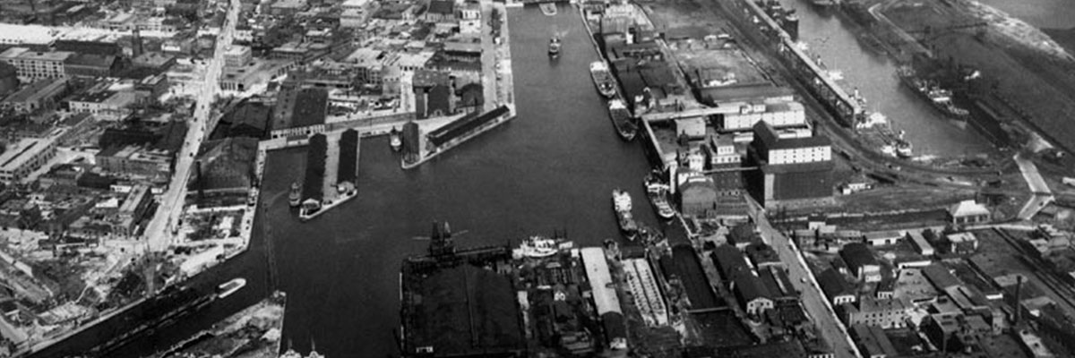
![Backfilling of the Peel Basin - 1972 © Archives de la Ville de Montréal [VM94-B103-006]](-/media/D3BF8F1C92374B38A6773E98CAC11CA5.ashx)
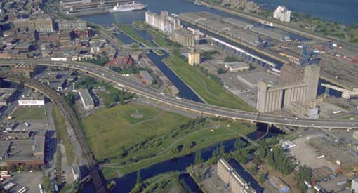
With the opening of the St. Lawrence Seaway in 1959, commercial shipping ceased and although through navigation for businesses along the canal continued, Reach No. 2, downstream of Spillway No. 2, was gradually backfilled between 1966 and 1970. Today, you can see the Bonaventure Expressway crossing part of the Peel Basin.
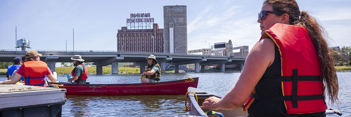
From 1997 to 2002, work carried out by Parks Canada to restore the Lachine Canal allowed for the clearing of the flour basins. The Peel Basin area offers a beautiful and unique view of Montreal’s historic industrial landscape, including Silo No. 5 and the famous “Farine Five Roses” flour mill sign.
Would you like to learn more about the transformation of this area? In collaboration with the Laboratoire d'histoire et de patrimoine de Montréal de l'UQAM, Parks Canada presents an interactive map showing the evolution of businesses in this sector over five important years: 1880, 1890, 1913, 1950 and 1964.

- Date modified :