
A Checkered History
Saint Croix Island International Historic Site
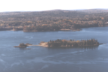
In 1797, Robert Pagan of St. Andrews, New Brunswick, proved that Dochet Island, as Saint Croix Island was then called, was the former site of Sieur de Mons' settlement.
Based on this and other evidence, the Boundary Commission set the Saint Croix River as the international boundary. This was the first use of archaeological techniques in North America to solve an historical question.
During the War of 1812 officials from the United States and Britain met at Saint Croix Island and for a while it was called "Neutral" Island.
Recognition
In 1958, the Historic Site and Monuments Board of Canada recognized Saint Croix Island for its national historic significance to Canada.
In 1984, the United States Congress designated Saint Croix Island an international historic site in recognition of the historical significance of the island to the United States and Canada.
The majestic Saint Croix River forms part of the Canadian Heritage Rivers System, and the currents of history continue to flow between both countries.
First Nations
Archaeological evidence indicates that Aboriginal peoples, such as the Passamaquoddy, have used Saint Croix Island for about the past 3,000 years. There is also evidence that the adjacent river area had been used for thousands of years before that. (US. National Park Service)
Next part: A Legacy for All
- Date modified :