
Henry Youle Hind National Historic Person (1823-1908)
A Victorian-era scientist, explorer, surveyor, and writer of popular exploration texts, Henry Youle Hind made a range of contributions to the advancement of science in Canada. His surveys of the North-West between 1857 and 1860 produced the country’s first scientific information about the region, including the earliest photography and accurate maps. His identification of travel routes and especially of arable land led to definitive statements that linked the future of the west to eastern Canada and to settlement and agriculture, and held a role in Canada’s decision to pursue the acquisition of Rupert’s Land from the Hudson’s Bay Company (HBC), albeit without regard for Indigenous peoples.
His popular versions of his experiences of the North-West and of his 1861 exploration of the Moisie River in Quebec are classics of Canadian exploration literature. His perceptive descriptions of the lands where he travelled and of their First Nations, Métis, and settler inhabitants brought Canadian exploration into the public realm. Hind also promoted the idea of an expansive country in the years around Confederation by producing the country’s first regional handbooks.
Hind was born in England, and arrived in Toronto in the 1850s where he became a professor of chemistry and geology. In 1857, he participated in a survey and scientific study of the area known as the North-West. This was the first such study funded by the Province of Canada of areas beyond its borders. The lands to be examined began at the head of Lake Superior and went as far as Portage la Prairie. Hind was the expedition’s geologist and naturalist, and his report presented new information about the North-West that ranged from natural history, geology, topography, meteorology, to ethnography.
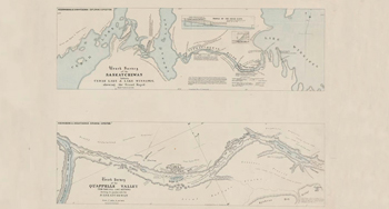
In 1858-60, Hind directed a second, more ambitious survey, westward from Lake Winnipeg and Red River as far as the south branch of the Saskatchewan River. His subsequent reports and publications provided Canada with geological, agricultural, and climatological knowledge of the region between Red River and the Rocky Mountains, and affirmed that some of the land beyond Lake Superior was suitable for settlement and not sub-Arctic wilderness suitable only for fur trade.
Hind advanced Canadian science across several disciplines, publishing widely for half a century. Other notable contributions include his early work in plant pathologies, the identification of fundamental geological structures of the North-West, the glacial drift theory in support of continental glaciation, the impact of wild fires on landscape, early work on the coastal geology of Labrador, and a study of Labrador fisheries and ocean currents that served to expand that fishery.
The National Program of Historical Commemoration relies on the participation of Canadians in the identification of places, events and persons of national historic significance. Any member of the public can nominate a topic for consideration by the Historic Sites and Monuments Board of Canada.
- Date modified :