
Mehtawtik (Meductic) Village National Historic Site
Mehtawtik (Meductic) Village was designated a national historic site in 1924.
Commemorative plaque: Fort Meductic Road, off highway 165, Meductic, New BrunswickFootnote 1
Mehtawtik (Meductic) Village
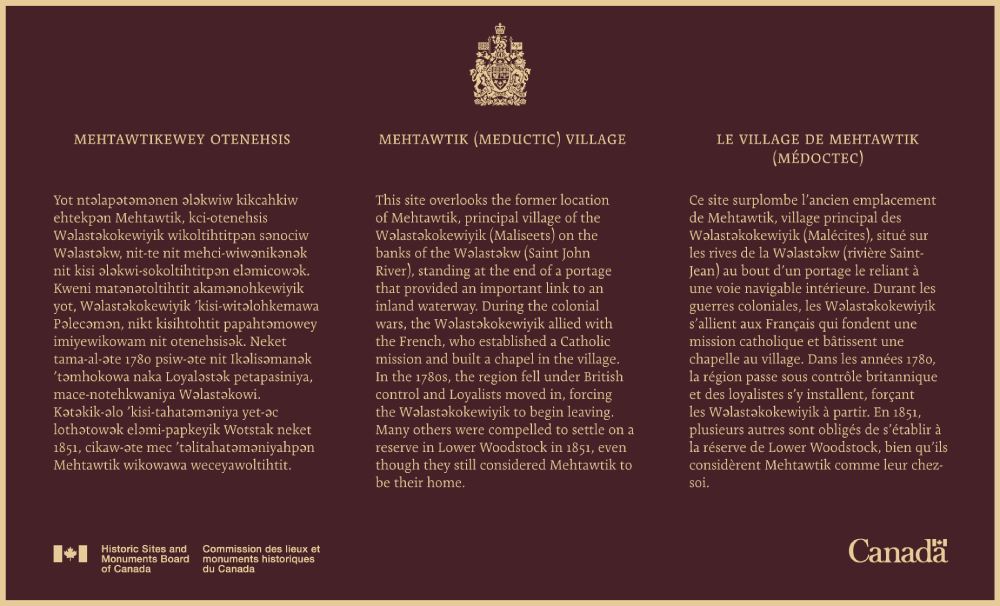
This site overlooks the former location of Mehtawtik, principal village of the Wəlastəkokewiyik (Maliseets) on the banks of the Wəlastəkw (Saint John River), standing at the end of a portage that provided an important link to an inland waterway. During the colonial wars, the Wəlastəkokewiyik allied with the French, who established a Catholic mission and built a chapel in the village. In the 1780s, the region fell under British control and Loyalists moved in, forcing the Wəlastəkokewiyik to begin leaving. Many others were compelled to settle on a reserve in Lower Woodstock in 1851, even though they still considered Mehtawtik to be their home.
Mehtawtikewey otenehsis
Yot ntəlapətəmənen ələkwiw kikcahkiw ehtekpən Mehtawtik, kci-otenehsis Wəlastəkokewiyik wikoltihtitpən sənociw Wəlastəkw, nit-te nit mehci-wiwənikənək nit kisi ələkwi-sokoltihtitpən eləmicowək. Kweni matənətoltihtit akamənohkewiyik yot, Wəlastəkokewiyik ’kisi-witəlohkemawa Pəlecəmən, nikt kisihtohtit papahtəmowey imiyewikowam nit otenehsisək. Neket tama-al-əte 1780 psiw-əte nit Ikəlisəmanək ’təmhokowa naka Loyaləstək petapasiniya, mace-notehkwaniya Wəlastəkowi. Kətəkik-əlo ’kisi-tahatəməniya yet-əc lothətowək eləmi-papkeyik Wotstak neket 1851, cikaw-əte mec ’təlitahatəməniyahpən Mehtawtik wikowawa weceyawoltihtit.
Mehtawtik (Meductic) Village
The ancient village of Mehtawtik (Meductic) was the principal settlement of the Wəlastəkokewiyik (Maliseets) from before the 17th century. It was located on the west bank of the Wəlastəkw (St. John River) at the mouth of Hay Creek, west of the Eel River in what is now New Brunswick. The village was surrounded on three sides by lowlands, which filled with water every spring, and defined on the last remaining side by the Wəlastəkw. Its name, Mehtawtik (meaning “end of the trail”), is evocative of the village’s location, as it stood at the end of a portage connecting it to an extensive inland waterway.
Mehtawtik was located in a strategic area, valued by the Wəlastəkokewiyik for excellent hunting and fishing in the vicinity as well as its fertile soil. In the spring, the Wəlastəkokewiyik would regularly visit the area to plant corn, returning later in the year to harvest the crops. For families who gathered here, the harvest was an occasion for social, cultural, and spiritual activities.
In the 17th century, the French established seigneuries throughout the Wəlastəkw (St. John River) valley. In Mehtawtik, they also established a Catholic mission and built a chapel. During the colonial wars, the Wəlastəkokewiyik allied with the French, building fortified earthworks at Mehtawtik for defense and protection.
When the region came under British control in the 1780s, Loyalists resettled the lower St. John River Valley. This forced many Wəlastəkokewiyik to begin leaving the area and seek refuge elsewhere. Those who remained were eventually compelled to abandon Mehtawtik and settle on a reserve in Lower Woodstock in 1851, even though they still considered Mehtawtik to be their home.
The location of the former village site has been under the waters of the Mactaquac Hydroelectric Dam since 1968 when the area of the Wəlastəkw (Saint John River) valley was flooded.
About the designation
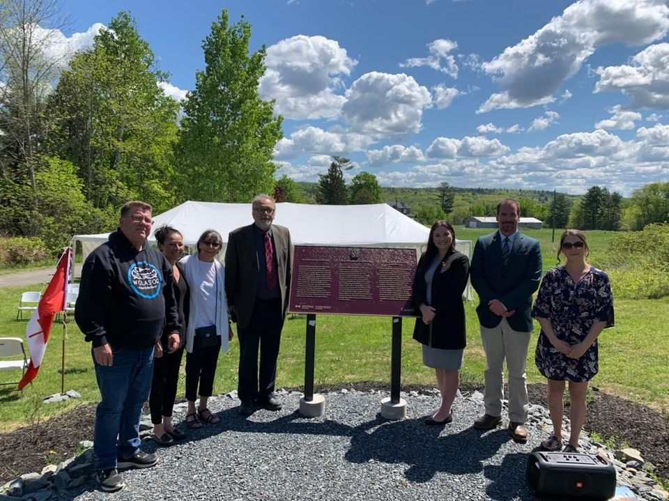
The Historic Sites and Monuments Board of Canada commemorative plaque has been installed at a location overlooking the site of the ancient village of Mehtawtik. The Woodstock First Nation Chief and Council chose the location of the plaque and collaborated with Parks Canada on the preparation of the plaque text.
When this national historic site was designated in 1924, it was known as Fort Meductic. The name was later changed to Meductic Village-Fort Meductic and more recently to Mehtawtik (Meductic) Village. This followed a request from the Woodstock First Nation for the designation name to be changed and for the use of Wəlastəkwiyik spelling, according to the Teeter orthography.
This backgrounder was written in May 2022 for the plaque unveiling.
Description of historic place
Mehtawtik (Meductic) Village National Historic Site of Canada is located on the west bank of the Wəlastəkw (St. John River) at the mouth of Hay Creek, west of the Eel River in what is now New Brunswick. The location of the former village site, dating from before the 17th century, has been under the waters of the Mactaquac Hydroelectric Dam since 1968 when the area of the Wəlastəkw (Saint John River) valley was flooded. A Historic Sites and Monuments Board of Canada plaque has been installed at a location overlooking the site of the ancient village of Mehtawtik. Official recognition refers to a polygon measuring 30 metres beyond the archaeological evidence identified in 1964.
Heritage value
Mehtawtik (Meductic) Village was designated a National Historic Site of Canada in 1924. It is recognized because:
- the village of Mehtawtik (Meductic) was the principal settlement of the Wəlastəkwiyik (Maliseets) from before the 17th century.
Mehtawtik was located in a strategic area, valued by the Wəlastəkokewiyik for excellent hunting and fishing in the vicinity as well as its fertile soil. In the spring, the Wəlastekokewiyik would regularly visit the area to plant corn, returning later in the year to harvest the crops. For families who gathered here, the harvest was an occasion for social, cultural, and spiritual activities. In the 17th century, the French established seigneuries throughout the Wəlastəkw (St. John River) valley. In Mehtawtik, they also established a Catholic mission and built a chapel. During the colonial wars, the Wəlastəkokewiyik allied with the French, building fortified earthworks at Mehtawtik for defense and protection. When the region came under British control in the 1780s, Loyalists resettled the lower St. John River Valley. This forced many Wəlastəkokewiyik to begin leaving the area and seek refuge elsewhere. Those who remained were eventually compelled to abandon Mehtawtik and settle on a reserve in Lower Woodstock in 1851, even though they still considered Mehtawtik to be their home.
Sources: Historic Sites and Monuments Board of Canada, Minutes, 1924, 2008, 2020.
The National Program of Historical Commemoration relies on the participation of Canadians in the identification of places, events and persons of national historic significance. Any member of the public can nominate a topic for consideration by the Historic Sites and Monuments Board of Canada.
- Date modified :