
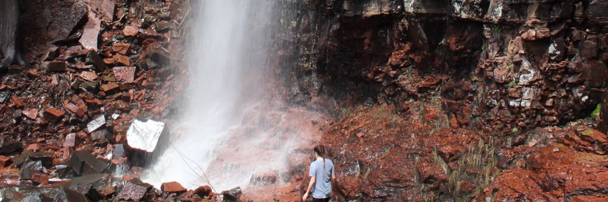
Mazukama Falls
Lake Superior National Marine Conservation Area
CAUTION
Creeks may require wading. Creeks may become hazardous or be impassable under some flows.
Organization: Nor'Wester Voyageur Trail Club
Classification: Difficult (Be advised: Unstable footing, steep climbs, creeks must be waded)
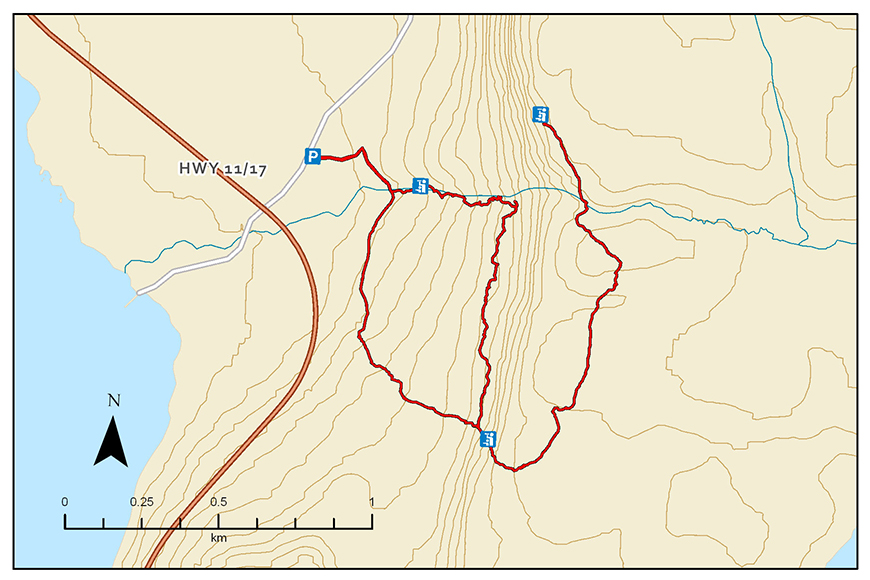
Distance: 3.1 km Mazukama Falls Loop, 6.7 km return with spur to Wingtip Lookout
Elevation Gain: 120 m Mazukama Falls Loop, 250 m Wingtip Lookout spur
Estimated Time: 1.5-2 hours Mazukama Falls Loop, 4-5 hours return with Wingtip Lookout spur
Features: 25 metre waterfalls and several smaller falls, cascading stream flowing off the red rocks of the Kama Cliffs, old growth cedar forest, massive fern covered boulders, talus slopes, spectacular lookout over Nipigon Bay of Lake Superior and beyond. Spectacular ice formations in winter.
Description: This is a wilderness recreation trail. This day hike has been described as magical. The challenging Mazukama Falls Loop trail climbs steeply for 500 m and passes beside the many cascades and waterfalls of Mazukama Creek as it tumbles off the red rocks of the Kama Cliffs through huge old growth cedars. For those seeking a panoramic view of Nipigon Bay, take the steep climb up “The Stairway of the Saints” to the top of Kama Cliffs and hike to Wingtip Lookout, 250 m above the trailhead. Allow an additional 2 hours to do this spur trail.
Directions: This trail is located approximately 20 km east of Nipigon on Highway 17 at km 677.4. Travel north on a gravel road (Camp 81 Road) for 200 m to the trailhead on right.
- Date modified :