
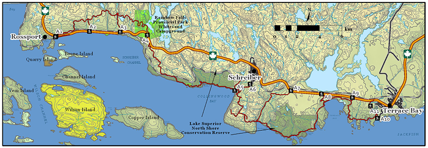
Casque Isles Trail
Lake Superior National Marine Conservation Area
Organization: Casque Isles Trail Association (Voyageur Trail Club)
Classification: Difficult
Distance: 53 km (one way with optional shorter segments)
Estimated Time: 3-5 days
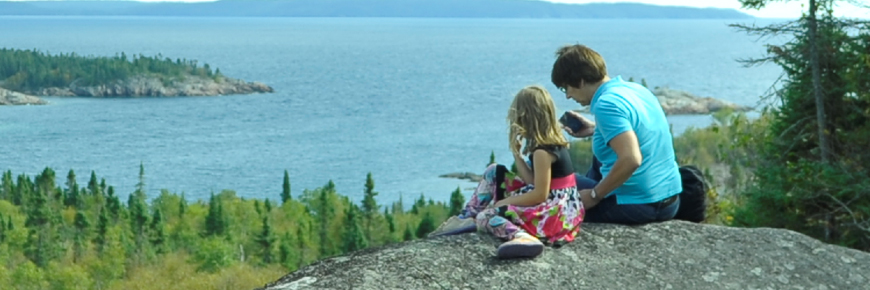
Description: Follow the shore of Lake Superior from Rossport through Schreiber to Terrace Bay on this rugged trail, passing by old gold mines, fossil deposits, and rock faces adorned with Indigenous pictographs. With 11 access points over 5 segments, this well maintained and signed trail offers an achievable experience for avid hikers.
To complete the whole 53 km trail usually takes 3-5 days. However, if time is limited, to sample our trail, two shorter hikes are recommended. Consider a 2 km walk (45 minutes - one way) on an easy to moderate trail to the panoramic view at the Picnic Table Lookout. Or, hike for 1.5 km (~30 minutes, one way) to the tranquility of Danny’s Cove on the Lyda Bay Segment, beginning at the spectacular Aguasabon Gorge or at Terrace Bay Beach.
Directions: For the Picnic Table Lookout, turn off Highway 17 at Winnipeg Street in Schreiber and follow the wayfinding for Casque Isles. After crossing under the railway tracks, continue straight past Isbestor Drive and take the next right, following the wayfinding to the far south end of Winnipeg Street South, where you will find the trailhead in the back of the field at the Wastewater Treatment Plant.
In Terrace Bay, turn off Highway 17 at Lakeview Drive and follow the signage to the Waterfront/Beach. Alternatively, turn off Highway 17 at the Aguasabon Gorge Road and follow the road to the Aguasabon Gorge parking lot.
Follow the trailhead signage at each location.
- Date modified :