Chilkoot Trail National Historic Site of Canada
Cassiar, British Columbia
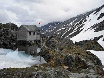
General view
© Parks Canada Agency / Agence Parcs Canada, Michael Prochazka, 2009.
Address :
Chilkoot, Cassiar, British Columbia
Recognition Statute:
Historic Sites and Monuments Act (R.S.C., 1985, c. H-4)
Designation Date:
1987-11-20
Dates:
-
1897 to 1900
(Significant)
Event, Person, Organization:
-
Klondike Gold Rush
(Event)
Other Name(s):
-
Chilkoot Trail
(Designation Name)
Research Report Number:
1967-15
DFRP Number:
56505 00
Description of Historic Place
The Chilkoot Trail National Historic Site of Canada is a traditional transportation route through rugged mountain terrain, connecting the upper Yukon River in British Columbia with the Pacific Coast on the Taiya Inlet in Alaska. It is best known as the route used by thousands of prospectors on their way to the Yukon gold fields during the gold rush of 1897-1900. The designation refers to the Canadian portion of the trail extending from the summit of the Chilkoot Pass along a natural valley to the former townsite of Bennett British Columbia.
Heritage Value
Chilkoot Trail was designated a national historic site of Canada in 1967. It is designated because of the role it played in the mass movement of people to the Yukon during the Klondike Gold Rush.
The heritage value of the Chilkoot Trail lies in its association with the Yukon gold rush of 1897-1900 as illustrated by the relict cultural landscape. The trail, established and long used as a trade and travel route by First Nation people, was part of a larger network of trails and river routes used to reach the Klondike gold fields of the Yukon Territory.
Sources: Historic Sites and Monuments Board of Canada, November 1987 Minutes; Commemorative Integrity Statement, May 1996.
Character-Defining Elements
Key elements which contribute to the heritage value of this site include: the route of the trail from the Taiya Inlet in Alaska to the headwaters of the Yukon river in British Columbia; the linear quality and historical integrity of the path including its siting, traffic wear patterns, surviving log and stonework; the contained setting of the Canadian portion of the trail in a natural valley; the integrity of the relationship between the commemorated trail, its natural stopping places and the local topography; the unobstructed viewscapes along the valley, toward the skyline, to associated historic trails, and to the surrounding topography; the natural features and disparate ecological zones along the trail; the rugged, physically demanding nature of the route as a physical obstacle for the gold stampeders’ quest; the presence of artifacts in situ such as discarded tins, boxes, boat frames, sleds, wheels; nearby, associated grave sites; remnant features from the gold rush period, including associated foot trails, docks, roadways, vestigial water routes of the Chilkoot run from the summit of the Pass to Bennett, and natural resting places with remnant tent platforms, rock walls, dugout embankments and gravesites; the Presbyterian Church at Bennett in its location, siting, form, materials and craftsmanship.