Kay-Nah-Chi-Wah-Nung National Historic Site of Canada
Stratton, Ontario
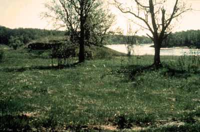
General view
© Agence Parcs Canada / Parks Canada Agency n.d.
Address :
340 Ross Road, Stratton, Ontario
Recognition Statute:
Historic Sites and Monuments Act (R.S.C., 1985, c. H-4)
Designation Date:
1969-10-23
Event, Person, Organization:
-
Laurel culture
(Organization)
-
Blackduck culture
(Organization)
-
Ojibway culture
(Organization)
Other Name(s):
-
Kay-Nah-Chi-Wah-Nung
(Designation Name)
-
Manitou Mounds
(Other Name)
-
Rainy River Mounds
(Other Name)
-
Armstrong Mounds
(Other Name)
-
GENWAAJIWANAANG
(Plaque name)
Plaque(s)
Existing plaque: 340 Ross Road, Stratton, Ontario
For thousands of years Aboriginal people have lived and gathered on the banks of the Rainy River at Kay-Nah-Chi-Wah-Nung, place of the long rapids. Here traces of Ojibway villages are found among the burial mounds and village sites of more ancient Aboriginal peoples. Also known as Manitou Mounds, this place was at the centre of a continent-wide Aboriginal trading network. Kay-Nah-Chi-Wah-Nung is sacred to the Ojibway and to other First Peoples of North America, thus marking an enduring spirituality.
*Note: This designation has been identified for review. A review can be triggered for one of the following reasons - outdated language or terminology, absence of a significant layer of history, factual errors, controversial beliefs and behaviour, or significant new knowledge.
Description of Historic Place
Kay-Nah-Chi-Wah-Nung National Historic Site of Canada is part of a vast network of ancient burial mounds extending from Quetico in the east through Rainy River and Lake of the Woods into south-eastern Manitoba. Constructed from approximately 3000 BCE to 1650 CE, the national historic site of Canada consists of a 500 metre-wide strip of lowland stretching 3 kilometres along the north bank of the Rainy River in the isolated area mid way between Rainy Lake and Lake of the Woods. The site contains 15 burial mounds and the archaeological remains of some 30 village sites.
Heritage Value
Kay-Nah-Chi-Wah-Nung was declared a National Historic Site of Canada because of: its long cultural history including evidence of site occupancy and use by the Laurel and Blackduck cultures, with the visible burial mounds of those time periods.
Kay-Nah-Chi-Wah-Nung National Historic Site of Canada is one of the most significant centres of early habitation and ceremonial burial in Canada. It contains evidence of 5,000 years of human habitation including burial mounds from the Laurel (300 BCE - 1100 CE) and the Blackduck (800-1650 CE) cultures. Home to the Ojibway people in past centuries, the site area was homesteaded by the Rainy River First Nations from the time of the signing of Treaty no. 3 in 1873 to 1916, and therefore also contains evidence of cabins, farm buildings, and associated activities. This site has deep cultural and spiritual significance to the Ojibway people as a living link in the continuum of past, present and future. Its location at the centre of a major network of North American waterways also means it has significance to First Nations peoples on other parts of the continent.
The heritage value of Kay-Nah-Chi-Wah-Nung National Historic Site of Canada resides in its historical associations with past and present cultures as symbolized by its strong sense of place, the location and natural features of the site, the presence of its ancient burial mounds and habitation sites, and the site’s function as a living link between those who visited, occupied or used it in the past and the lives of the Ojibway people of today.
Source: Commemorative Integrity Statement, 1998.
Character-Defining Elements
Key elements contributing to the heritage value of this site include: its continued use by the Ojibway people with respect for the continuity of this place as a living (and therefore evolving) link between past, present and future, and as a sacred place in First Nations, particularly Ojibway culture; the site’s relative isolation from major development and the health of its ecosystem including its relic oak savannah habitat, its Lakes-St.Lawrence Lowlands forest, its vascular plants, migratory and resident birds; the inter-relationship between the natural and man-made features; its ancient burial mounds and habitation sites in their undisturbed condition; the stability of the two broad terraces that contain the site; the presence of the Long Sault Rapids which allow access to an active freshwater fishery year-round; the relationship of the archaeological sites to the river and to the more recent (Ojibway) use of the land; the viewplanes between and among individual burial mounds and habitation sites, from the site to the river and to the open oak savannah areas along the river terraces, to burial mounds and habitation sites outside the area of the historic site of Canada.