Toronto Carrying Place National Historic Event
Toronto, Ontario
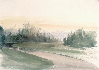
Watercolour of the Humber River near Toronto
(© Library and Archives Canada | Bibliothèque et Archives Canada / Acc. No. 1950-29-59)
Address :
Toronto, Ontario
Recognition Statute:
Historic Sites and Monuments Act (R.S.C., 1985, c. H-4)
Designation Date:
1969-10-23
Other Name(s):
-
Toronto Carrying Place
(Designation Name)
Importance:
This designation has been identified for review
Plaque(s)
Existing plaque: Etienne Brule Park 37 Humbercrest Boulevard, Toronto, Ontario
What came to be known as the Toronto Route or Carrying Place actually consisted of two alternate passages: one ascended the Humber River to the Holland, while a lesser one began 40 kilometres to the east and followed the Rouge River. The route connected Lakes Simcoe and Ontario and was an important trade route for the Indian nations and later the French. Étienne Brûlé travelled it in 1615 and the Iroquois reputedly used it on their way to attack Huronia in 1649. Although of lesser importance to British fur traders, it still contributed to the favourable position of the settlement which became Toronto.
*Note: This designation has been identified for review. A review can be triggered for one of the following reasons - outdated language or terminology, absence of a significant layer of history, factual errors, controversial beliefs and behaviour, or significant new knowledge.