Droulers-Tsiionhiakwatha National Historic Site of Canada
Saint-Anicet, Quebec
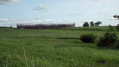
General view
© Parks Canada Agency / Agence Parcs Canada, Michel Gagné, 2006.
Address :
1800 Leahy Road, Saint-Anicet, Quebec
Recognition Statute:
Historic Sites and Monuments Act (R.S.C., 1985, c. H-4)
Designation Date:
2007-06-08
Event, Person, Organization:
-
St. Lawrence Iroquoians
(Person)
Other Name(s):
-
Droulers-Tsiionhiakwatha
(Designation Name)
Research Report Number:
2006-035, 2009-072
Plaque(s)
Existing plaque: 1800 Leahy Road, Saint-Anicet, Quebec
Home to a community of roughly 600 Iroquoian farmers around the mid-15th century, the archaeological site now known as Droulers-Tsiionhiakwatha is one of the best preserved villages of the St. Lawrence Iroquoian people. Among the remains of its longhouses, storage pits, and middens are clues to understanding the everyday life of these people. Excavations here also recovered a remarkably diverse assortment of plant remains that provide important evidence of Iroquoian agriculture and wild plant use. This rich heritage is reflected in the modern Mohawk name for the site, which means " the place where we gather berries."
Description of Historic Place
Droulers-Tsiionhiakwatha National Historic Site of Canada represents an Iroquoian village complex, which, at the height of Iroquoian civilization in the St. Lawrence Valley, was the central place in a region that has yielded an impressive number of archaeological sites. Situated in south-western Québec, some eight kilometres from the St. Lawrence River, its geographical location makes it one of the most remote of the Iroquoian villages in Québec. This major archaeological site, discovered in 1994, was the subject of a campaign of six intensive digs, which produced over 150 000 archaeological remains, making it possible to deduce the presence of a series of longhouses. Official recognition refers to the remains of the former palisade marking the village compound, bounded by Chemin Leahy that divides the property into two parts, the second part forming a space with a surface area of 557 square metres bounded in the south, west and east by the slope of the terrace.
Heritage Value
Droulers-Tsiionhiakwatha was designated a national historic site of Canada in 2007 because: it is the most important and best-preserved known site associated with the St. Lawrence Iroquoian people in Canada;
- the quality of the scientific data it contains ranks it among the major sites that documents the traditional life of Iroquoians in eastern Canada; and, this archaeological site contains one of the most significant collections of domesticated and wild plants recovered from an Iroquoian site in eastern Canada.
Droulers-Tsiionhiakwatha is the largest paleohistorical village discovered to date throughout Québec. This site was occupied around the mid-15th century by a group now identified as the St. Lawrence Iroquoians. Particularly good soil conditions have allowed for the preservation of the village structures, including fireplaces, pits and trenches, which indicate the positions of some fifteen dwellings that date from the last three centuries before the arrival of the Europeans.
In terms of scientific data, Droulers-Tsiionhiakwatha ranks among the major sites documenting Iroquoian village life. Its unique situation makes it possible to properly document the use of plant species in the daily diet, since an appreciable quantity of bone objects and bone remains associated with cooking activities have been found in a remarkable state of preservation. Droulers-Tsiionhiakwatha has one of the most significant collections of domesticated and wild plants gathered on one site in eastern Canada. These remains indicate that when the site was occupied, the population used several ecosystems present on its territory. The remains demonstrate the strong dependence of this population on cultivated plant species, in addition to attesting to other activities such as farming, fishing and gathering small wild fruits.
Source: Historic Sites and Monuments Board, Minutes, June 2006.
Character-Defining Elements
Key elements that contribute to the heritage character of the site include: its siting on the south shore of the St. Lawrence River, facing Lake St. Francis, near a small steep-sided stream, in a setting composed of glacial deposits forming a terrace markedly different in level from the adjacent plane; the archaeological resources related to the traditional life of Iroquoians in Eastern Canada, including depressions, middens, mounds and any other archaeological material; a total of 25 archaeological features that constitute architectural remains, distributed throughout the archaeological site, including 11 pits, 10 fireplaces, 3 features in the form of trenches related to the building of houses, and a fourth which might indicate the existence of a palisade; indications of house layout from which it seems possible to infer the presence of over 15 longhouses within the village compound; the arrangement of the cultural material and the structures of some of the houses suggesting the latter measured some 30 metres in length and 6 metres long; two middens, one being in the slope of the side of the terrace and the other located to the north, alongside the presumed location of the ancient palisade; the large collection of rims of ceramic vessels, including all categories of containers indispensable to performing daily tasks, such as hand pots, small, medium and large-sized pots used for cooking and storing food, featuring a large spectrum of designs ranging from simple parallel lines to varied geometric forms; the pipe fragments, including the so-called trumpet-shaped pipes common among the Iroquoians, ranging from the miniature pipe to the capacious bowl, made of clay or soapstone, including pipe fragments decorated with red ochre, and some particularly rare finds, such as one pipe decorated with a mammal effigy; the assemblage of stone objects, including hand grinders (manos), lower grindstones (metates) and crushers, tools used to shape bone or wood, such as hammerstones, sharpeners and hatchets, in addition to some tools chipped in stone such as projectile heads, scrapers, drills and bifaces; tools made from raw materials that might be from the Montréal region, southern and north-central Ontario or New York state, evidence of the possibility of direct access to the sources of raw materials or of exchanges with other groups living in neighbouring regions or even beyond; the bone tools and objects, made from the bones of mammals, including punches, spatulas, gouges, cutting incisors, projectile heads, harpoons, needles, cup-and-ball games, and unique pieces such as an ornamental object made from a bear femur decorated with various lines, and a finely carved circular rod; scraps of clay from the manufacture of ceramic pots and ornamental objects of soapstone and ceramic beads; the preserved food remains, including identified species of fish and mammals; plant remains, comprising complete seeds, seed fragments, ears, fragments of fruit or cotyledons, seven species of wild plant remains, including hawberries, wild plum, pin cherry, wild grape, butternut tree, raspberry and choke cherry; the integrity of any potential archaeological remains that may be found within the site including features, artefacts and remains in both their original placement and extent.