
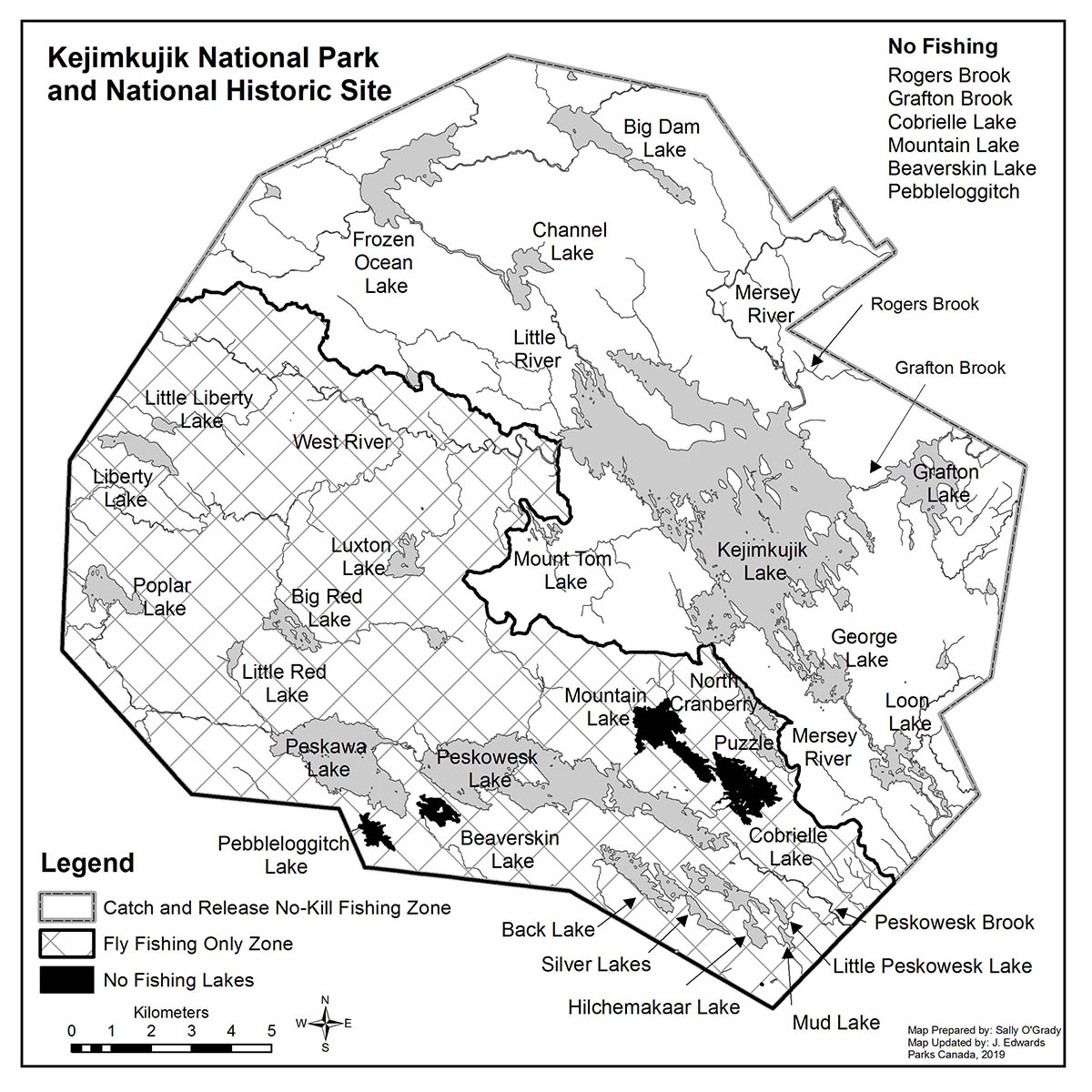
Fishing zones map
Kejimkujik National Park and National Historic Site
All native fish species are "catch and release" within Kejimkujik.
Text version
Map prepared by Sally O'Grady. Map updated by J. Edwards, Parks Canada, 2019.
All native fish species are "catch and release" within Kejimkujik.
No fishing
No fishing of any kind is allowed within:
- Rogers Brook
- Grafton Brook
- Pebbleoggitch Lake
- Beaverskin Lake
- Cobrielle Lake and
- Mountain Lake
"Catch and release no-kill" fishing zone
The "Catch and release no-kill" fishing zone includes the following brooks and lakes in the Northern and Eastern areas of Kejimkujik.
- Big Dam Lake
- Channel Lake
- Frozen Ocean Lake
- George Lake
- Grafton Brook
- Grafton Lake
- Kejimkujik Lake
- Little River
- Loon Lake
- Mersey River
- Mount Tom Lake
- Rogers Brook
"Fly fishing only" zone
The "fly fishing only zone" includes the following brooks, lakes, and rivers in the Western and Southern areas of Kejimkujik.
- Back Lake
- Big Red Lake
- Hilchemakaar Lake
- Little Liberty Lake
- Little Red Lake
- Little Peskowesk Lake
- Liberty Lake
- Luxton Lake
- Mud Lake
- North Cranberry
- Paskawa Lake
- Peskowesk Brook
- Peskowesk Lake
- Poplar Lake
- Puzzle
- Silver Lakes
- West River
Closed waters
No fishing at any time on these waterways:
- Rogers Brook
- Grafton Brook
- Cobrielle Lake
- Mountain Lake
- Pebbeloggitch Lake
- Beaverskin Lake
- Date modified :