
Bears Gut to Branagin Island Valley
Torngat Mountains National Park
What Do I Need to Know to Hike the from the Bears Gut to Branagin Island Valley?

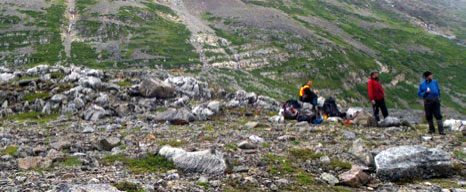
Hikers on the Bears Gut Plateau
© Parks Canada
Visitor Registration
Hiking parties who are interested in hiking in this area will need to register (before their visit) with Torngat Mountains National Park (Parks Canada). Visitors are also required to de-register after they have departed from the park to ensure that staff know they have left the park and have been accounted for.
Contact Information
Torngat Mountains National Park
Phone: 1-888-922-1290
Email: torngats.info@pc.gc.ca
Torngat Mountains Base Camp and Research Station
This camp is situated in St. John’s Harbour in Saglek Bay. It presently operates from mi d-July until early September. The base camp can provide support for visitor parties wanting to travel into Torngat Mountains National Park. Bear guards, Inuit guides, a helicopter, speed boats and longliners (fishing boats) are generally available for local charter. Please contact Air Borealis by phone 1-709-635-4336 or email at thetorngats@airborealis.ca or for inquiries visit the following website: thetorngats.com

Boat drop-off at Bears Gut
© Parks Canada

A pair of polar bears in the Bears Gut area
© Parks Canada
Route Overview
Bears Gut to Branagin Island
Type of hike: Moderate multi-day hike
Distance: Approximately 40 km / 25 miles
Time required: Allow 3 to 5 days depending on the exact route you plan to take
Elevation gain: 1225 metres / 4000 feet
Maximum elevation: 700 metres / 2300 feet
Point of departure: Bears Gut (20V 494958 E 6503450 N)
Route access:
1. By boat from Base Camp (1.5 hours to 2 hours)
2. By helicopter from Base Camp (15 minutes)
Route Overview
This multi-day hiking route description is based on an exploratory hike from Bears Gut to Branagin Island Valley (valley northwest of Branagin Island), located in Saglek Fjord. This area is only a short distance from the Torngat Mountains Base Camp and Research Station, where many visitors begin and end their visit to Torngat Mountains National Park.
Throughout this route, you will be travelling over 1.9 billion year old sedimentary rocks. If you keep a lookout, you may see flat surfaces of rocks with ripple marks that are identical to those you would find in a modern-day estuary. It is remarkable that these features have been preserved, untouched, for nearly 2 billion years.
Hikers have many options in this area because of the openness of the Bears Gut Plateau, which is accessible from Bears Gut to the east and from Little Ramah Bay to the north. This description is for a route that starts at the bottom of Bears Gut, an aptly named body of water surrounded by several peaks over 1000 metres in height, where polars bears are often encountered.
This hiking route description follows the route taken by Parks Canada staff in August 2011 but also suggests alternative routes, including an alternate point of departure from Little Ramah Bay and a more direct route from Bears Gut to Branagin Island.
The most practical and cost-effective way of getting to the start of this hike is by speedboat, which can be arranged through the NGC from the Torngat Mountains Base Camp and Research Station. Speedboats can carry four to five passengers at one time. It is recommended that you finish your hike at the mouth of Branagin Island Valley, where you can be picked up either by speedboat or longliner. Pickup arrangements (the date and time of your pickup) should be made beforehand with the NGC.
You are strongly encouraged to hire an Inuit bear guard to accompany you on any hiking excursion in Torngat Mountains National Park, as you are constantly in polar bear and black bear country. The accompaniment of a bear guard will allow you to relax and enjoy your hike, but will also give you the opportunity to experience the park with the help and guidance of Inuit who truly know the land.
All visitors should consult the General Hiking Information for Torngat Mountains National Park document before planning a hike in the Torngat Mountains. On this particular hike, it is recommended that you have sturdy hiking boots and hiking poles, as the terrain can be quite rough. Hikers will also find useful trip planning information in the Google Earth layer that is available for Torngat Mountains National Park.
Hikers travelling up the Bears Gut River
© Parks Canada
Section 1: Bears Gut to Skull Lake (NiaKuk)
20V 494958 E 6503450 N to 20V 487074 E 6507561 N
Approximately 12 kilometres

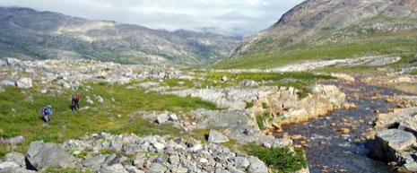
North side of Bears Gut River
© Parks Canada
Route Description
The first section of this route description covers the route from Bears Gut to Skull Lake. Note that there is also an alternate and more direct route from Bears Gut to the Branagin Island Valley.
Your time of arrival at Bears Gut will dictate the distance your party will cover on the first day. However, it is strongly advised that you allow yourself enough time to travel as far inland as possible to lessen the likelihood of polar bear encounters.
Begin your hike on the north side of the river feeding into Bears Gut as this will allow you to hike along the north side of the lake, which has a wider and flatter shoreline than the south side of the lake. The terrain is relatively flat in the lower portion of the valley (vertical gain of only 150 metres over the first 7 kilometres) and you will find several caribou trails that you can follow along the banks of the river. Just beyond the lake you will reach a small waterfall (20V 491887 E 6504711 N). It is recommended that you remain on the north side of the river at this point to avoid having to cross it again further upstream at 20V 490098 E 6504566 N, where there is a deep canyon to the south and some impressive waterfalls. By staying on the same side of the river, you will save valuable time and energy by not having to change your footwear in order to cross the river. Nevertheless, all hikers should carry water sandals or neoprene booties for fording rivers in the park.
Beyond the waterfalls and canyon at the last UTM coordinate, there is a large elbow in the river along with three small lakes (20V 489588 E 6504637 N). Continue to hike along the north side of the river until you reach the stream at 20V 488000 E 6504146 N. At this point you should begin to climb out of the valley in a northwesterly direction. The climb is gradual (100 metres gained over a distance of 1.6 kilometres) and it should take no more than an hour to reach a plateau that is dotted with lakes, the largest of which looks like a skull, hence the name Skull Lake (20V 487074 E 6507561 N) or NiaKuk (knee-yeah-hook). This is an ideal spot to camp for the night with easy access to water.

Skull Lake
© Parks Canada
Section 2: Skull Lake (NiaKuk) to Emerald Lakes Area
20V 487074 E 6507561 N to 20V 485321 E 6499311 N
Approximately 9 kilometres
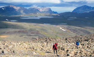
Steady climb from Bears Gut Plateau
© Parks Canada
Route Description
From Skull Lake, an attractive option is to do a day trip northeast to Little Ramah Bay or east towards Mount Goetze and the surrounding peaks (see below).
To continue the main route from Skull Lake to the emerald-coloured lakes near the pass leading into the Branagin Island Valley starts with a morning of very nice hiking across the undulating Bears Gut Plateau, with great views all around. From Skull Lake, travel in a south-southwesterly direction for approximately 3.5 kilometres to reach the lake at 20V 485743 E 6504613 N, which is the safest and easiest place to cross the stream.
From this lake, you will begin a steady climb (gain of over 200 metres over the next 2 kilometres) along a steep ridge that runs from north to south. Keep an eye out for black bears in this area; they can sometimes wander around at these elevations. You will find an impressive lookout at 20V 486184 E 6502829 N, which is a great spot for lunch on a clear day.
Beyond the lookout, continue travelling south below the ridge towards a series of lakes located approximately 4 kilometres away. The final portion of this section includes a few short ascents and descents, but nothing like the long, steady climb that you will have tackled earlier in the day. It is recommended that you hike along the east side of the lake at 20V 485804 E 6500636 N and on the west side of the next lake just south of it.
A possible campsite can be found at a grassy spot on the west side of the second lake (20V 485321 E 6599311 N). An evening scramble up the 1000 metre summit (a one-hour hike to the top) on the opposite side of the lake would be a nice way to cap off the day. This unnamed peak provides an amazing view of Bears Gut Plateau as well as the pass leading towards Branagin Island Valley. Another option would be to continue hiking for 1 or 2 hours (4–5 kms) and camp next to the emerald-coloured lakes at 20V 487670 E 6498063 N, although it may be difficult to find a flat, open spot for camping due to the large boulders in this area.
Alternate Route
Another possible day hike from Skull Lake would be to hike west about 7 kilometres (as the crow flies) towards the summit of Mount Goetze (1150 metres, UTM 20V 494003 E 6508871 N). There are also a number of shorter and more accessible summits to the west of Mount Goetze that would provide equally impressive views of Bears Gut and the Labrador Sea.
Hikers keeping an eye out for the boat pick-up
© Parks Canada
Section 3: Emerald Lakes Area to Branagin Island Valley
20V 485321 E 6499311 N to 20V 491884 E 6487142 N
Approximately 19 kilometres

A pair of caribou in Branagin Island Valley
© Parks Canada
Route Description
The final section of this hike can be hiked over 2 days starting from the last campsite and ending at the mouth of Branagin Island Valley. This is the most technical and dangerous section of the hike because of the scree slopes and boulder fields that you must travel over (hiking poles will come in handy here). Take your time—especially in wet weather—to avoid slipping and falling in this rough terrain as this could result in a serious injury to you or one of your group members!
Starting from the lake at 20 V 485321 E 6599311 N, travel south for about 1 kilometre and then east (for about 2.5 km) along the south slope if the 1000 metre summit that was scaled the previous day. In order to reach the start of the climb up and over the pass, you will need to hike around the north shore of the largest of the emerald-coloured lakes (aim for UTM 20V 487682 E 6498887 N). Next, follow the eastern shore of the lake to reach a trouble-free water crossing at 20V 488026 E 6498157 N.
After the water crossing, you will climb for approximately 1 kilometre heading in a southeasterly direction towards a pair of lakes (20V 488902 E 6496313 N). Although the group travelled in an almost-straight line from the water crossing to the east side of these lakes, it is suggested that you hike further down the slope (to the east) to reach these lakes, which are unsuitable for camping due to rocky and uneven terrain. If you are looking for a good campsite in this area, you will find one at 20V 489218 E 6495293 N next to a small lake surrounded by 1000-metre peaks in every direction.
The very steep descent into Branagin Island Valley begins at 20V 489354 E 6495326 N. You will descend approximately 150 metres over a distance of 700 metres. Be very careful here and make sure to spread yourselves out during your descent to avoid creating mini-landslides that could result in the person below you being struck by falling rocks. Once you reach the bottom of the pass (20V 489526 E 6494903 N), make your way to the east side of the valley and start making your way down the valley towards Saglek Fjord.
To minimize the risk of polar bear encounters and also to break up this section over 2 days, it is suggested that you camp in this area (20 V 488969 E 6493018 N), which is approximately 8 kilometres (4 hours of hiking) away from the pickup location on the east side of the Branagin Island Valley.
On the final day of the hike, after travelling downstream for about 1 kilometre, angle southeast from the river to higher ground (about 250 metres) at 20 V 488575 E 6491881 N. This will allow you to save time by travelling in a straight line over less vegetated terrain (old landslide), rather than following the river’s edge, which is wet and rocky.
By the time you reach 20V 488801 E 6491123 N (approx. 5 km away from pickup location), you should be able to see Branagin Island. At this point, it would be wise to make contact with base camp to confirm your location and the exact time of your pickup if you have a radio or satellite phone. From here, the group travelled along the scree slope for about 1.5 kilometres before moving downhill at 20V 488920 E 6490676 N. In the lower portion of Branagin Island Valley, it is recommended that you travel to the east of the lakes where you will find firmer ground and avoid the wet and boggy terrain in the middle of the valley. If the tide is low, you will have to walk along the shore to find deeper water for your boat pickup to avoid the tidal flats.
Alternate Route 1: Little Ramah Bay to Skull Lake
An alternate point of departure for this route is Little Ramah Bay, which is accessible by speedboat from base camp (2 to 3 hours). This should be a relatively straightforward 8 kilometre hike that would take about 4 hours to complete.
Keep a close eye out for polar bears and black bears, especially in poor visibility.
If possible, start the hike on the west side of Little Ramah Bay and work your way up the valley to the southwest, crossing over to the south side of the stream that feeds into Little Ramah Bay. Once you make your way to the south side of the main stream, look for a second stream and the valley that begins at 20V 487321 E 6511685 N. Work your way south up this valley for about 4 km (either side of the valley should be fine) and make a right turn (to the west) through a small gap at 20V 487672 E 6508449 N that will lead you to the east side of Skull Lake. You will find a nice spot to camp at 20V 487074 E 6507561 N.
Alternate Route 2: Direct Route from Bears Gut to Branagin Island Valley
This route, which is the shortest route from Bears Gut to Branagin Island, would take 3 or 4 days to hike depending on when you reach Bears Gut and when you arrange to be picked up at Branagin Island.
The first portion of this hike is the same as Section 1 of the main route description. Before you reach the canyon and waterfalls at 20V 490098 E 6504566 N, you will need to find a safe location to cross over to the south side of the river flowing into Bears Gut. Once you reach the south side of the river, you will climb gradually along the side slope of the peaks directly south of the bottom of Bears Gut. Aim for the lake at 20V 489435 E 6500832 N, which could be a suitable location for your first campsite.
The following day, you will continue to work your way uphill towards the pass leading into the Branagin Island Valley. If you hope to complete your hike in 3 days/2 nights, you will want to make your way over the pass and into the Branagin Island Valley by the end of your second day. If you have an extra day, however, you could camp near the emerald-coloured lakes at 20V 487656 E 6498086 N and potentially climb the 1000-metre peak immediately to the northwest of these lakes. This longer option would allow you to make your way down the pass into the Branagin Island Valley on your third day to reach the pickup location by midday on your fourth and final day.
Important UTM Coordinates
Suggested campsites:
The following are suggested campsites based on the route that was taken from Bears Gut to Branagin Island in August 2011.
Points of interest:

- Date modified :