
Balu Pass Trail
Parks Canada / A. Kellas
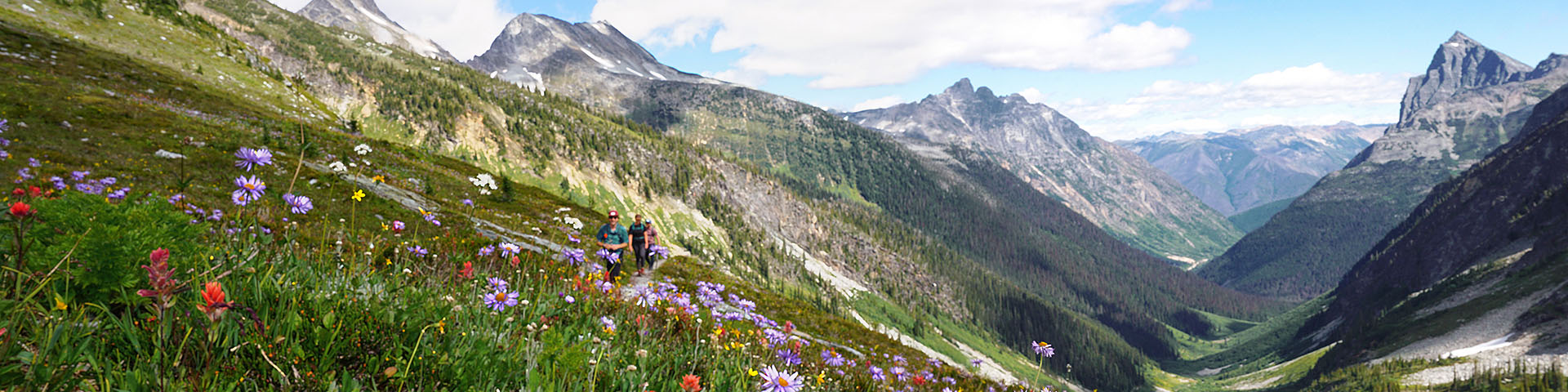
Day hikes
Glacier National Park
Follow steep trails from dense hemlock and spruce forest to rewarding alpine views. The hiking season is very short at high elevations because of the deep snowpack. Water sources can be limited, especially at higher elevations.
Many trails in the park can be accessed from either Illecillewaet Valley or Illecillewaet Campground parking lots. If you are hiking from the Illecillewaet Campground, subtract 2 km from the trail length.
Most requested
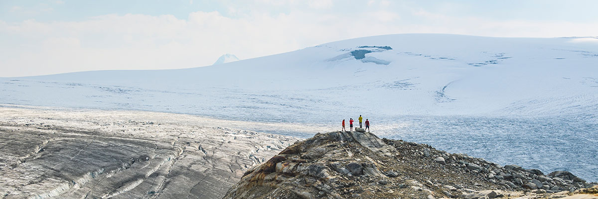
Great Glacier
- 8.4 km* (return)
- 320 m elevation change
- 2.5 hrs
- Natural trail and rock
- Moderately steep
Trailhead: Illecillewaet Valley or Illecillewaet Campground*
The "Great Glacier," now called the Illecillewaet Glacier, has been a well-known landmark to visitors in this region since the 1880s. At that time, a hike to the icy toe of the glacier was a short stroll from the railway and the comforts of Glacier House. Over the past century, the ice has receded about 1.5 km upslope.
This is among the shortest trails of the Illecillewaet area. It stops well short of the Illecillewaet Glacier and the view of the glacier is blocked from the trail's end by the sloping bedrock below it. However, it gives an excellent panorama of Mount Sir Donald and the Vaux Glacier to the east.
Lower Beaver Valley Bicycles allowed
- 10.2 km (return)
- 320 m elevation change
- 3.5 hrs
- Natural trail
- Gently rolling with some steep sections
Trailhead: 10 km east of Rogers Pass Discovery Centre
This rare valley bottom trail winds through rich old growth forest. Listen closely for the hum of the Mount Macdonald railway tunnel’s ventilation fans in the distance.
Turn right at junction (5.1 km): Maintained trail ends shortly after at the Grizzly Creek bridge. The Upper Beaver Valley Trail beyond Grizzly Creek is no longer maintained and is not recommended. Visitors enter at their own risk.
Turn left at junction: A 2.4 km return side trip (unmaintained) is possible up to Copperstain Bridge. The trail is closed beyond this point.
Balu Pass No dogs allowed
- 12.8 km (return)
- 780 m elevation change
- 4 hrs
- Natural trail, rock stairs
- Steep sections
Trailhead: Rogers Pass Discovery Centre
Please note: Seasonal bridges are removed for the winter beginning late September. Creek crossings may be necessary after this time.
Trail through avalanche paths into alpine meadows offering amazing views. It's hard to forget that you're in bear country on this hike. The name is derived from the Indian word "baloo", meaning bear. Grizzly bears are common here and you must hike in a group of 4 or more adults between July 15 and September 30. Stay alert! Dogs are not allowed on this trail.
The steepest part of the walk is at the end – a short uphill hike to Balu Pass summit. Wild flowers in August and the view of the glaciers, icefields and mountain peaks repay the effort. The trail ends at the summit of the pass. Access beyond this point is strictly regulated to increase public safety and minimize displacement of grizzly bears from prime food sources.
Parks Canada / I. Houghton
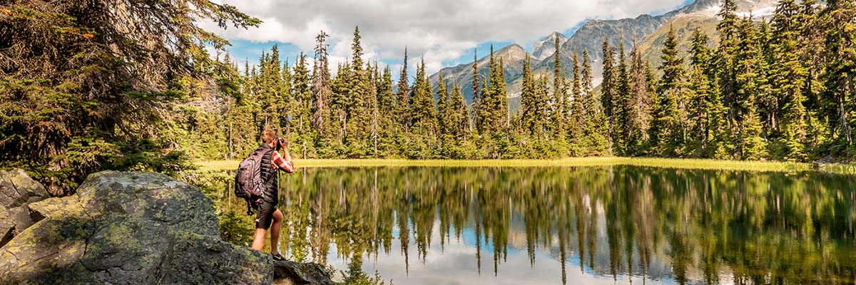
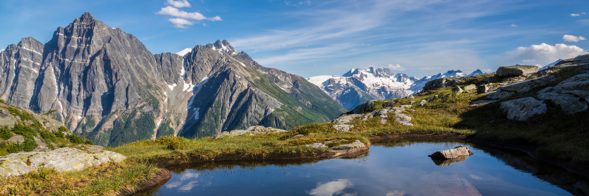
Marion Lake
- 6.4 km* (return)
- 425 m elevation change
- 2.5 hrs
- Natural trail
- Steep
Trailhead: Illecillewaet Valley or Illecillewaet Campground*
Steep forested hike to a small subalpine lake along the first leg of the Abbott Ridge Trail.
From Marion Lake, hikers can take a short side trip to a viewpoint above the Trans Canada Highway. From this viewpoint, you can see trains coming from or going into the Connaught tunnel. The tunnel was completed in 1916, as a way to protect rail traffic from the deadly avalanches of Rogers Pass.
Bostock Creek
- 15.6 km (return)
- 740 m elevation change
- 7 hrs
- Natural trail
- Moderately steep
Trailhead: 4 km east of western park boundary
Hike from the interior rainforest into the subalpine forest.
At the summit of the pass, hikers have the opportunity to see one of the few areas in the park where sedimentary rock covers the older and harder metamorphic bedrock typical of the Columbia Mountains. This blanket of limestone and shales gives a distinctively different look and feeling.
From the pass, you can explore relatively gentle alpine tundra ridges.
Avalanche Crest
- 10.2 km* (return)
- 795 m elevation change
- 5 hrs
- Natural trail
- Steep
Trailhead: Illecillewaet Valley or Illecillewaet Campground*
One of the best scenic trails in the park. Hike into an open alpine basin nestled between Avalanche Crest to the left and a ridge off Eagle Peak. The nearby left ridge overlooks the highway/railway corridor.
From November through May each year this crest generates numerous avalanches which threaten the Trans-Canada Highway. The treeless slopes stretching down the mountain offer proof to summer hikers of this winter phenomenon.
Watch for hoary marmots, porcupines, Clark's nutcracker and pikas. You may see woodpeckers in the small burned-over areas along the trail. The trail ends in an open alpine basin nestled between Avalanche Crest and a ridge from Eagle Peak.
Parks Canada / R. Buchanan
Abbott Ridge
- 15.6 km* (return)
- 1030 m elevation change
- 6.5 hrs
- Natural trail
- Very steep
Trailhead: Illecillewaet Valley or Illecillewaet Campground*
The Abbott Ridge Trail takes you up into true alpine tundra the land above the trees and ends on a narrow ridge. For strong hikers, there are few routes that more closely simulate a mountain-top experience from the security of an established trail. During early season take the marked short cut to avoid a steep snow slope.
Tourism Golden / A. Bernard
Asulkan Valley
- 15.8 km* (return)
- 870 m elevation change
- 6 hrs
- Natural trail
- Gently rolling to steep moraine ridge after 4 km
Trailhead: Illecillewaet Valley or Illecillewaet Campground*
Please note: Seasonal bridges are removed for the winter beginning late September. Creek crossings may be necessary after this time.
A glacier carved landscape with lush forest, mountain views and waterfalls. This hike starts as a valley walk and then climbs a steep glacial moraine. At trail's end, the lower tongue of the Illecillewaet Glacier lies below you. At the end of the trail is the Asulkan Cabin, available to public use upon reservation with the Alpine Club of Canada. Persons wishing to proceed to Asulkan Pass should be equipped with mountaineering gear and be knowledgeable in its use.
The name "Asulkan" was first used by William Spotswood Green, who climbed in the area in 1888. It reportedly means "wild goat" in the dialect of one of the First Nations of the region, and recognizes the abundance of mountain goats he saw at the end of this valley in Asulkan Pass.
Glacier Crest
- 13.4 km* (return)
- 960 m elevation change
- 6 hrs
- Natural trail with rocky sections
- Very steep
Trailhead: Illecillewaet Valley or Illecillewaet Campground*
This trail climbs a rock ridge between two valleys carved by the Illecillewaet and Asulkan glaciers. The ridge itself is an arête carved by the glaciers that once flowed down the valleys on either side. The view from this alpine spine is a Columbia Mountain panorama of rock and glacial ice.
Tourism Golden / A. Chad
Perley Rock
- 12.8 km* (return)
- 1145 m elevation change
- 6 hrs
- Natural trail and boulder fields
- Very steep
Trailhead: Illecillewaet Valley or Illecillewaet Campground*
Important: Glaciers are constantly moving and changing. Due to the unstable nature of retreating glacial ice, ice caves and ice overhangs can collapse at any time. For your safety, do not walk under or on overhanging ice.
Please note: Seasonal bridges are removed for the winter beginning late September. Creek crossings may be necessary after this time.
An ambitious day hike in the park ending at a high viewpoint overlooking the Illecillewaet Icefield and Abbott Ridge.
The trail leads upwards at a moderate pace until it crosses Vaux Creek, then launches a brutal climb towards the alpine. After many, many switchbacks, the trail reaches a steep snow slope. Crossing snow slopes can be dangerous; consider ending your hike at this point, especially if conditions are icy. If plan to continue, exercise caution and consider bringing crampons . Once across the snow slope, your uphill labour ends at a high viewpoint overlooking the vast and otherworldly expanse of the Illecillewaet Icefield.
Hermit Backcountry campground
- 6.4 km (return)
- 820 m elevation change
- 4 hrs
- Natural trail with rock stairs
- Very steep
Trailhead: 1.5 km east of Rogers Pass Discovery Centre
Known for its epic steepness! Climb many switchbacks, rock stairs, and a rope-assisted scramble to an alpine meadow and backcountry campsite (permits required). The trail serves as quick access to the Hermit Range, which offers good climbing and scrambling opportunities on peaks such as Mount Tupper, Hermit Mountain, Mount Rogers and Swiss Peak.
The hike begins east of a large avalanche path and soon enters dense subalpine forest. The forest is a good place to watch and listen for birds, such as the white-winged crossbills, fox sparrows, and hermit thrush.
The first great mountain views are at about 1900 metres where the trail comes out of the forest.
Sir Donald Backcountry campground
- 12.2 km* (return)
- 1010 m elevation change
- 5 hrs
- Natural trail
- Very steep
Trailhead: Illecillewaet Valley or Illecillewaet Campground*
Please note: Seasonal bridges are removed for the winter beginning late September. Creek crossings may be necessary after this time.
Mount Sir Donald is named for Sir Donald A. Smith, the famous Canadian Pacific Railway director who drove the last spike on the CPR at Craigellachie in 1885.
A mountaineering route created by North America’s first recreational climbers, this tough trail switchbacks from valley bottom to alpine. If you are looking for a way to test your wind and energy, this trail is for you.
Beyond the turnoff to Perley Rock, conditions vary and hikers should have route finding skills. The trail ends at the Sir Donald backcountry campsite (a.k.a. the Lower Sir Donald bivouac site) that is an ideal climbing basecamp (permits required). From here, the soaring peaks of western Glacier National Park can be seen in the distance.
Travel beyond the campground is not recommended except as a climbers' route for Mount Sir Donald. It requires careful route-finding and is exposed to rockfall from above and precipitous drop-offs along ledges. For more information, see the ‘Climbers Descent Guide to Mount Sir Donald’.
Bald Mountain Wilderness Route
Double black trail rating: suitable for well prepared visitors with exceptional trail and navigation experience.
- 30 km (return)
- 1125 m elevation change
- Distance and elevation change varies with route selection
Trailhead: Safe access is only available via the Spillimacheen provincial forest service road which begins at Parson, B.C.
This wilderness hiking route crosses rolling subalpine meadows that form the east boundary of the park. The route receives no maintenance. Hikers should have the skills, equipment and experience required for route finding and travel in remote mountain environments.
Download map and trail information

- Date modified :