
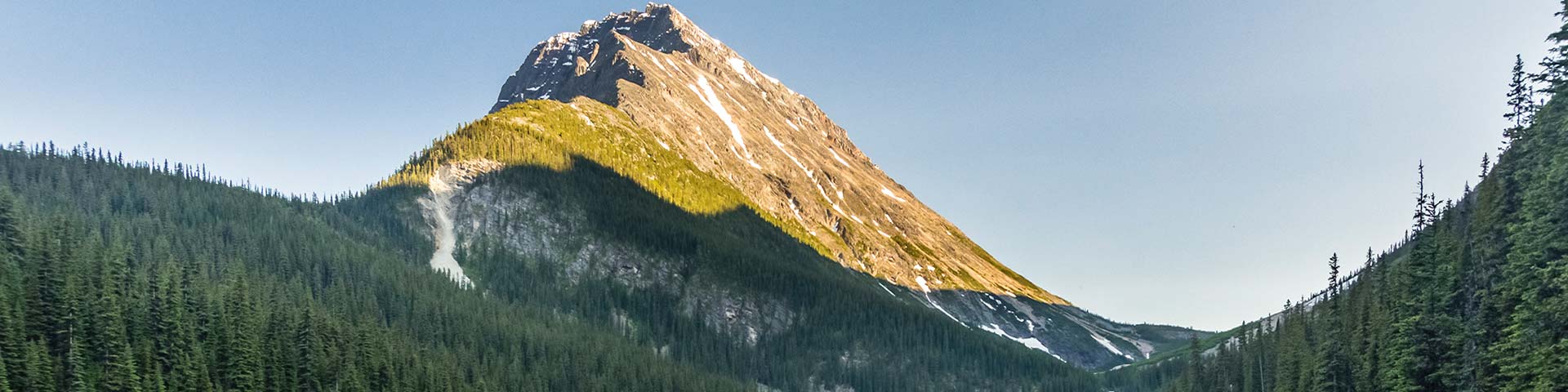
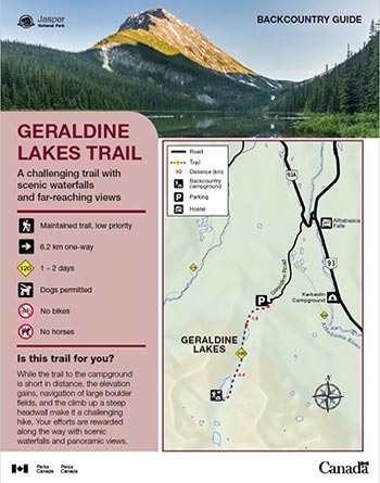
A challenging trail with scenic waterfalls and far-reaching views.
Geraldine Lakes
Jasper National Park
 Geraldine Lakes Backcountry Guide (PDF, 1.44 MB)
While the trail to the campground is short in distance, the elevation gains, navigation of large boulder fields, and the climb up a steep headwall make it a challenging hike. Your efforts are rewarded along the way with scenic waterfalls and panoramic views.
Planning considerations
- Maintained trail: Low priority
- 6.2 km one-way
- Trail #120: 1 - 2 days
- Dogs permitted
- No bikes
- No horses
From June 9 to September 30: Geraldine Road is open to public traffic subject to the following restrictions:
- During working hours (typically 07:00 to 19:00), travel on Geraldine Road by vehicle only. Drive with care. Follow traffic control measures and all posted speed limits and warnings. Expect delays of up to 15 minutes. Work schedules are subject to change without notice.
- During non-working hours, the road is open to all users.
From October 1 to June 8: Geraldine Road is closed to all public traffic.
The details
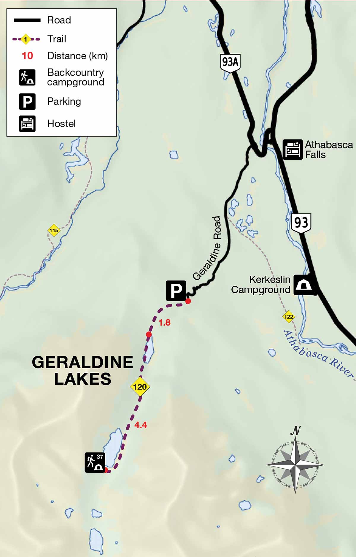
This is a strenuous but rewarding backpacking trip. The gentle, forested hike to first Geraldine Lake is 1.8 km. After climbing steeply at the end of the first lake, the trail travels across a large boulder field marked with a series of cairns. At km 4.2 is an impressive waterfall and a steep headwall. The trail from the top of the headwall continues to a rocky ridge and across several more boulder fields along the second lake. The campground is located at the far end of the second lake, across a small creek.
Strong, experienced hikers may wish to explore the upper valley and its lakes beyond the campground. There are no official, signed trails beyond the campground. Route finding skills are required.
- This trail can be challenging for children and dogs.
- Boulders become very slippery in wet conditions.
- Navigating through boulder fields can be difficult with a large pack.
- There is a two-night maximum stay at this campground.
- The campground can flood with snow melt during early season.
Elevation profile

Text version
- The elevation profile shows the trail beginning at 1480 m.
- The next 1.8 km to the first lake is a steady ascent of approximately 145 m.
- At the end of the first lake is a steep 90m climb.
- The trail gains only slight elevation until shortly before the Second Lake, where there is a steep 150 m climb.
- There is no significant elevation gain or loss in the final 1.2 km along second lake to the campground (1890 m) at the far end.
Campground information
| Campground | Elevation | Description | # of sites | Toilet type | Food storage | UTM |
|---|---|---|---|---|---|---|
| Second Geraldine Lake #37 |
1890 m | This campground is located next to a small creek on the far shore of the second Geraldine Lake. The view towards the lower valley is spectacular. It is a great location to spend one or two nights. | 4 | Barrel | Lockers | 11U 435994 5826817 |
How to get there
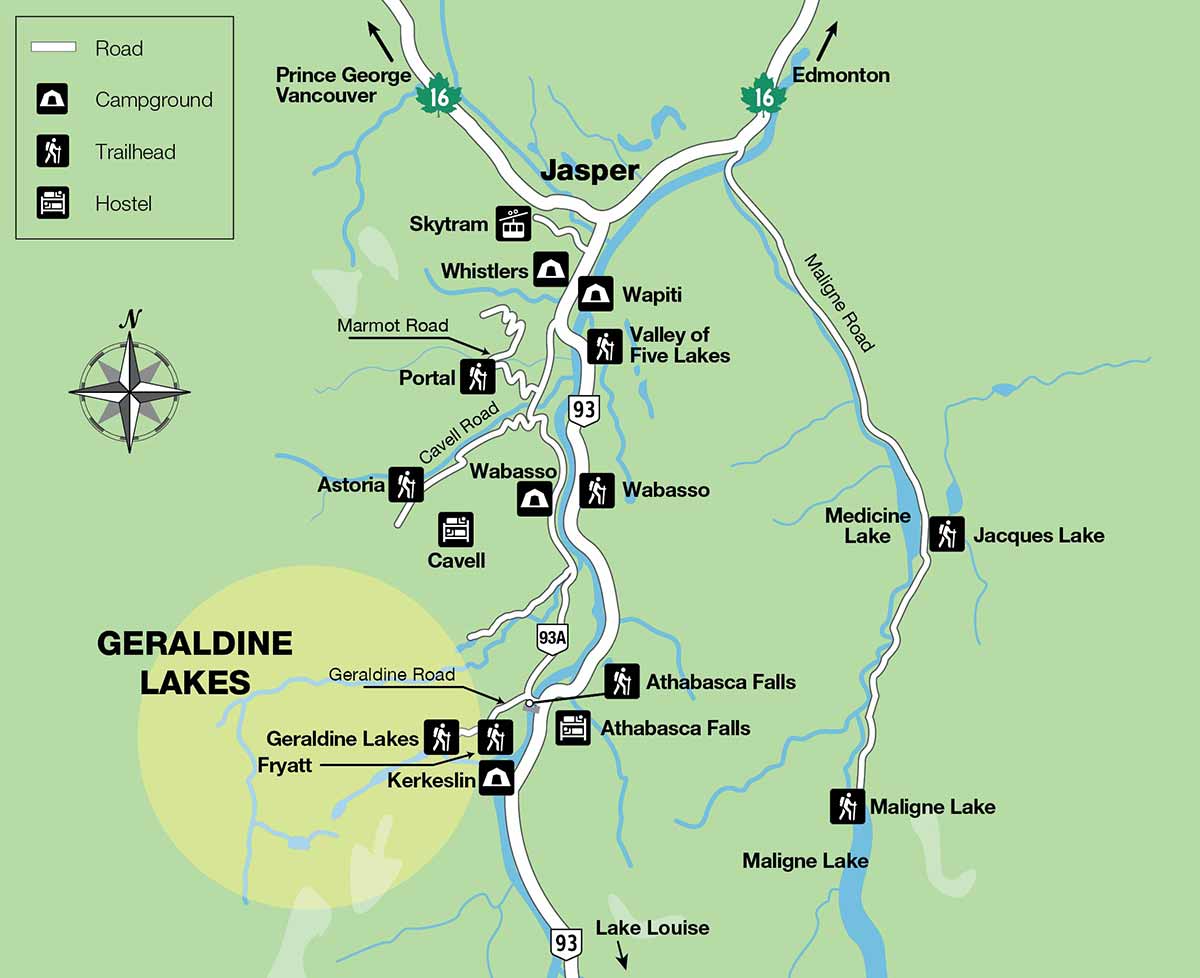
From Jasper: 37 km
- Take the Icefields Parkway (Highway 93) toward Lake Louise.
- At Athabasca Falls (30 km south of Jasper) turn right onto Wabasso Road (93A) Continue for 1 km.
- Turn left onto rough, unpaved Geraldine Road and continue for 6 km, 3.3 km beyond the Fryatt trailhead.
From Banff and Lake Louise: 211 km
- Take the Icefields Parkway (Highway 93) towards Jasper.
- At Athabasca Falls (30 km south of Jasper) turn left onto Wabasso Road (93A). Continue for 1 km.
- Turn left onto rough, unpaved Geraldine Road and continue for 6 km, 3.3 km beyond the Fryatt trailhead.
Note: Geraldine Road is a seasonal access road that is open from mid-June to late September. Check 511.alberta.ca to confirm if the road is open.
This is a rough gravel road. High-clearance vehicles are recommended. No trailers or RVs are permitted.
Are you prepared?
Safety is your responsibility
Refer to the Jasper National Park Backcountry Planning Guide:
- descriptions of trail types and campground facilities;
- equipment checklists;
- responsible camping practices;
- safety information.
Before heading out, check trail, weather and road conditions at: parks.canada.ca/jaspertrails.
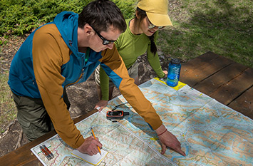
Maps
| NTS | National Geographic | Gem Trek |
|---|---|---|
| Athabasca Falls 83C/12 | Jasper South | Jasper and Maligne Lake |
Permits
A backcountry camping permit is mandatory for all overnight trips and can be obtained online at reservation.pc.gc.ca or by calling 1-877-737-3783.
- Date modified :