
2024 reservations launch February 5, 2024 at 8 am EST for island camping and oTENTiks.
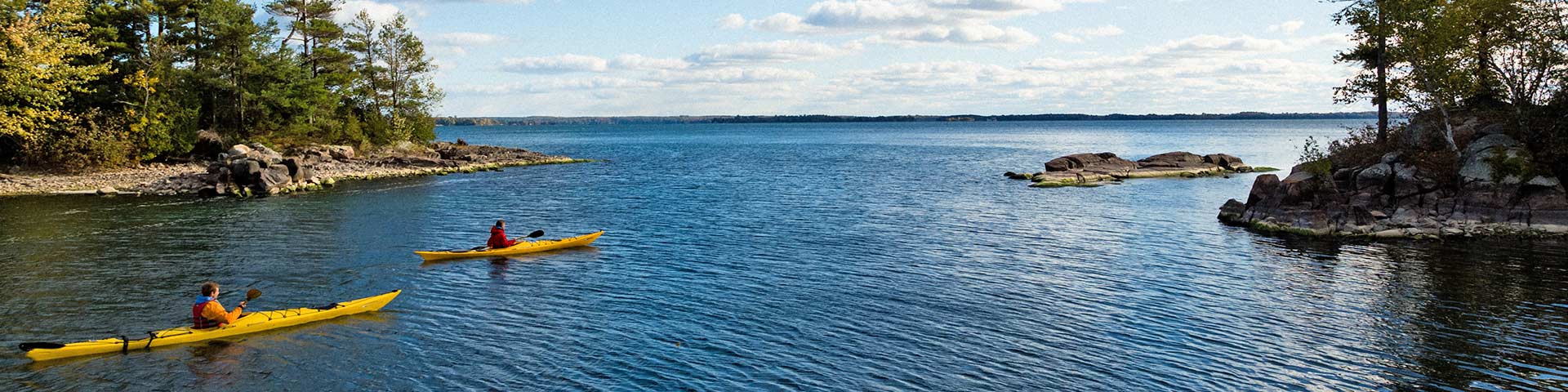
Thousand Islands National Park
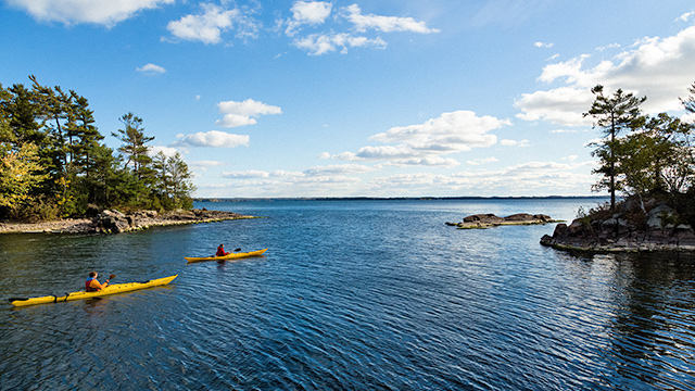
Journey to the picturesque granite islands and rugged shorelines of Thousand Islands National Park. Explore secluded bays by kayak or boat, camp or picnic by the river, or learn about the region's biodiversity and rich Indigenous heritage from the vantage point of wooded trails and rocky lookouts.

Apply today to join the Parks Canada team!
Thousand Islands National Park is hiring student and entry level positions for many roles.
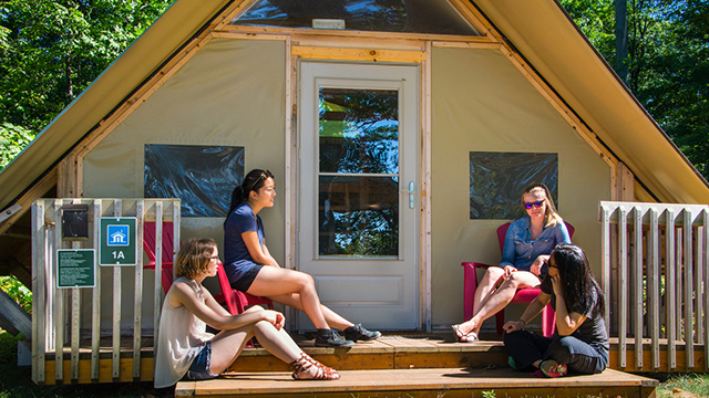
Island and mainland oTENTiks
Try an oTENTik accommodation at Mallorytown Landing, Gordon Island or McDonald Island.

2024 reservations launch
Island camping and oTENTik reservations can be made as of February 5, 2024 at 8 am EST.
Visiting Thousand Islands National Park
Activities and experiences
Things to do, trails, programs, paddling, boating, red chairs and more.
Plan your visit
How to get here, maps, facilities and services and weather.
Camping and overnight accommodations
Campsites and oTENTiks.
Reservations
Make a reservation for campsites and oTENTiks.
Fees
Daily visitor fees, camping, boat launch and mooring fees, and more. Free admission for youth.
Passes
Seasonal and annual admission passes.
Safety and guidelines
Important bulletins, wildlife, camping and water safety, and park regulations.
About Thousand Islands National Park
Nature and science
Conservation and science, R.A.R.E project, animals, plants, the environment, and research.
Culture and history
History, cultural landscape, designation information.
Stewardship and management
Contact information, jobs, public consultations, plans, business licenses and policies.
Contact Thousand Islands National Park
General inquiries:
Phone: 613-923-5261
Toll-free: 1-888-773-8888
pnmille-iles-thousandislandsnp@pc.gc.ca
For emergencies within the park:
Police, Fire, Ambulance (emergency only): 911
Wildlife incidents/Wildfires: 1-877-852-3100
Hours of operation
Thousand Islands National Park is now closed for the season. We look forward to seeing you in 2024.
Facilities are not maintained between Thanksgiving and Victoria Day. Natural hazards present in area.
More places to discover with Parks Canada
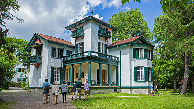
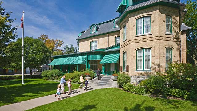
Bellevue House National Historic Site
Follow staff in period costume on a tour of Bellevue House. Hear stories about Canada’s first prime minister, who made history here in the 1840s. Feel a Lake Ontario breeze in an heirloom garden.
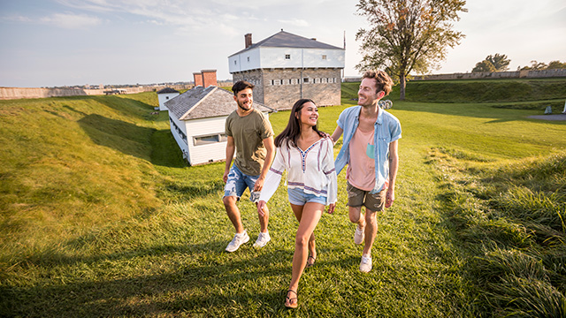
Fort Wellington National Historic Site
At Fort Wellington, one of the fortified posts the British built to defend its colonies against American invasion in 1812 and 1838, you can relive this precarious period when the fate of Canada hung in the balance.
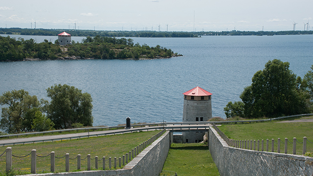
Kingston Fortifications National Historic Site
Kingston Fortifications National Historic Site is located in and around the harbour area of Kingston, Ontario. Situated at the mouth of the Cataraqui River, and overlooking the confluence of Lake Ontario and the St. Lawrence River, the fortifications consist of five separate 19th-century military installations.
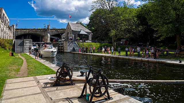
Rideau Canal National Historic Site
An historic 19th century military waterway linking rivers and lakes across Eastern Ontario’s countryside, the Rideau Canal is now a popular natural playground, perfect for boating, paddling, fishing, camping, hiking and cycling the canal’s wooded pathways.
Laurier House National Historic Site
Two of Canada’s most important Prime Ministers, Sir Wilfrid Laurier and the Rt. Hon. William Lyon Mackenzie King, resided in this Victorian Ottawa mansion where they entertained dignitaries and politicians while often conducting the nation’s business.
Thousand Islands National Park
Granite islands speckle the St. Lawrence River in a transition zone between Canadian Shield and Adirondack Mountains. Explore by boating, paddling, or hiking. Awesome Thousand Islands National Park awaits, a few hours from Toronto or Montreal.
- Date modified :