
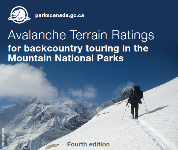
Avalanche terrain ratings for backcountry touring in the mountain national parks
Mountain safety
Avalanches are part of life in the mountains, an integral piece of the winter cycle. Anytime snow and steep slopes are combined, avalanche potential results. If you wish to travel through backcountry terrain that is exposed to avalanches, you must accept that you are taking a risk. You need to understand these risks before taking them, and the information included here will help give you a better sense of the type of trip you are planning.
Traditional models for rating avalanche danger are based on the stability of snow, which changes regularly with the weather – from day to day, or even hour to hour. Terrain however, doesn't change much. The angle and shape of the ground, or the number of established avalanche paths won't vary from day to day. By using the Avalanche Terrain Exposure Scale (ATES), you can begin to measure your skills, experience and risk tolerance against the landscapes through which you choose to travel.
Avalanche terrain ratings and avalanche bulletins must be used together for evaluations hazards and managing personal risk in the backcountry.
Do I still need to read the avalanche bulletin every day?
Absolutely - terrain is only part of the picture. When the avalanche conditions are poor, you should select very conservative terrain. Alternatively, when the avalanche conditions are good, this might be the time to consider that next level of terrain you have been contemplating. The two must be used together for understanding the big picture of how to manage your risk in the backcountry. Daily avalanche information is available at Park Information Centres, 1-800-667-1105, or on the web at: avalanche.pc.gc.ca.
When should I use this system?
These ratings are intended to supplement pre-trip planning material. This means reading guidebook descriptions, studying maps and photos, talking to friends, checking weather and avalanche conditions, and referring to the ATES ratings while planning the trip. All of these resources together will give you a better sense of the route you are choosing.
How do I use the scale?
The list of rated trips represents some of the most common destinations in the mountain National Parks. Don't use this scale alone – you'll need additional material to learn about the trip you are proposing. The following guidebooks are recommended
- Summits & Icefields, Columbia Mountains – by Chic Scott
- Summits & Icefields, Canadian Rockies – by Chic Scott
- Ski Trails in the Canadian Rockies – by Chic Scott
- Ski Touring in Rogers Pass – by J.P. Kors, John Kelly & Eric Dafoe
These publications are available at local mountain specialty stores, or via
For further information on specific trips visit any Parks Canada Information Centre in the Mountain National Parks – or check with a local professional guide service.
How much experience do I need for these trips?
Simple (Class 1) terrain requires common sense, proper equipment, first aid skills, and the discipline to respect avalanche warnings. Simple terrain is usually low avalanche risk, ideal for novices gaining backcountry experience. These trips may not be entirely free from avalanche hazards, and on days when the Backcountry Avalanche Advisory is rated ‘Poor', you may want to re-think any backcountry travel that has exposure to avalanches – stick to groomed x-country trails, or within the boundaries of a ski resort.
Challenging (Class 2) terrain requires skills to recognize and avoid avalanche prone terrain – big slopes exist on these trips. You must also know how to understand avalanche bulletins, perform avalanche self rescue, basic first aid, and be confident in your routefinding skills. You should take a Avalanche Skill Training Level 1 course prior to traveling in this type of terrain. If you are unsure of your own, or your group's ability to navigate through avalanche terrain - consider hiring a professional, ACMG certified guide.
Complex (Class 3) terrain demands a strong group with years of critical decision-making experience in avalanche terrain. There can be no safe options on these trips, forcing exposure to big slopes. A recommended minimum is that you or someone in your group should have taken an Avalanche Skill Training Level 2 course and has several years of backcountry experience. Be prepared! Check the avalanche bulletin regularly, and ensure everyone in your group is up for the task and aware of the risk. This is serious country - not a place to consider unless you're confident in the skills of your group. If you are uncertain - consider hiring a professional, ACMG certified guide.
Disclaimer
There are inherent risks in backcountry travel, and most of the routes described here will at times be unsafe due to potential snow avalanches. The Parks Canada Agency has done its best to provide accurate information and to describe the terrain characteristics typical of each general region. However, it is up to the users of this information to learn the necessary skills for safe backcountry travel, access additional trip planning materials, and to exercise caution while traveling through the backcountry in any national park.
Users of this information do so entirely at their own risk, and the Parks Canada Agency disclaims any liability for injury, injury resulting in death or damage to anyone undertaking a trip into any of the regions described. This information is no substitute for experience and good judgment.
Click on Simple, Challenging or Complex below for a list of rated trips in the Mountain National Parks.
Avalanche Terrain Exposure Scale (ATES) v.1/04
| Description | Class | Terrain Criteria |
|---|---|---|
| Simple | 1 | Exposure to low angle or primarily forested terrain. Some forest openings may involve the runout zones of infrequent avalanches. Many options to reduce or eliminate exposure. No glacier travel. |
| Challenging | 2 | Exposure to well defined avalanche paths, starting zones or terrain traps; options exist to reduce or eliminate exposure with careful routefinding. Glacier travel is straightforward but crevasse hazards may exist. |
| Complex | 3 | Exposure to multiple overlapping avalanche paths or large expanses of steep, open terrain; multiple avalanche starting zones and terrain traps below; minimal options to reduce exposure. Complicated glacier travel with extensive crevasse bands or icefalls. |
Related links
- Date modified :