
Hiking
Kejimkujik National Park and National Historic Site
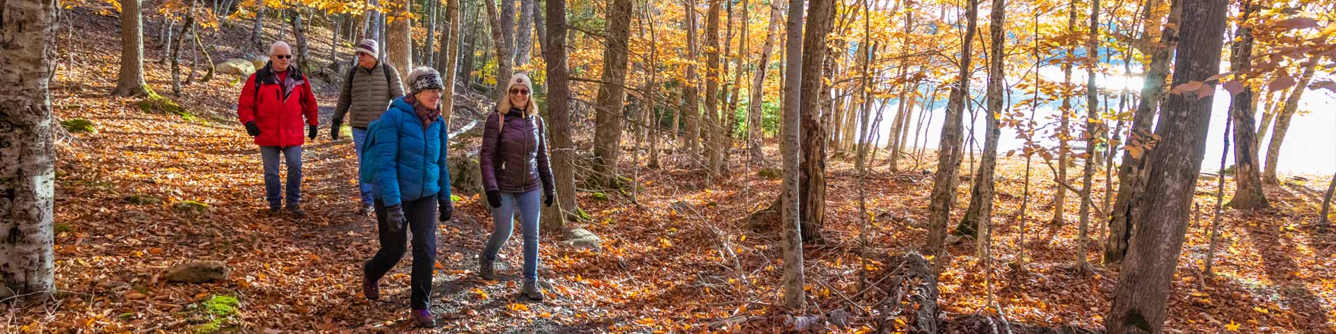
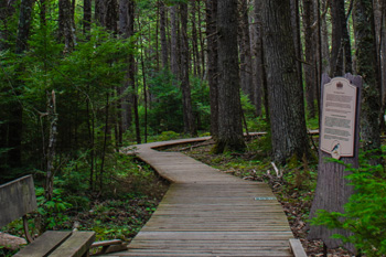
Hiking is one of the most popular activities at Kejimkujik. Enjoy many front country, backcountry, and seaside trails of different lengths and levels of difficulty. Experience a variety of habitats and scenery and places of cultural and natural significance. Dogs must be kept on leash.
Fall, winter, and spring conditions
Note that trails are not maintained or patrolled between November 1 and Victoria Day weekend.
You may encounter washed out or flooded sections and/or downed trees.
Most facilities and services are closed at this time of year. More information
Emergencies: Call 911 and prepare to wait for help to arrive.
Take a hike at Kejimkujik
Transcript
[ This video contains no spoken words ]
Animated Parks Canada logo.
Kejimkujik National Park and National Historic Site, Nova Scotia. [A scenic aerial shot of Kejimkujik's forests and lakes during sunrise.]
Kejimkujik National Park and National Historic Site, Nova Scotia. [Kejimkujik sign.]
[A family with two adults and two children standing with bikes and putting on helmets at Jake's Landing. The Visitors begin biking along Kejimkujik's forested trails.]
[The family walks across the rainbow crosswalk.]
[The family sits at a picnic table in the forest and shares a picnic meal.]
[Two visitors run through the forest along one of Kejimkujik's trails and pass by the family who are eating their picnic lunch.]
[A visitor wanders along one of Kejimkujik's forested trails.]
[Visitors bike across a bridge crossing the Mersey River.]
[Two visitors mountain bike around twisting turns and over natural obstacles along Kejimkujik's Ukme'k Trail.]
[The back of two empty Parks Canada branded Red Chairs.]
[Two visitors sit in the Parks Canada Red Chairs overlooking Kejimkujik Lake while watching the sun set. Screen fades to black.]
Parks Canada logo.
Animated Canada wordmark.
Trails
Trails vary in length so everyone can have the opportunity to explore. Ensure dogs are kept leashed to avoid confrontations with wildlife.
- Frontcountry trails
- Backcountry trails
- Seaside trails
- Self-guided trails
- Trail descriptions
- Safety - A shared responsibility
- Contact us
Frontcountry trails
| Trail | Activity | Difficulty | Distance | Type |
|---|---|---|---|---|
| 1 Mill Falls | Easy | 2 km (return) | Linear | |
| 2 Beech Grove | Moderate | 2.2 km | Loop | |
| 3 Flowing Waters | Easy | 1 km | Loop | |
| 4 Hemlocks and Hardwoods | Easy | 5 km | Loop | |
| 5 Farmlands | Easy | 1.1 km | Loop | |
| 6 Rogers Brook | Easy | 1 km | Loop | |
| 7 Grafton Woods | Easy | 1.6 km | Loop | |
| 8 Snake Lake | Easy | 3 km | Loop | |
| 9 Peter Point | Easy | 1.9 km (one way) | Linear | |
| 10 Mersey River | Easy | 3.3 km (one way) | Linear | |
| 11a Slapfoot | Easy | 3.7 km (one way) | Linear | |
| 11b Slapfoot | Easy | 2.7 km (one way) | Linear | |
| 12 Ukme'k | Moderate | 6.3 km (one way) | Linear |
Backcountry trails
| Trail | Activity | Difficulty | Distance | Type |
|---|---|---|---|---|
| 13 Channel Lake | Difficult | 24 km | Loop | |
| 14 Liberty Lake | Difficult | 56 km (one way) | Linear |
Seaside trails
| Trail | Activity | Difficulty | Distance | Type |
|---|---|---|---|---|
| Harbour Rocks trail at the Seaside | Easy | 2.8 km one way | Linear | |
| Port Joli Head trail at the Seaside | Difficult | 4.4 km (one way) | Loop |
Self-guided trails
Self-guided trails are a great way for you to learn about Kejimkujik and the natural and cultural resources it protects.
Interpretative panels offer information as you move along, so you can walk these trails at your own pace.
Self-guided frontcountry trails at Kejimkujik:
Trail descriptions
Safety – a shared responsibility
Please help us ensure everyone has a safe and enjoyable visit.
- Do not approach or feed wildlife.
- Staying on the trail protects trailside vegetation.
- Do not enter restricted areas.
- Bike only on designated biking trails.
- Bikers yield to hikers.
- Protect yourself against ticks. Cover up, spray and self-check!
- Please keep your pets on a leash. Pets off-leash may disturb and harm wildlife or other visitors.
- Backcountry campsites are for registered campers only, please respect their privacy.
- Black Bears: They prefer to avoid humans but may be attracted if you leave food, coolers, or garbage out. Store food and waste securely at all times.
- If you see a coyote or a bear, don't run; back away slowly, act big, and make noise.
- Please report bear or coyote sightings to staff at the Visitor Centre.
- Provincial Motor Vehicle legislation is applicable and enforced in Kejimkujik. It is unsafe and illegal to ride in the back of trucks. Speeding and failure to stop at the entrance kiosk poses a safety hazard and is against the law.
Contact us
Summer
- Call the Visitor Centre: 902-682-2772
- Email: kejimkujik@pc.gc.ca
- Ambassadors: 902-298-0668
- Police, Fire, Ambulance: 911 (emergency only)
Winter and spring
- Call 902-682-2770 Monday to Friday, 8:30 am to 4:30 pm.
- Email: kejimkujik@pc.gc.ca
- Police, Fire, Ambulance: 911 (emergency only)
Related links
- Activities and experiences at Kejimkujik National Park...
- Fall, winter, and spring at Kejimkujik
- Calendar of events
- The Coastie Initiative
- Geocaching
- Canoeing, kayaking and stand-up paddleboarding (SUP)
- Swimming
- Fishing
- Parks Canada red chairs
- Explore the dark sky
- Tours and programs
- Snowshoeing and cross-country skiing
- Date modified :