
Getting here
Cape Breton Highlands National Park
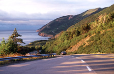
The world-famous Cabot Trail loops around northern Cape Breton.
The park stretches across the northern tip of Cape Breton Island between the Gulf of St. Lawrence and the Atlantic Ocean.
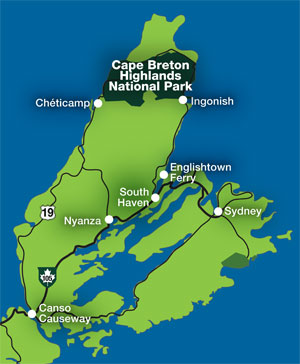
There are many ways to get to Cape Breton Highlands National Park. Two main auto routes lead to the western entrance of the park near Chéticamp, while two other options lead to the eastern entrance in Ingonish. The scenery you experience while traveling the Cabot Trail will be vastly different depending on the direction you choose to travel—clockwise or counterclockwise—but either way, the views are breathtaking.
The Cabot Trail, one of North America's most scenic travelways, loops around northern Cape Breton and runs for nearly 300 kilometres. Approximately one-third (106 km) of the Cabot Trail is located within the park's boundaries.
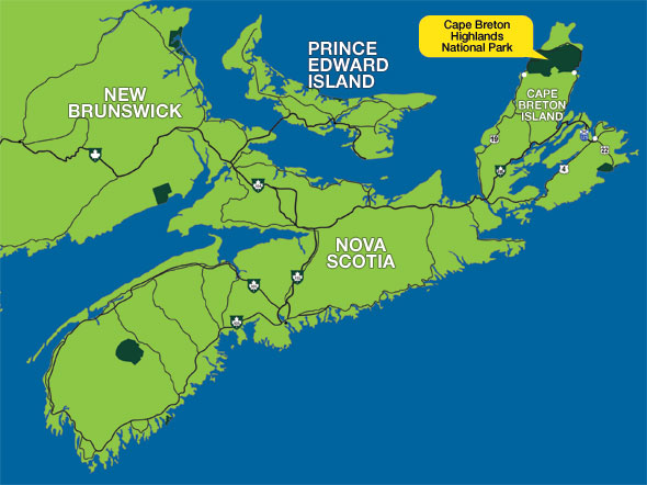
Locator map - Cape Breton Highlands National Park
Cape Breton Island - map
Clockwise (west to east):
The two main routes to the Chéticamp entrance of the park are:
- via Route 19 (Ceilidh Trail), which leads you through Judique, Mabou, Inverness and Margaree Harbour. Route 19 begins at the rotary in Port Hastings, on the "island" side of the Canso Causeway.
- via the Cabot Trail (West), traveling through Middle River, Lake O'Law, Margaree Harbour. This part of the Cabot Trail may be accessed from Exit 7 of the Trans-Canada Highway 105, in Nyanza.
Counterclockwise (east to west):
The two main options for traveling to the Ingonish entrance of the park are:
- via the Cabot Trail (East) through St. Ann's, accessed from Exit 11 of the Trans-Canada Highway 105, at South Haven.
- via the Englishtown Ferry (Route 312), accessed from Exit 12 of the Trans-Canada Highway 105, at the western base of Kelly's Mountain. This route includes a 5-minute ferry ride.
Both routes to Ingonish will converge north of the Englishtown Ferry and continue to the Ingonish visitor centre in Ingonish Beach.
Geographic coordinates (GPS)
Chéticamp visitor centre: 46.646414, -60.950784Ingonish visitor centre: 46.644680, -60.403369
- Date modified :