
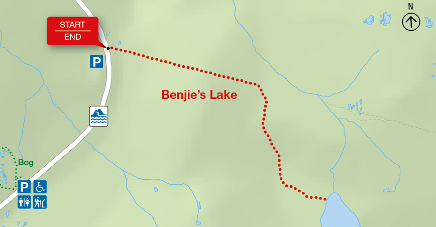
Benjie's Lake
Cape Breton Highlands National Park
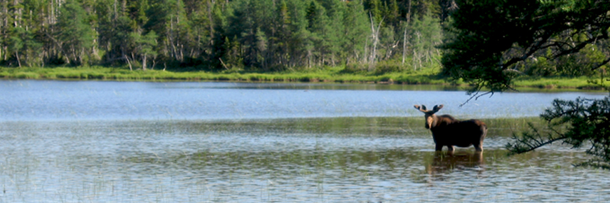
On the plateau at the top of the mountain, this trail crosses wet barrens and evergreen forests typical of the highlands, ending at a small lake. Boardwalks in some sections keep you dry and protect the habitat from trampling. Moose are frequently seen as well as a variety of northern birds.
| Length | 3 km / 1.9 mi (return) |
    |
| Rating | Easy  |
|
| Elevation | 400 m (1,315 ft) | |
| Time | 1 - 1.5 hours | |
| Significant features | Boreal highland forest Level trail, suitable for most skill levels. Some muddy sections. |
|
| Trailhead | On the Cabot Trail at the top of French Mountain Lat: 46.747348 Long: -60.821458 |
Related links
- Acadian
- Salmon Pools
- Le Chemin du Buttereau
- Le Buttereau
- Le vieux chemin du Cap-Rouge
- Corney Brook
- Skyline
- Bog
- Fishing Cove
- MacIntosh Brook
- Lone Shieling
- Aspy
- Mica Hill
- Jack Pine
- Coastal
- Jigging Cove Lake
- Green Cove
- Broad Cove Mountain
- Warren Lake
- Branch Pond Look-off
- Franey
- Clyburn Valley
- Middle Head
- Freshwater Lake Look-off
- Freshwater Lake
- Date modified :