
Protecting bear zones
Bears in the mountain national parks
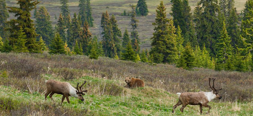
One of the biggest challenges Parks Canada faces in the mountain parks is ensuring that bears have the space and habitat they need to make a living. We are working to restore, connect and protect spaces that meet a bear’s needs.
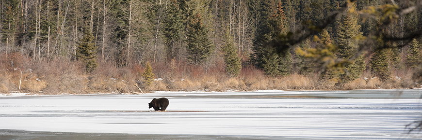
Lake Minnewanka
Lake Minnewanka is on the edge of one of three “core areas” for grizzly bears in Banff National Park. These core areas contain critical bear habitat, and...
Moraine Lake
At certain times of the year, access to Moraine Lake trails may be managed to protect visitors and to minimize disturbance to bears. When in place,...
Bryant Creek
The Bryant Creek area is one of three “core areas” for grizzly bears in Banff National Park. These core areas contain critical bear habitat, and a...
Restoring Habitat
Parks Canada is restoring more open habitat for grizzly bears away from crowded valley bottoms by bringing fire back to the landscape. In the Rocky Mountains, grizzly bears evolved with dynamic landscape events like fire, avalanche and flood. These natural disturbances cultivate the diverse habitats that bears and many other species rely on. Past fire suppression practices have resulted in open forests and meadows being replaced by older, dense forests that provide limited bear foods.
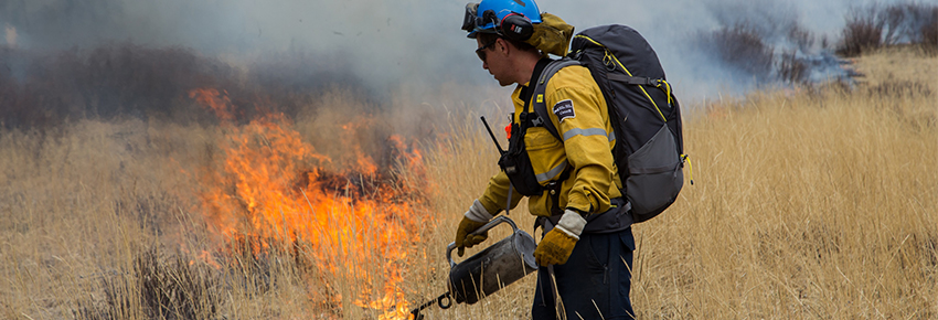
Prescribed fire mimics the natural process which opens up the forest, allows new vegetation to grow, and creates better bear habitat.
The first prescribed fire was lit in Banff National Park in 1983. Since then, the mountain parks have become leaders in fire management. Through science, research and experience, we are gaining a deeper understanding of how we can use this tool to maintain habitat zones for wildlife away from the hustle and bustle of human activity.
Connecting Habitat
Restoring quality bear habitat in the mountain parks is only the first step in meeting a bear’s needs. Research has shown that protecting “islands” of habitat isn’t enough. Because bears are great travellers and establish large home ranges (up to 2000 km2), the next step to ensuring their survival is providing safe passage from habitat to habitat.
Wildlife Corridors
The naturally fragmented landscape of the Rocky Mountains dictates where bears can move—along mountain ridges, over mountain passes and through river valley bottoms. Such routes are called wildlife corridors or habitat linkages; they link both habitat and populations. Linkages can be within a bear’s home range, or connect populations on a larger scale.
Grizzly bears need to move far and wide to find adequate food, shelter, and mates. If landscape connectivity is lost, bear populations may become isolated. Isolated populations are more likely to be extirpated as they are vulnerable to disease, environmental changes such as drought and climate change, in-breeding, or inability to find a mate. If connectivity remains, a large population can rescue a small population from extirpation by providing a source of immigrants.
The best, most continuous habitat and wildlife corridors sweep along major valley bottoms. Here, bears are also most likely to encounter busy trails, roads and highways, railways, campgrounds, or townsites.
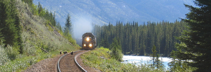
These developments and human activity create pinch points, fragment habitat, and can filter or even block wildlife movement.
Bears that risk using habitat or travel routes near human developments are more likely to die human-caused deaths by being struck by vehicles or trains, or by becoming ‘problem’ bears that are destroyed as a public safety risk.
Corridor Restoration
Parks Canada is working to restore wildlife corridors around communities in the mountain parks.
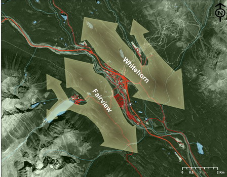
In Banff National Park, the restoration of the Sulphur, Norquay-Cascade, and Middle Springs wildlife corridors allows bears and other wildlife to navigate around the Banff townsite. The establishment of the Fairholme Range Environmentally Sensitive Site further supports wildlife movement through the Bow Valley. The Whitehorn and Fairview corridors provide wildlife passage around the hamlet of Lake Louise.
In Yoho National Park, an effective East-West wildlife corridor has been enhanced around the village of Field, enabling wildlife to access Kicking Horse Pass and other wilderness areas.
A significant undertaking happened in Jasper National Park in 2001, when Parks Canada and the Jasper Park Lodge worked together to restore a wildlife corridor through the Lodge’s golf course. A fence around the golf course was forcing wildlife to travel up high along the benches of Signal Mountain to get from the Valley of the Five Lakes to the Maligne River area. The removal of the fence and realignment of the golf course created a “short-cut” corridor that was used almost immediately by wildlife to access prey and to get to where they needed to go.
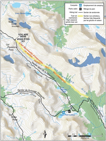
Communities are not the only areas that require attention when it comes to habitat connectivity: any area of high human use can disrupt wildlife movement. The Pipestone River Valley in Banff National Park forms part of an important wildlife corridor that contains critical grizzly bear habitat.
Here are two examples:
- The Lake O’Hara region in Yoho National Park is a spectacular gem in the Canadian Rockies and a popular hiking destination. Conflicts between people and grizzly bears here in the 1990s led to a research study that identified this area as key grizzly bear habitat and part of an important wildlife corridor. In order to protect people and give bears some breathing room in this vital McArthur Valley-Cataract Brook wildlife corridor, area closures, access restrictions, and trail relocations were implemented.
- The Pipestone River Valley in Banff National Park forms part of an important wildlife corridor that contains critical grizzly bear habitat. Sub-alpine and alpine areas in the upper reaches of this valley contain concentrations of high-quality food such as glacier lilies, an important food source for grizzly bears during the summer months.
To allow bears to use valley bottom areas free from human disturbance, and avoid the potential for a surprise bear encounter, hikers are encouraged to use the alpine trail to travel between Fish Lakes and Pipestone Pass. The valley bottom trail is no longer maintained beyond this point, in keeping with park management and grizzly bear conservation strategies.
How does Parks Canada keep an eye on how well these corridors are working?
Trail cameras are an efficient way to monitor restored corridors and other wildlife routes and collect useful data on how wildlife and people roam. The Wild Images video will show you some of the images captured by these cameras.
Wildlife Crossing Structures
How did the bear cross the road?
With the help of wildlife crossing structures, in a few special places.
Parks Canada is working to reconnect bear habitat fragmented by highways. The busy four-lane Trans-Canada Highway in Banff National Park is a major east-west connector and serves more than 26,000 vehicles a day in the summer. When construction is completed in 2013, 38 underpasses and 6 overpasses catering to wildlife only will help bridge the gap.
Monitoring shows us that grizzly bears prefer the wider, more open overpasses where they are better able to see what lies ahead. Black bears seem more comfortable using the sheltered security of underpasses.
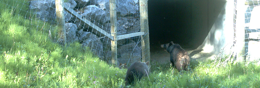
Mother bears of both species are now successfully passing on their knowledge of the structures to their offspring.
Elsewhere in the mountain parks …
Highway 93 South, Kootenay National Park – As part of the Highway 93S Crossing Project, crossing structures, fencing and alert systems are planned for a 3-km section of highway to reduce vehicle-wildlife collisions and restore wildlife habitat connectivity.
Two Jack Canal Wildlife Bridge, Banff National Park – In 1998, Parks Canada and TransAlta Utilities worked cooperatively to build a wildlife bridge across Two Jack Canal to better connect adjacent habitats. The hydroelectric canal that funnels water from Two Jack Lake to a hydropower station two km away created a barrier to winter wildlife movement into the Fairholme Bench Environmentally Sensitive Site, an area of prime montane habitat. The fluctuation of water levels in the canal in winter creates an unstable ice surface that wildlife are reluctant to cross. Three flat-deck railway cars were recycled for the bridge deck, which were covered with deck plating, organic soil, and native seed stock. The number of crossings made by wildlife over the canal more than doubled following bridge construction.
Salamander Crossings , Waterton Lakes National Park – The wildlife crossing structure idea is catching on for all kinds of species: tiny underpasses were designed and installed for use by long-toed salamanders, provincially listed as a species of Special Concern in Alberta. The structures are also used by other small wildlife, like western toads and red-sided garter snakes.
Protecting Habitat
Access Restrictions
Group Access
Group Access requires people to travel in a tight group of four or more. A tight group means that the person in front must be able to comfortably speak with the person in back at all times. Research indicates that larger groups that stay together and make noise are less likely to be attacked by a bear.
Group Access was first used in 1999 in the Moraine Lake area of Banff National Park following several serious bear-human encounters. Complete area closures were initially implemented; then, Group Access was piloted to allow people to use the area in a way that minimized their risk of a bear encounter. The minimum group size requirement was changed in 2007 from six hikers to four, following expert review.
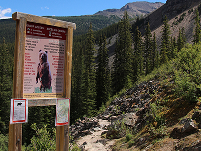
Today, Group Access is used where recurring bear-human encounters have occurred or where the risk is high for such an encounter.
Seasonal Access Restrictions
Some access restrictions are routinely in effect during certain times of the year.
Banff National Park:
Yoho National Park:
- McArthur Valley
- Odaray Highline Trail
Kootenay National Park:
- Sinclair Creek – Kindersley Pass Trail
Glacier National Park:
- Illecillewaet Valley
- Asulkan Valley
- Balu Pass
Always check Important Bulletins or contact park Visitor Centres for current restrictions, warnings and closures.
Those who do not comply will be charged under the National Parks Regulations; maximum fine $25 000.
Relocating Facilities
Access restrictions are an efficient way to temporarily reduce human use in important bear habitat. Sometimes it is necessary to look for more permanent solutions: relocating facilities like trails and campgrounds away from prime bear zones minimizes disturbance to bears, while still allowing people to enjoy the parks.
Parks Canada’s trail crew and backcountry managers are kept busy finding the most suitable spots for park facilities that suit both visitors and wildlife. Here are two examples of relocation projects that are making a big difference.
Paradise Valley, Banff National Park:
Facilities located in Paradise Valley underwent a major overhaul. Trails were adjusted and the backcountry campground was relocated to better separate grizzly bears and people. The campground was moved from Horseshoe Meadow to an area of lower quality bear habitat near Giant Steps Falls. Separate sleeping and cooking areas were created to help ensure that food odours would not attract wildlife to tent sites. Signs and bridges were removed from the lower trail.
Three Valley Confluence, Jasper National Park:
The Three Valley Confluence Trail Plan is a result of three years of collaborative discussion and planning through the Jasper Trails Project. The Plan sets out goals, objectives, key actions and strategies to improve both the ecological and recreational condition of the day-use trail network surrounding the town of Jasper. Volunteers, with the assistance of the International Mountain Biking Association Trail Care Crew, have helped to re-route wildland trails away from sensitive habitat. Local trail user groups will continue to be involved in the rehabilitation of unofficial trails along the shoulder of Signal Mountain.
- Date modified :