 Map of Wapusk National Park
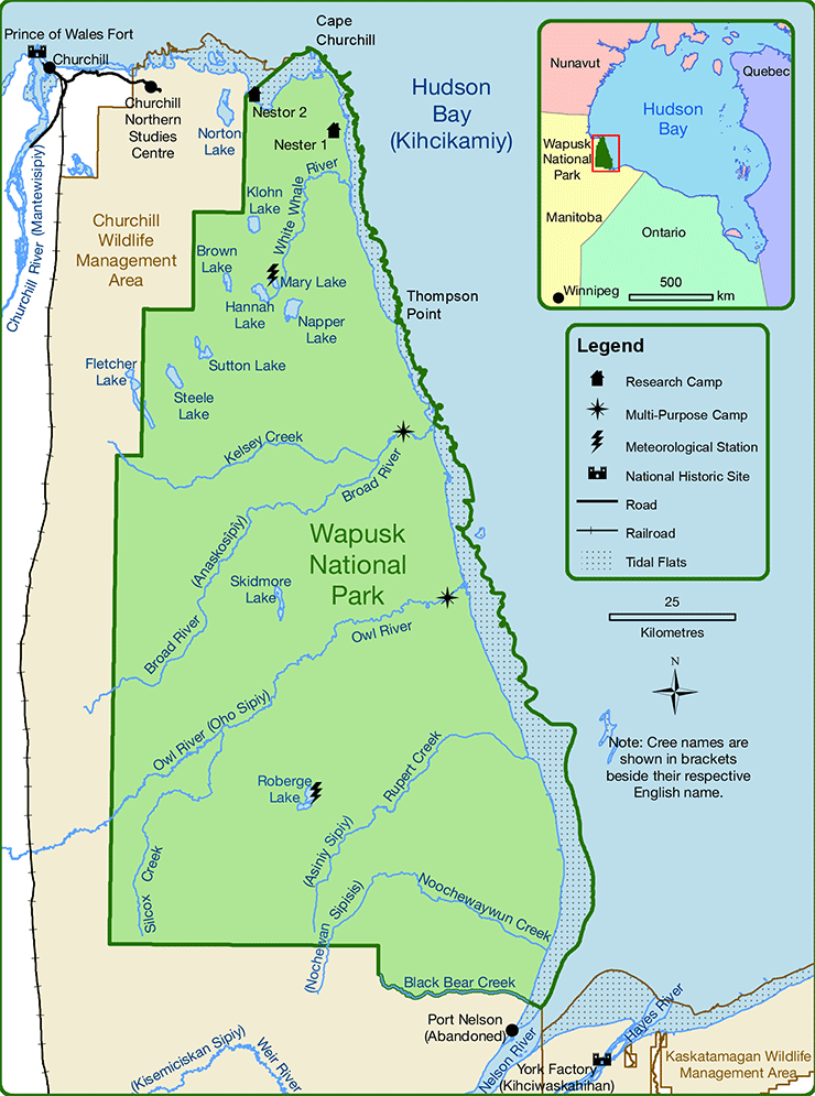
Image description
A map of Wapusk National Park in northern Manitoba. There are two research camps, Nestor Two and Nester 1, in the northern part of the park, as well as meteorological stations at Mary Lake and Roberge Lake. There are park management compounds on Broad River and Owl River near the eastern edge of the park close to the Hudson Bay shore. Other identified bodies of water are Norton Lake, Klohn Lake, Hannah Lake, Napper Lake, Steele Lake, Fletcher Lake and Skidmore Lake, the Churchill River, the White Whale River, the Weir River, the Nelson River and the Hayes River, Kelsey Creek, Silcox Creek, Rupert Creek and Noochewaywun Creek. Immediately west and south of the park is the Churchill Wildlife Management Area, while the Kaskatamagan Wildlife Management Area is to the southeast. The town of Churchill is identified with a black dot, while Prince of Wales Fort and York Factory national historic sites are identified. Blue dots in Hudson Bay along the north and eastern shore identify the tidal flats, while Cape Churchill is marked along the northern shore and Thompson Point is marked on the eastern shore. A railroad extends south from Churchill.
An inset map shows the entirety of Hudson Bay with southeastern Nunavut, northeastern Manitoba, northern Ontario, and northwestern Quebec all identified.
Data used to compile this map was supplied by Natural Resources Canada, Manitoba Land Inventory, and Parks Canada Agency.
This map is intended for general orientation purposes only and should not be used for navigation.
Map is projected in the UTM coordinate system.
