
Geographical maps: boundaries of the Site and cultural resources
Lachine Canal National Historic Site
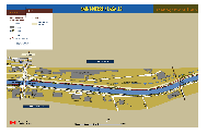
 Geographic Map
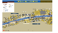
Boundaries of the National Historic Site
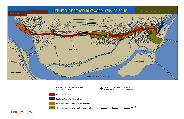 Boundaries of the National Historic Site
download the PDF version (609 Kb)
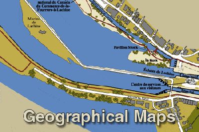
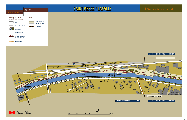
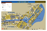
Cultural resources, Lachine area
 Cultural Resources of the Lachine Area
download the PDF version (609 Kb)
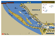
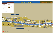
Cultural resources, Rockfield area
 Cultural Resources of the Rockfield Area
download the PDF version ( Kb)
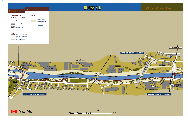
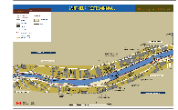
Cultural resources, Ville Saint-Pierre / LaSalle area - West
 Cultural Resources of Ville St-Pierre- Lasall Area
download the PDF version (172 Kb)
Cultural resources, Ville Saint-Pierre / LaSalle area - Centre
 Cultural Resources of Ville Saint-Pierre / Lasalle Area - Centre
download the PDF version (184 Kb)
Cultural resources, Ville Saint-Pierre / LaSalle area - East
 Cultural Resources of Ville St-Pierre/Lasalle Area East
download the PDF version (198 Kb)
Cultural resources, Saint-Henri / Côte-Saint-Paul
 Cultural Resources of St-Henri/Cote st-Paul
download the PDF version (294 Kb)
Cultural resources, Pointe-Saint-Charles / Petite-Bourgogne area
 Cultural Resources of Pointe St-Charles/ Petite Bourgogne Area
© Parks Canada
download the PDF version (318 Kb)
Cultural Resources, Old-Port of Montréal area
 Cultural Resources of Old-Port of Montreal Area
download the PDF version (365 Kb)
- Date modified :