
Water levels
Trent-Severn Waterway National Historic Site
The Parks Canada Agency is providing the information on this site under the express stipulation that the accuracy and reliability of the information is not guaranteed or warranted in any way and that Parks Canada Agency, its agents and servants, disclaim liability of any kind whatsoever and cannot be held liable for any damages, including, without limitation, claims, injury, expenses or other costs, or losses of revenue or profit, or indirect, special, incidental or consequential damages attributable to or arising from the use of this information. The onus is on the individual to verify the accuracy of the data, information, or results obtained through its use and accept that this information cannot be guaranteed. The information displayed on this site is obtained automatically through land-line transmissions from hydrometric stations operated by Parks Canada within the Trent-Severn Waterway. Data recovered from automated stations will typically be posted every 24 hours. In addition, manual water level readings are also displayed however the data is updated less often as a result of the time required to compile manual readings. This information is not intended to be used for the purpose of flood warning and/or flood forecasting. If you require information regarding watershed status you should contact your Conservation Authority or local Ontario Ministry of Natural Resources district. Proceeding beyond this Disclaimer will signify your acceptance of the terms and conditions outlined above.
Please read before proceeding:
Interactive map
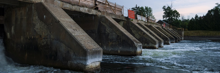
A tool that shows an instantaneous water level that was measured around 6 am. The tool provides water level data from the last 30 days and a graphic representation for the current year. The information comes from hydrometric gauges located at key points along both waterways.
The maximum, minimum and average data sets vary from site to site, but in general extend back to the late 1970s or early 1980s.
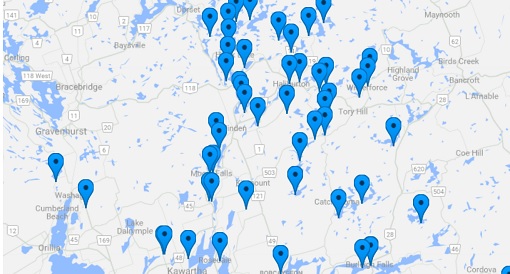
Trent-Severn Waterway watersheds
The Trent River basin encompasses some 218 lakes in the Haliburton Highlands region, 37 of which are directly controlled by Waterway dams. Water from these lakes flows south along either the Gull River, Burnt River, Nogies Creek, Mississauga River, Eels Creek or Jack Creek systems into the Kawartha Lakes. The Kawarthas drain down the Otonabee River into Rice Lake and on to Trenton on Lake Ontario via the Trent River. The Crowe River drains the eastern-most lakes in the Trent Watershed. Lake Scugog drains northward from the Oak Ridges Moraine to Sturgeon Lake.
The Trent River basin drains more than 12,000 km² of Central Ontario. The neighbouring Severn River watershed drains an area just over 6,000 km². Included in this watershed are the Canal Lake - Talbot River system, the Holland River, the Lake Simcoe - Couchiching basin, the Black River and the channels of the Severn River below the hamlet of Washago.
Because of the differing topography of these watersheds, they react differently to seasonal climatic variations. The fertile farmland of the Trent River and Lake Simcoe areas retains and releases water gradually following precipitation or a spring thaw. The shallow soils of the Canadian Shield which characterize the Haliburton Highlands and The Black River cannot absorb much water, resulting in more rapid runoff.
- Date modified :