
Shoreline management and protection
Fortress of Louisbourg National Historic Site
The Fortress of Louisbourg National Historic Site is an iconic historic site and the country largest archaeological site with enormous historical and cultural value for Canadians. Parks Canada responsibility is to ensure this place is protected for future generations.
Parks Canada is taking action to help protect and preserve an important part of Canada's history that is under threat of being lost to coastal erosion and sea level rise. The Flood Protection Project outlined below identifies the steps that will be taken.
Hurricane Fiona Repairs
On September 24-25, 2022, extratropical cyclone Fiona, still delivering hurricane-force winds, landed in Atlantic Canada, causing a major wind and rain event in Nova Scotia and Newfoundland. The Fortress of Louisbourg National Historic Site experienced damage due to extreme high winds, storm surge, and rain. Emergency repairs have been completed, but work is still ongoing on repairs and replacements that incorporate sustainable and climate change resilient features.
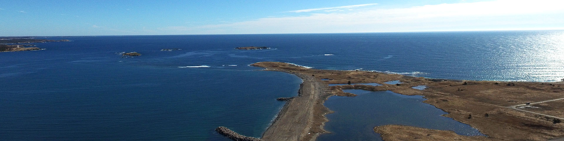
A section of the access road, which follows the edge of the Atlantic coast to the south of the reconstructed site was washed away. As a preventative measure, armor stone is being installed along a 128 meter-length of the shore to mitigate the impact of future storm surges and wave action on infrastructure and cultural resources. The armor stone installation is expected to be completed in 2024.
The Louisbourg Lighthouse trail was significantly impacted by Hurricane Fiona and is unsafe for public use. Parts of the trail sustained extreme damage, with sections of the trail completely eroded away. Parks Canada, the Coastal Connections Trail Association and Indigenous partners are working together to realign the trail and reopen it for public use in 2024.
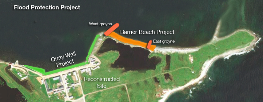
Flood Protection Project
The Flood Protection Project began in 2017 and was completed in 2019. It is intended to help protect the Fortress of Louisbourg from damages to the reconstructed buildings, cultural resources and ecologically sensitive areas. Parks Canada has sought the advice of marine geologists and engineers to provide solutions that are practical and effective to minimize the risk of flooding.
Parks Canada, in collaboration with Fisheries and Oceans Canada, has conducted an environmental assessment of the project and identified mitigation measures for potential impacts related to fish habitat and the environment. Parks Canada has a proven track record in ensuring projects do not cause significant adverse environmental effects.
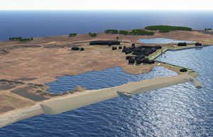
Barrier Beach is one of the most fragile features along the coastline of the Fortress of Louisbourg and it was at risk of breaching. Two protective structures of stones called groynes now extend from the shore into the water to prevent the beach from washing away.The work along Barrier beach also included beach nourishment and dredging sediment.
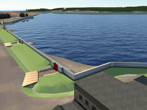
The height of the Quay Wall, which runs along the shore of the resconstructed townsite, has been raised one meter to minimize the risk of flooding, protect existing cultural resources and support positive visitor experiences. The increase in height is met with a higher embankment to view out to the community of Louisbourg.
The Flood Protection Project consists of two components: Barrier Beach and the Quay Wall.
 Flood protection project
Barrier Beach
Barrier beach
Barrier Beach is one of the most fragile features along the coastline of the Fortress of Louisbourg and it is at risk of breaching in the very near future. The project involves the construction of two groynes, protective structures of stones that will extend from the shore into the water to prevent beach from washing away, along with beach nourishment and dredging sediment.
Parks Canada has engaged directly with lobster fishers, including those who fish in and around the project footprints. This project’s impacts to fish habitat will be offset through measures that maintain or improve fisheries productivity, by creating or restoring productive fish habitat.
Quay Wall
Quay wall
The height of the Quay Wall, which runs along the shore of the reconstructed townsite, has been raised one meter to minimize the risk of flooding, protect existing cultural resources and support positive visitor experiences. The increase in height is met with a higher embankment to view out to the community of Louisbourg.
If you have questions, comments or would like to find out more information about the Flood Protection Project, please email pc.infocb.pc@pc.gc.ca.
Related links
- Date modified :