
Chaffeys Lockstation
| < Newboro Lockstation | Davis Lockstation > |
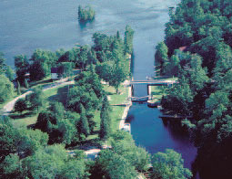 Chaffeys Lockstation was built on a short excavated channel. The dam and weir create a rise of 3,1 m to establish navigable depths on the upstream lakes. © Parks Canada |
148,7 km – 148,8 km
The access to Chaffeys Lockstation follows the natural course of the Cataraqui River, which was improved by excavation during construction. The lock and its excavated channel are on the south side of the river, with a dam and weir spanning the river on the north side of the site. The lock permits navigation between Indian Lake and Opinicon Lake.
One lock – A manually operated lock with a lift of 3,1 m, 1830. CRM1.
Defensible lockmaster’s house – A one-storey stone building, 1844, with a frame second storey added in 1894. CRM1.
Lockstation office – A two-storey frame building 1920. CRM2.
Weir – A reinforced concrete stoplog weir with two bays, 1920. CRM2.
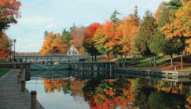 A public road is carried over the lock on this plate girder swing bridge. © Parks Canada |
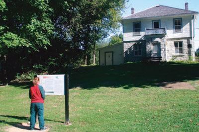 The defensible lockmaster’s house is now operated as a museum by a local heritage society. © Parks Canada |
Chaffeys Lockstation to Davis Lockstation
148,8 km – 152,0 km
This slackwater section, known as Opinicon Lake, was created by the construction of the dam at Davis Lockstation.
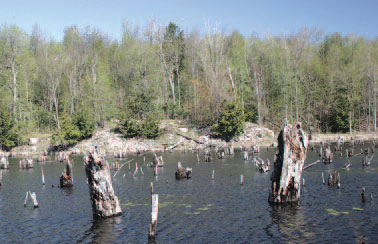 Stumps from the virgin forests that were inundated by dam construction, are still evident on Opinicon Lake. © Parks Canada |
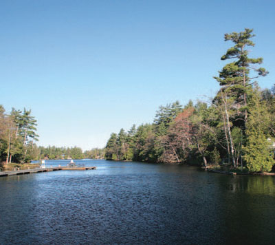 The excavated channel at Chaffeys Lockstation leads to Opinicon Lake, whose levelwas raised by the dam at Davis Lockstation. © Parks Canada |
| < Newboro Lockstation | Davis Lockstation > |
Related links
- Ottawa Lockstation
- Hartwells Lockstation
- Hogs Back Lockstation
- Black Rapids Lockstation
- Long Island Lockstation
- Burritts Rapids Lockstation
- Nicholsons Lockstation
- Clowes Lockstation
- Merrickville Lockstation
- Kilmarnock Lockstation
- Edmonds Lockstation
- Old Slys Lockstation
- Smiths Falls Combined Lockstation
- Smiths Falls Detached Lockstation
- Poonamalie Lockstation
- Beveridges Lockstation, Tay Canal
- Perth, Tay Canal
- The Narrows Lockstation
- Newboro Lockstation
- Davis Lockstation
- Jones Falls Lockstation
- Upper Brewers Lockstation
- Lower Brewers Lockstation
- Kingston Mills Lockstation
- Date modified :