
Clowes Lockstation
| < Nicholsons Lockstation | Merrickville Lockstation > |
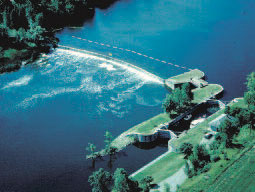 Clowes Lockstation, showing the spillway dam and weir stretching across the river. © Parks Canada |
70,5 km – 70,6 km
Clowes Lockstation is located on the north side of the Rideau River. The lock is built into the bank, creating a narrow island from which the stone arch spillway dam spans the river, creating a slackwater section between Clowes and Merrickville Lockstation.
Cultural Resources
One lock – A manually operated lock with a lift of 2,4 m, 1830. CRM1.
Stone arch spillway dam – A dam, 151 m long and 4,45 m high, 1830. CRM1.
Weir – A stoplog weir made of reinforced concrete with one bay, late 19th century. CRM2.
Defensible lockmaster’s house – A one-storey stone house, 1838, with a frame extension, 1890. CRM1.
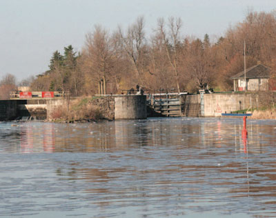 The lower gates pinned open for the winter months with the stoplog weir to the left. © Parks Canada |
Clowes Lockstation to Merrickville Lockstation
70,6 km – 73,8 km
A 3,2-km slackwater section of river created by the construction of the spillway dam at Clowes Lockstation.
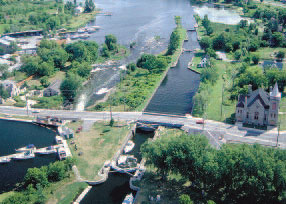 The slackwater section from Clowes as it approaches Merrickville Lockstation. © Parks Canada |
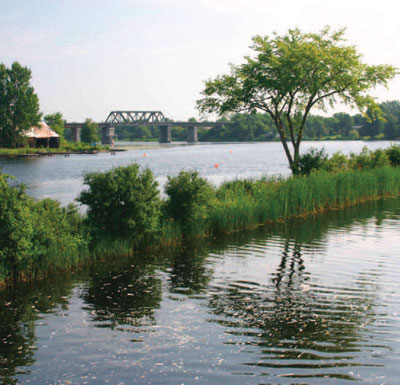 An elevated railway bridge crosses this wide slackwater section of the Rideau River. © Parks Canada |
| < Nicholsons Lockstation | Merrickville Lockstation > |
Related links
- Ottawa Lockstation
- Hartwells Lockstation
- Hogs Back Lockstation
- Black Rapids Lockstation
- Long Island Lockstation
- Burritts Rapids Lockstation
- Nicholsons Lockstation
- Merrickville Lockstation
- Kilmarnock Lockstation
- Edmonds Lockstation
- Old Slys Lockstation
- Smiths Falls Combined Lockstation
- Smiths Falls Detached Lockstation
- Poonamalie Lockstation
- Beveridges Lockstation, Tay Canal
- Perth, Tay Canal
- The Narrows Lockstation
- Newboro Lockstation
- Chaffeys Lockstation
- Davis Lockstation
- Jones Falls Lockstation
- Upper Brewers Lockstation
- Lower Brewers Lockstation
- Kingston Mills Lockstation
- Date modified :