Kootenae House National Historic Site of Canada
Invermere, British Columbia
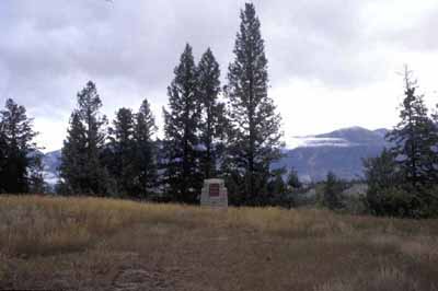
General View
© Agence Parcs Canada | Parks Canada Agency, 2005.
Address :
Westside Road, Invermere, British Columbia
Recognition Statute:
Historic Sites and Monuments Act (R.S.C., 1985, c. H-4)
Designation Date:
1934-05-28
Dates:
-
1807 to 1812
(Construction)
-
1807 to 1809
(Significant)
Event, Person, Organization:
Other Name(s):
-
Kootenae House
(Designation Name)
-
Fort Kootenae
(Other Name)
Research Report Number:
2005-SDC/CED-046
DFRP Number:
11799
Plaque(s)
Existing plaque: Westside Road, Invermere, British Columbia
In 1806 the North West Company clerk, Jaco Finlay, blazed a trail over Howse Pass from the Saskatchewan to the Columbia River. The next year, David Thompson followed this route to the Columbia, then turned up river and built Kootenae House below Windermere Lake. Using this fort as a base, he explored the Upper Colombia and Kootenay rivers, and established a chain of posts on the Columbia watershed. Kootenae House was used periodically until 1812, when the hostility of the Peigans east of the pass forces its abandonment.
Description of Historic Place
Located just north of Invermere, British Columbia, Kootenae House National Historic Site of Canada is an archaeological site at the confluence of Toby Creek and the Columbia River. Some above ground remains, as well as surface depressions, mark where this trading fort once stood. The open grasslands, stands of Douglas Fir, and defensible terrace over the water evoke the qualities of the landscape at the time that Kootenae House stood on this location. The official recognition refers to the 0.77 acres that surrounds the remains of Kootenae House.
Heritage Value
Kootenae House was designated a national historic site of Canada in 1934 because: built in 1807, Kootenae House was the first trading post in the Columbia Basin; it served as David Thompson’s base of exploration of the Columbia River and its tributaries; and, its establishment led to contacts and trade with First Nations throughout the region.
In 1806 the North West Company clerk, Jaco Finlay, blazed a trail over Howse Pass from the Saskatchewan to the Columbia River. The next year, David Thompson followed this route to the Columbia, then turned up river and built Kootenae House below Windermere Lake in order to trade with the Ktunaxa (Kootenay) people. Using this fort as a base, he explored the upper Columbia and Kootenay rivers, and established a chain of posts on the Columbia watershed. Kootenae House was used periodically until 1812, when the hostility of the Peigans east of the pass forced abandonment. The land where Kootenae House stood was donated to the Government of Canada by Mrs. Alice M. Hamilton in 1935 in honour of her husband Basil G. Hamilton.
Sources: Historic Sites and Monuments Board of Canada, Minutes, July 2005; Commemorative Integrity Statement.
Character-Defining Elements
Key elements contributing to the heritage value of this site include: the archaeological remains in their current location, including the remains of stone chimneys, palisade trenches and building foundations, as well as middens and some unidentified depressions; the archaeological remains of Contact Period Aboriginal campsites; the remains of an historic trail on the south side of the site; in situ features and artefacts; the location of the site on a promontory over looking the junction of Toby Creek and the Columbia River; the landscape qualities, the terraced edge, of open grassland and stands of Douglas Fir trees; and, views of the Columbia Valley contained within the Rocky Mountain Trench flanked by the Stanford Range to the east and Mount Nelson an the Purcell Mountains to the west.