Île aux Basques National Historic Site of Canada
Île aux Basques, Quebec
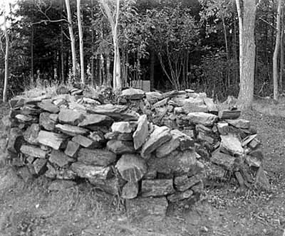
General view
© Parks Canada Agency / Agence Parcs Canada, Daniel Laroche.
Address :
Île aux Basques, Quebec
Recognition Statute:
Historic Sites and Monuments Act (R.S.C., 1985, c. H-4)
Designation Date:
2001-04-27
Event, Person, Organization:
-
Aboriginal groups
(Organization)
-
French Basques
(Organization)
Other Name(s):
-
Île aux Basques
(Designation Name)
Research Report Number:
2000-34
Plaque(s)
Existing plaque: Quebec
From about 1580 to 1630, this small island was a seasonal outpost for the Basque fishermen who crossed the ocean mainly from coastal France. Found at this site are remains of ovens for rendering whale blubber, as well as artifacts associated with their hunting, fishing and fur trade activities, and with Aboriginal people engaged in their seasonal rounds. The Basque presence on the island has ever since captured the imagination of the region's inhabitants, and lives on today in place names and in oral history.
Description of Historic Place
Île aux Basques National Historic Site of Canada is a long, narrow island located five kilometres north of Trois Pistoles on the Saint Lawrence River in Quebec. Two kilometres long by 400 metres wide, the island supports a mixture of woods, prairie and marshland while the surrounding shoreline features sheltered bays and sandy beaches. Archaeological remains at four sites reveal evidence of Aboriginal activity from both the pre-contact and post-contact periods. Three more sites show evidence of occupation by French Basque fishermen between 1584 and 1637. Official recognition refers to the island at its low water mark.
Heritage Value
Île aux Basques was designated a national historic site of Canada in 2000 because: by comparison with other known Basques sites in Canada, the sites on the island represent the westernmost and most important concentration of French Basque occupation in the Gulf of St. Lawrence and Lower St. Lawrence River between 1584 and 1637; the island is the only recorded site in the Gulf and River where early commercial contact between Europeans and Aboriginal Peoples is formally confirmed through the archaeological record; the island represents a remarkable archaeological record which documents continuous human use from Prehistory to the present; the French Basque presence on the island has left an enduring legacy among communities along the Lower St. Lawrence River, as reflected in local and regional histories, the collective memory of residents, and in place names.
Occupied successively by Aboriginal groups, Basque sailors, Jesuit missionaries, and homesteaders, Île aux Basques bears witness to many centuries of human activity. Archaeological remains have been discovered at seven sites in the southern part of the island. The Aboriginal presence may have consisted of small groups visiting for short periods on a seasonal basis while hunting, fishing and gathering. Harsh climatic conditions may also have limited the French Basque occupation of the island to sporadic, seasonal visits during the warmer months. The island represents the eastern limit of the Iroquoian presence in the southern Saint Lawrence area and also contains the largest concentration of Basque sites in the St. Lawrence estuary. The island was occupied by French Basques, in contrast to Red Bay National Historic Site of Canada, which was occupied by Spanish Basques. The island is the only Basque settlement in the estuary where contact between Europeans and Aboriginals is supported by archaeological evidence. It is now a protected area designated a sanctuary and refuge for migrating birds.
Source: Historic Sites and Monuments Board of Canada, Minutes, December, 2000; March, 2004.
Character-Defining Elements
The key elements that contribute to the heritage character of this site include: its location near the south bank of the Saint Lawrence River, in Quebec; the mixed nature of the island’s landscape with wooded areas, prairie and marshland; the integrity of the extensive surviving archaeological remains, features and artefacts in their original placement and extent including those that date from three main periods: the pre-contact period that includes the Middle Woodland period (700-1000 CE) and Late Woodland (1000-1500 CE); the period between 1584-1637 when the island was a base for Basque whaling operations; and, the post-contact period of occupation that revealed both Aboriginal and French and Euro-Canadian artifacts such as at site (DaEh-1) which hosted two Aboriginal occupations from the second half of the 17th century or the beginning of the 18th century and where the remains of Aboriginal encampments were found in association with those of European origin including what may be Jesuit mission remains; the in situ vestiges and structural remains of buildings including those of the 1872 farm “Maison-Bernier” with various associated non-structural archaeological features such as middens and associated artefacts dating from the 19th century; the integrity of any potential archaeological remains that may be found including features, artefacts and remains in both their original placement and extent; viewscapes to and from the island and between the seven archaeological sites.