Construction of Yonge Street National Historic Event
Richmond Hill, Ontario
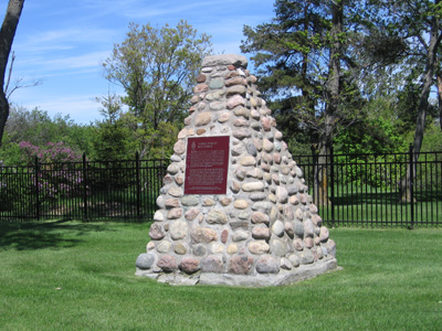
HSMBC plaque and cairn
© Parks Canada / Parcs Canada, 2006
Address :
11901 Yonge Street, Richmond Hill, Ontario
Recognition Statute:
Historic Sites and Monuments Act (R.S.C., 1985, c. H-4)
Designation Date:
1927-05-19
Dates:
-
1795 to 1796
(Significant)
Other Name(s):
-
Construction of Yonge Street
(Designation Name)
Importance:
Begun in 1795, became the main road from Toronto to Georgian Bay
Plaque(s)
Existing plaque: 11901 Yonge Street, Richmond Hill, Ontario
This highway was planned by the first governor of Upper Canada, John Graves Simcoe, as a military and commercial route between Lakes Ontario and Huron. Begun in 1795 by the Queen's Rangers it was cut through to Lake Simcoe in 1796, reached Georgian Bay in the first quarter of the next century, and was later extended into Muskoka. A main line of transport before the railway, it opened lands for settlement and carried trade to Toronto. With the development of automotive transport in the twentieth century, it became the highway to northern recreational areas and vast new resources.